Category: Conservation

  • Snow cancelled clearance

    Retreat from Newmarket Hill
    Retreat from Newmarket Hill.

    Just catching up on a post I meant to write a while back – the day after I surveyed the site in the snow.

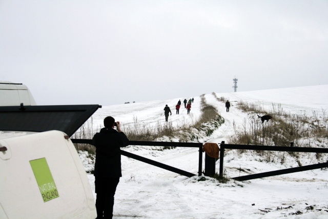
    Whilst the site itself was only covered in a shallow few inches of snow, the snow on the Juggs Road (Drove Avenue) just on the northern side of the ridge leading towards the top of Newmarket Hill had drifted considerably. Also, working on-site in slippery conditions whilst using sharp slashing tools is not sensible from a Health & Safety point of view so, after a quick look around and history lesson, we all went home!

  • Upcoming Events

    Here I am making public the dates of my forthcoming volunteer dig days! The next three days are:

    Location When Summary Description
    Castle Hill car park, Sea View Way, Brighton and Hove, Brighton BN2 6NT, UK 2026-10-20 at 10:30 – 11:30 Castle Hill Healthwalk Castle Hill Healthwalk: Explore this stunning chalk grassland National  Nature Reserve. (When conditions are muddy,  and on the last Tuesday of the month, the walk  follows an alternative route around Bullock Hill,  opposite the reserve.)Meeting Place: Castle Hill National Nature Reserve Car Park, Woodingdean, off  Falmer Road (B2123), just north of the junction with Bexhill Road. …
    Castle Hill car park, Sea View Way, Brighton and Hove, Brighton BN2 6NT, UK 2026-10-27 at 10:30 – 11:30 Castle Hill Healthwalk Castle Hill Healthwalk: Explore this stunning chalk grassland National  Nature Reserve. (When conditions are muddy,  and on the last Tuesday of the month, the walk  follows an alternative route around Bullock Hill,  opposite the reserve.)Meeting Place: Castle Hill National Nature Reserve Car Park, Woodingdean, off  Falmer Road (B2123), just north of the junction with Bexhill Road. …

    We work on site every Friday and Sunday, 10am-4pm, from April to December 2013. Volunteers and other visitors are most welcome. We meet at the Falmer Road Car Park, Woodingdean (just N of the junction with Bexhill Rd) but please contact me beforehand in case we have to cancel for any reason.

    David Cuthbertson: scienceinthegreen@yahoo.co.uk

  • Dancing in Public!

    It is (almost) always a good idea as part of a planning process to review and revise – flexible planning! English Heritage‘s MoRPHE planning process recognises this, which I like very much. But I have had problems trying to follow their product based planning, based on the PRINCE2 project planning methodology.

    English Heritage’s MoRPHE planning process is to identify outcomes, then to work backwards to discover what intermediate steps may be required to meet that end point. They use the term product to characterise each of the outcomes. Then the tasks are defined which are needed to generate these products. However, I have previously studied David Allen’s ‘Getting Things Done‘ (GTD) methodology, which emphasises a more task orientated approach. His main focus is on the actions required to complete a task. In practice, at the initial stages of project planning, both are required. Both top-down and bottom-up. My study of the hermeneutic circle helped me with this. How can you know where you are going if you don’t know how you might get there?

    Knowledge of how you might get somewhere can help in deciding where you want to go – and – knowledge of where you want to go can help in deciding how you might get there. And so one performs a dance between the two – except this dance is rarely made explicit. It is this dance that I am performing right now – and – in public!

  • Lots of Good News!

    Another hurdle has been cleared! Smiths Gore, who manage Brighton & Hove City Council’s farmland portfolio (including Castle Hill Nature Reserve), have obtained formal permission for me to go ahead with my excavation project.

    There is now only one more permission to be obtained – namely that of being able to dig on a nature reserve of European significance. Luckily the reserve manager, Malcolm Emery, is dealing with this on my behalf. Because the site used to be a residence and farmyard, it is an area of high fertility (lots of poo and pee!), and therefore has become colonised by nettles and brambles. In the early 1950’s the area was bulldozed to make the site safe. This has very much reduced the biodiversity and ecological significance of this small corner of the reserve. Therefore further digging should not threaten the nature reserve’s conservation status in any way.

    I have also started receiving offers of help from volunteers interested in being involved in an archaeological dig. This is excellent news! I need to decide on a fixed day once a month for volunteer days to be able to happen – sometime in March.

    I was on site yesterday and it was good to see it again – without its earlier blanket of snow! I didn’t take any photos, but I did clean up a few fragments of wall that are visible – so it is now easier to show visitors the approximate ground plan.

    The next clearance day may possibly be next Thursday – though this hasn’t been confirmed yet – it depends on the forecast, and whether Malcolm Emery has any higher priority jobs that need doing.

    Yesterday was a very good day!

  • Project Planning and a hurting head!

    My head hurts! I am new to the formal discipline of Project Planning. I am trying to understand English Heritage’s guidelines on how I might best plan my archaeological excavation. There is so much to get my head around, both regarding the details of Project Planning in general, and the details of my own particular project.

    My Newmarket Farm Excavation Proposal Document was relatively easily to write, because it did not have to go into the small details. It was based on the English Heritage MoRPHE (Management of Research Projects in the Historic Environment) planning guidance. I recently completed a distance learning familiarisation course on the use of MoRPHE, which enabled me to realise that what I had attained was just the tip of the iceberg. Now that the Project Proposal Document has generally been accepted by both Greg Chuter and Malcolm Emery, I need to write the Project Design Document, which is to detail all the stuff that I am not – yet – entirely sure how to do.

    So I sat down and started to learn the subject of Project Management. Oh yes, and I wrote this post.

  • Marking Boundaries

    I wasn’t sure until recently the best way to mark out the Archaeological site boundary.

    • I know from experience that light weight string gets caught up in brambles and that it easily gets tangled, it can trip people up and can easily get accidentally cut.
    • Heavier duty rope would be better, but would be expensive, and heavy to carry.
    • Hazard warning tape is another possibility, but it draws too much attention to itself – I would only want to use it when there is a real need to keep people out of an area – which in this case I do not.

    I knew that surveyors on Time Team used a spray paint but I wasn’t sure how permanent it was, or toxic – I would be using it on a nature reserve. However, a little Googling on the Internet and I found a spray paint called SylvaMark. This has been approved for use by English Nature (Natural England‘s predecessor) on their own reserves, and after reading the blurb, it looks exactly what I want. I chose a blue colour since it was less fluorescent than the others and a type that only lasts a couple of weeks or more. It should arrive by the end of the week. I just hope the weather stays dry enough for me to be able use it before the next site clearance day.

  • Newmarket Farm Site Clearance

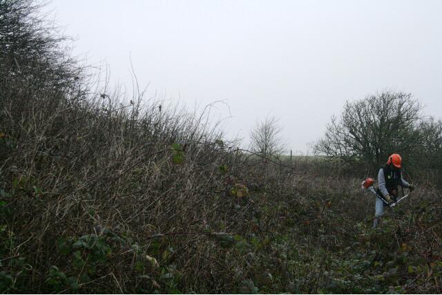
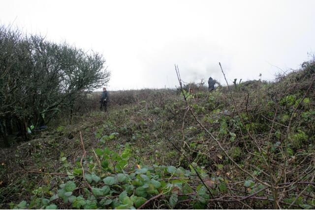
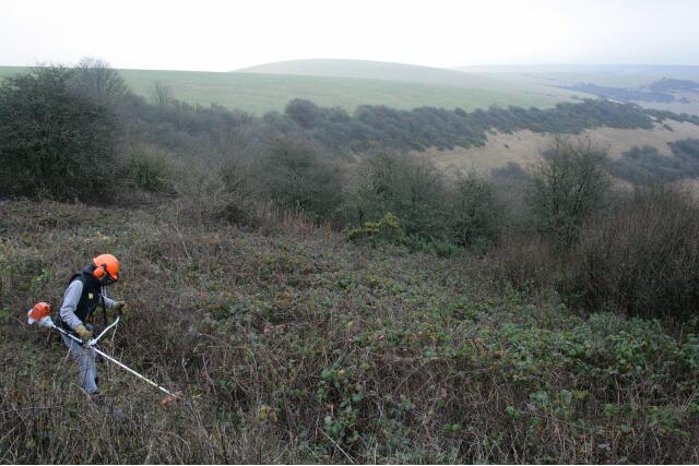
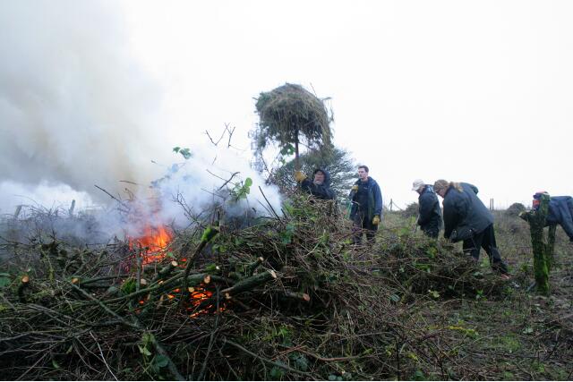
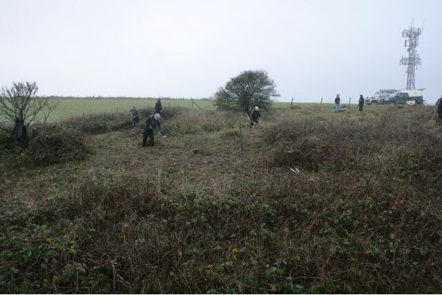
    Thanks to Malcolm Emery and a couple of colleagues from Natural England, as well as a group from the South Downs Volunteer Ranger Service, at least half the site was cleared yesterday (Weds 10th January 2013), and a second day has been planned to complete the job.

    View WSW from demolition rubble mound E side of the house site looking SW across back garden towards S farmyard boundary between the trees left and centre; 10th January 2013.
    View WSW from demolition rubble mound E side of the house site looking SW across back garden towards S farmyard boundary between the trees left and centre; 10th January 2013.
    Looking slightly W of S from bulldozed mound of rubble to E of house site looking towards SE corner of the garden just under the Prunus scrub; 10th January 2013.
    Looking slightly W of S from bulldozed mound of rubble to E of house site looking towards SE corner of the garden just under the Prunus scrub; 10th January 2013.
    Looking S along bulldozed mound of demolition rubble partially hidden by brambles. The side of the house would have been on the right of the picture. The small elder bush to the right of the fire marks the junction of the wall dividing the garden to its left from the farmyard to its right, and the wall which bounded both to the south; 10th January 2013.
    Looking S along bulldozed mound of demolition rubble partially hidden by brambles. The side of the house would have been on the right of the picture. The small elder bush to the right of the fire marks the junction of the wall dividing the garden to its left from the farmyard to its right, and the wall which bounded both to the south; 10th January 2013.
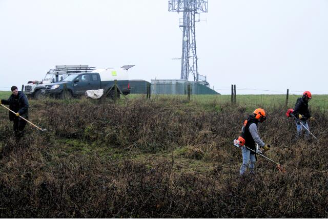
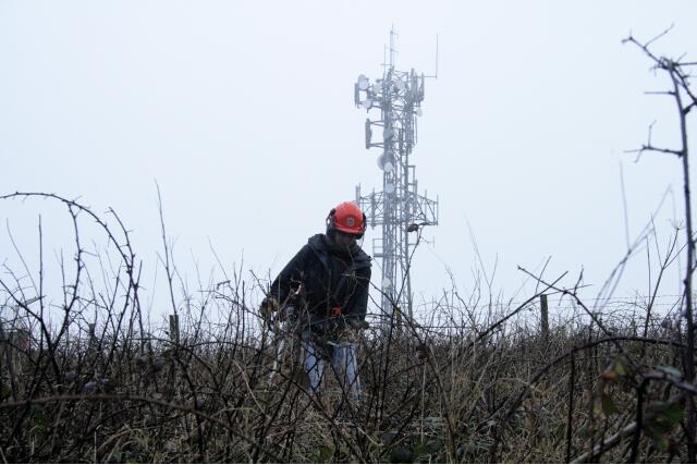
    Clearing NW corner of the site, the site of a barn. Looking towards what has become an a major landmark – a television aerial marking the top of Newmarket Hill; 10th January 2013.
    Clearing NW corner of the site, the site of a barn. Looking towards what has become an a major landmark – a television aerial marking the top of Newmarket Hill; 10th January 2013.
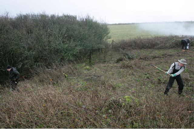
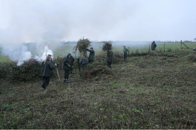
    The chap on the right is raking the mowings, which were burnt. Removing the debris reduces the fertility of the soil, which reduces the vitality of the rank vegetation; 10th January 2013.
    The chap on the right is raking the mowings, which were burnt. Removing the debris reduces the fertility of the soil, which reduces the vitality of the rank vegetation; 10th January 2013.
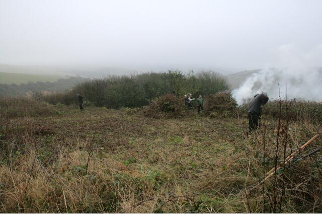
    Looking W at Newmarket Farm site being cleared of brambles; 10th January 2013.
    Looking W at Newmarket Farm site being cleared of brambles; 10th January 2013.
    Photo taken from within the house site looking to the SW at elder bush marking site of S end of wall dividing house and garden. The chap on the right is Malcolm Emery, taking a welcome break from his desk; 10th January 2013.
    Photo taken from within the house site looking to the SW at elder bush marking site of S end of wall dividing house and garden. The chap on the right is Malcolm Emery, taking a welcome break from his desk; 10th January 2013.
    Taken from under the spreading hawthorn near the NE corner of the house site, looking slightly west of south, with the elder (centre back near the fire) marking the site of the back wall between garden and farmyard; 10th January 2013.
    Taken from under the spreading hawthorn near the NE corner of the house site, looking slightly west of south, with the elder (centre back near the fire) marking the site of the back wall between garden and farmyard; 10th January 2013.
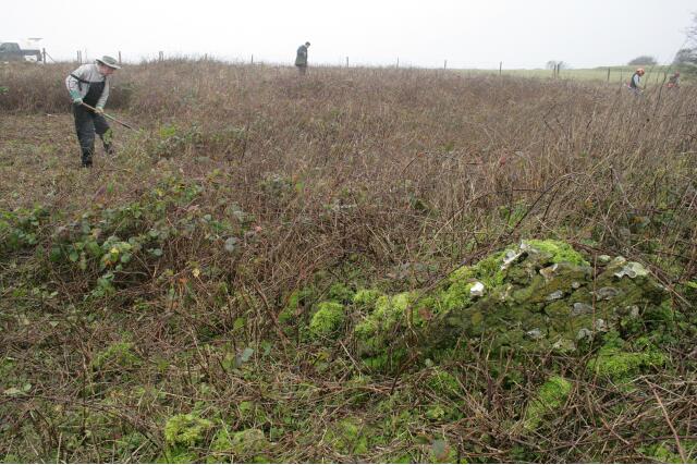
    A view of the site looking to the NW with a piece of demolished masonry revealed from under the brambles; 10th January 2013.
    A view of the site looking to the NW with a piece of demolished masonry revealed from under the brambles; 10th January 2013.
    View from location of barn on NW side of site looking SE across the farmyard towards distant Prunus scrub marking SE corner of the garden; 10th January 2013
    View from location of barn on NW side of site looking SE across the farmyard towards distant Prunus scrub marking SE corner of the garden; 10th January 2013
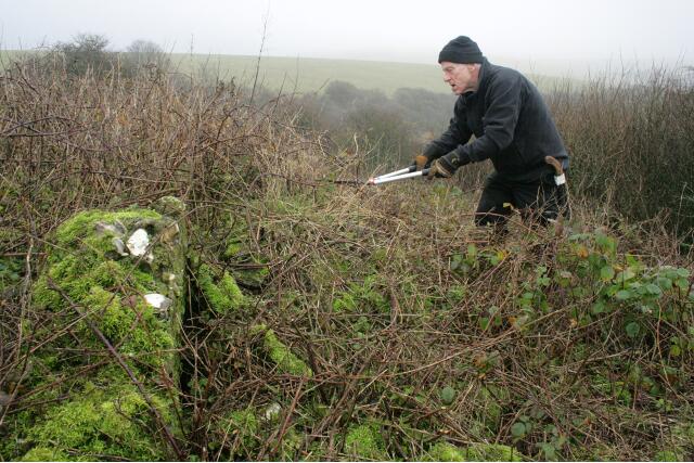
    Volunteer clearing back some of the vegetation from the mound of demolition rubble, just inside the east boundary wall of the garden, looking E - upright piece of masonry is not in situ - 10th January 2013.
    Volunteer clearing back some of the vegetation from the mound of demolition rubble, just inside the east boundary wall of the garden, looking E – upright piece of masonry is not in situ – 10th January 2013.
    Looking N towards the NE corner of the site, just outside the garden wall, clearing the vegetation about 3m wide of the site boundary to allow for public access as well as room for spoil from any trenches; 10th January 2013
    Looking N towards the NE corner of the site, just outside the garden wall, clearing the vegetation about 3m wide of the site boundary to allow for public access as well as room for spoil from any trenches; 10th January 2013
    Looking S towards SE corner of the garden boundary wall just under the Prunus scrub; 10th January 2013
    Looking S towards SE corner of the garden boundary wall just under the Prunus scrub; 10th January 2013
    View beyond the site, towards Castle Hill to the NE, from on top of the mound of demolition rubble; 10th January 2013
    View beyond the site, towards Castle Hill to the NE, from on top of the mound of demolition rubble; 10th January 2013
    Looking approx WSW from SE corner of house towards distant hawthorn near SW corner of farmyard showing surface contours of site being revealed; 10th January 2013
    Looking approx WSW from SE corner of house towards distant hawthorn near SW corner of farmyard showing surface contours of site being revealed; 10th January 2013

    The farmyard, in the centre of the photo, was discovered to be on a terrace, with the farm buildings – stables and cow barn – at a higher level (to the right), and the garden at a lower level (to the left).

    Photo taken approx SE corner of house site looking SW towards tree stump marking junction of dividing wall separating the garden on left, from the farmyard on right where it met the S property boundary; 10th January 2013.
    Photo taken approx SE corner of house site looking SW towards tree stump marking junction of dividing wall separating the garden on left, from the farmyard on right where it met the S property boundary; 10th January 2013.
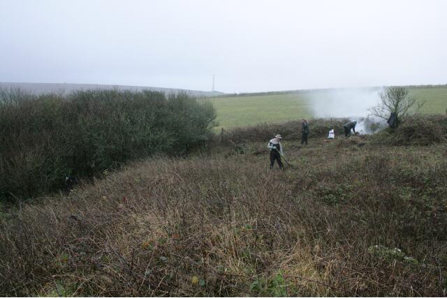
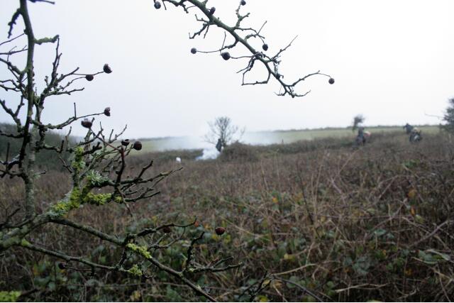
    Looking NW at site clearance by burning of the cut vegetation; 10th January 2013
    Looking NW at site clearance by burning of the cut vegetation; 10th January 2013
    Looking NW at burning of wet vegetation; 10th January 2013
    Looking NW at burning of wet vegetation; 10th January 2013

    It would have been nice if the cleared vegetation had been removed from site and composted. Better for the environment. But it would have involved a lot of work, a lot more transport, and a lot less of the site would have been cleared.

  • Some pictures of Castle Hill Nature Reserve

    Just visited the picture website Geograph. It has lots of wonderful pictures people have taken of geographical locations all over the UK. I thought I would load all those that people have taken of Castle Hill Nature Reserve.

    Taken in 2005…

    Falmer Bottom by Simon Carey
    Falmer Bottom by Simon Carey.
    Looking north towards Castle Hill. (10 September, 2005)
    Newmarket Bottom by Simon Carey
    Newmarket Bottom by Simon Carey.
    Looking east towards Castle Hill. (10 September, 2005)

    Taken in 2009…

    Castle Hill by Paul Gillett
    Castle Hill by Paul Gillett.
    (23 June, 2009)
    Castle Hill plantation by Paul Gillett
    Castle Hill plantation by Paul Gillett.
    (23 June, 2009)
    Castle Hill looking SW by Paul Gillett
    Castle Hill looking SW by Paul Gillett.
    Castle Hill is located 1 mile from Woodingdean, north east of Brighton. It comprises a series of valley-side slopes and is a good example of ancient, traditionally managed chalk downland. (23 June, 2009)

    Taken in 2010…

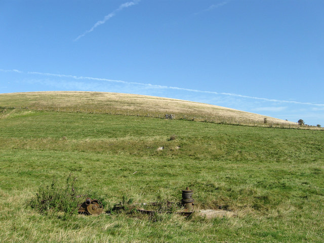
    Old well - Falmer Bottom by Robin Webster
    Old well – Falmer Bottom by Robin Webster.
    All very knocked about, but the part on the right looks like a wellhead, the central part like a pump, and the other part like a winch. All very perplexing. Made by F.E. Myers & Bro., Ashlan…. [?] U.S.A. The pump-like part has also cast on it “Self-oiling bulldozer”. A little further research found that the two brothers Francis and Philip set up the company in 1870 in Ashland, Ohio, and the company is still there, producing pumps and trading as Myers, although now part of the Pentair group. (27 February, 2010)
    Castle Hill National Nature Reserve by Robin Webster
    Castle Hill National Nature Reserve by Robin Webster.
    The public bridleway through the reserve curves round the slope to the left, although the rather hypothetical legal line is somewhat to the right at first. (27 February, 2010)
    Castle Hill NNR - scrub clearance by Robin Webster
    Castle Hill NNR – scrub clearance by Robin Webster.
    One of two bonfire sites seen on this shoulder of the hill. (27 February, 2010)
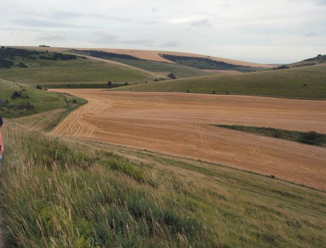
    Falmer Bottom by Robin Webster
    Falmer Bottom by Robin Webster.
    A good view to illustrate the vagaries of the selection of CROW public access land. The criterion should be down: unimproved grassland. The foreground fields up to the fence with the single tree are public – but certainly rather improved. The near shoulder on the right is not CROW-public but is unimproved (although possibly partly ploughed in the past). The far shoulder on the right is correctly public and unimproved. Both shoulders are in the Castle Hill NNR. The slopes on the left are correctly selected as public access unimproved downland. However, the non-CROW part of the NNR is now mapped as access land under some other non-CROW arrangement. (27 February, 2010)
    Vegetation investigations, Castle Hill National Nature Reserve by Robin Webster
    Vegetation investigations, Castle Hill National Nature Reserve by Robin Webster.
    Within the enclosure are many 1 m square areas marked out with green string. Castle Hill itself is the hill straight ahead – this part of the reserve is on the slopes of Newmarket Hill. (27 February, 2010)
    Welcome to Castle Hill National Nature Reserve by Robin Webster
    Welcome to Castle Hill National Nature Reserve by Robin Webster.
    The Natural England website still says “Access to the reserve is limited to public rights of way”. This is at variance both with this sign and with OS maps which show the reserve as public access land. In any case, the lower bridleway gate, just to the left of this sign, is away from the legal line which is well to the right and blocked by the fence. (27 February, 2010)

    The information on the Natural England website is very out of date and, as far as I know, there are plans to update it sometime soon.

    Industrial artefacts in Falmer Bottom (1) by Dave Spicer
    Industrial artefacts in Falmer Bottom (1) by Dave Spicer.
    Robin Webster’s explanation TQ3706 : Old well – Falmer Bottom is feasible bearing in mind there has to be water down there somewhere. (14 May, 2010)

    Taken in 2012…

    Newmarket Bottom by Paul Gillett
    Newmarket Bottom (30 July, 2012) by Paul Gillett.
    (30 July, 2012)
    Newmarket Bottom by Paul Gillett
    Newmarket Bottom by Paul Gillett.
    (30 July, 2012)
    Newmarket Bottom by Paul Gillett
    Newmarket Bottom by Paul Gillett.
    (30 July, 2012)
    Newmarket Bottom by Paul Gillett
    Newmarket Bottom by Paul Gillett.
    (30 July, 2012)
    Castle Hill by Paul Gillett
    Castle Hill by Paul Gillett.
    (30 July, 2012)
    Entrance to Castle Hill Plantation by Paul Gillett
    Entrance to Castle Hill Plantation by Paul Gillett.
    (30 July, 2012)

    [I think Paul was thinking of the nearby Newmarket Plantation, tried writing Castle Hill and so made his mistake – for there is no plantation on Castle Hill.]

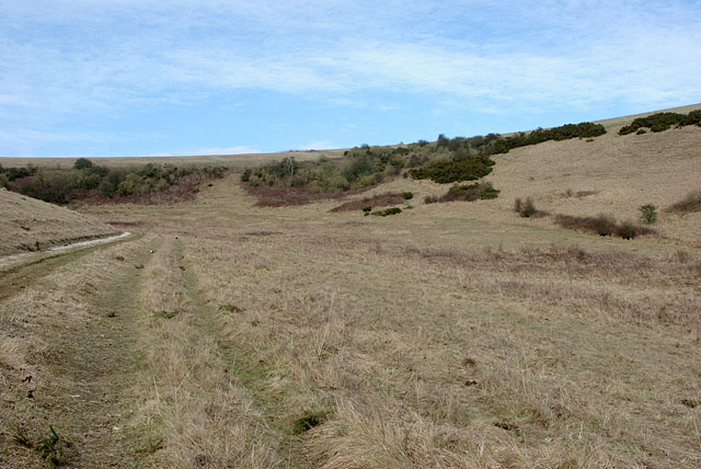
    Newmarket Bottom by Simon Carey
    Newmarket Bottom by Simon Carey.
    Beginning at the end of Falmer Bottom before climbing Newmarket Hill to the left. (15 September, 2012)
    Bridleway, Castle Hill National Nature Reserve by Simon Carey
    Bridleway, Castle Hill National Nature Reserve by Simon Carey.
    Climbing up from Falmer Bottom to meet Juggs Road to the east of Newmarket Hill. (15 September, 2012)
    Remains of a Pump, Balsdean by Simon Carey
    Remains of a Pump, Balsdean by Simon Carey.
    The only remnant of Norton Farm which originally lay out of shot to the left. The farm was apparently vacant by the early 20th century and was commandeered by the military during the Second World War used for target practice. The machinery was used to pump water from a well. Beyond is the southern slope of Castle Hill which is largely open access as evident by the gate in the fence. (15 September, 2012)
    Site of Norton Farm by Simon Carey
    Site of Norton Farm by Simon Carey.
    Other than TQ3706 : Remains of a Pump, Balsdean the only other clues to the site of the former farm is the depression to the left where the farmhouse was once located. Originally part of the small hamlet of Balsdean which originally included Sutton Farm which later became Balsdean Farm, the farm survived into the 20th century but had become uninhabited by the First World War. The buildings remained and were commandeered by the military during the Second who used it and the neighbouring buildings in Balsdean for target practice. Any remains were cleared after the war with the farm reborn a mile to the south and TQ3706 : Ruined Barns, Balsdean erected to service it. What was once a populous valley is now thoroughly deserted. Beyond is Falmer Bottom. (15 September, 2012)
    Falmer Bottom by Simon Carey
    Falmer Bottom by Simon Carey.
    Running northwards from TQ3706 : Site of Norton Farm to Newmarket Hill. (15 September, 2012)
    Falmer Bottom by Simon Carey
    Falmer Bottom by Simon Carey.
    The continuation of TQ3706 : Falmer Bottom as it rounds the corner to head towards Newmarket Bottom. (15 September, 2012)
    Castle Hill National Nature Reserve by Simon Carey
    Castle Hill National Nature Reserve by Simon Carey.
    A small nature reserve above Falmer Bottom that has been managed as chalk grassland. It was set up in 1975. (15 September, 2012)

    A big thank-you to Simon Carey, Paul Gillett, Dave Spicer, and Robin Webster.

  • Good news!

    Yesterday I was really pleased to receive a positive reply to my proposal to excavate the site of Newmarket Farm from Natural England’s, Senior Reserves Manager, Malcolm Emery.

    I wrote my proposal to conduct an archaeological dig shortly before Christmas, and sent a copy to Malcolm Emery, who is responsible for Castle Hill National Nature Reserve where the proposed dig site is located.

    Possible dates have now been set for volunteers to clear the site of its rank vegetation over the next month or two (weather permitting!); the clearance of the brambles and nettles on that part of the nature reserve is already part of the management plan.

    The nature reserve is both an SSSI (a Site of Special Scientific Interest) and an SAC (a Special Area of Conservation), and as such is an area which has been given special protection under the European Union’s Habitats Directive. It is understandable that metal detectors are forbidden without formal permission. Many of the rare plants found on the nature reserve only grow on undistured soils. Because of this, I have made sure that the dig site has been very carefully delineated to ensure that none of the protected species and habitats are disturbed. The use of a metal detector is standard policy for an archaeological excavation;

    • to scan the spoil from trenches for metal objects
    • as an aid to identifying possible trench locations (‘geophysics’)
    • they may also help identify the locations of potential unexploded WWII ordnance (the farm was used for artillery practice during the war)
    • they should not be used merely to prospect for ‘treasure’ as part of a planned excavation.

    I was therefore pleased that Malcolm Emery intends to forward copies of my proposal to his colleagues who share responsibility for various aspects of the Castle Hill SSSI / SAC.  They are Susan Simpson (Adviser with responsibility for the SSSI/SAC) and Kristoffer Hewitt (Team Leader for the Land Management Team covering the area). Between them, and using the information I sent him in my “meticulous project report” (as you may have gathered – I have a tendency to go on a bit!), the Appropriate Assessment will be completed and he will forward it to me. This is required to secure permission for the excavation under the SSSI / SAC legislative requirements, to ensure that the excavations and associated works will not have an adverse affect upon the notified natural features of the SAC.

    He also plans to talk to the neighbouring farmer in the hopes of negotiating terms for easier access. The most direct route to the site is across the field from the radio mast on top of Newmarket Hill. If this agreement is secured, he could get a ‘poor man’s gate installed in the fence line to avoid any need for climbing over it.

    Whilst I have been involved in a wide variety of projects in the past, several of which involved liason with a number of different agencies, this is certainly the most exciting. So a big thank-you to Malcolm Emery for helping to make it happen.
  • Welcome to Newmarket Hill – a South Down Blog!

    Welcome to Newmarket Hill – a South Down Blog!

    Two hundred metres above the nearby English Channel, Newmarket Hill crowns that part of the South Downs which lies between the towns of Brighton to the west and Lewes to the east, and between the villages of Rottingdean to the south and Falmer to the north. It’s top is in the parish of Kingston near Lewes, the village of which is about a mile and half away. It is now only about a mile to the north-east of the relatively modern village of Woodingdean and a mile and a half to the north-west of the deserted medieval hamlet of Balsdean. Its south-eastern slopes form a part of Castle Hill National Nature Reserve which is a site of European importance. This blog is about the history and ecology of its surrounding downland.

    Newmarket Farm by Douglas Holland
    Newmarket Farm by Douglas Holland.

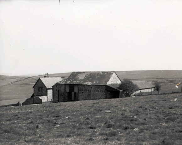
    In April 2013 I managed – as a volunteer for Natural England – a community based excavation of the site of a 19th century farm labourer’s cottage, farmyard and barns called Newmarket Farm, just inside Castle Hill NNR, near the summit of Newmarket Hill. It was built in 1830 and was the birth place of my mother in 1942, shortly before it was requisitioned for military training by British and Canadian troops stationed both locally and further afield in SE England.

    Newmarket Farm location
    Newmarket Farm location. Overlay of old and new O.S. maps and Google satellite images.

    Some Recommended Blog Entries

    Some post-dig updates

    Talks, related projects & research

    Reports & book

    David Cuthbertson: scienceinthegreen@gmail.com

    Some dates for your diary (best viewed by clicking on ‘Agenda’ tab):