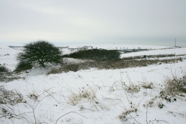
Looking SE at Newmarket Cottage site in snow; January 21st 2013.
I like snow – so am looking forward to helping clear the rest of the site of its brambles, etc tomorrow – in about 10cm or more of snow! Malcolm Emery, the Reserve Warden, agreed with me that we should go ahead as planned – unless it snows again in the night.
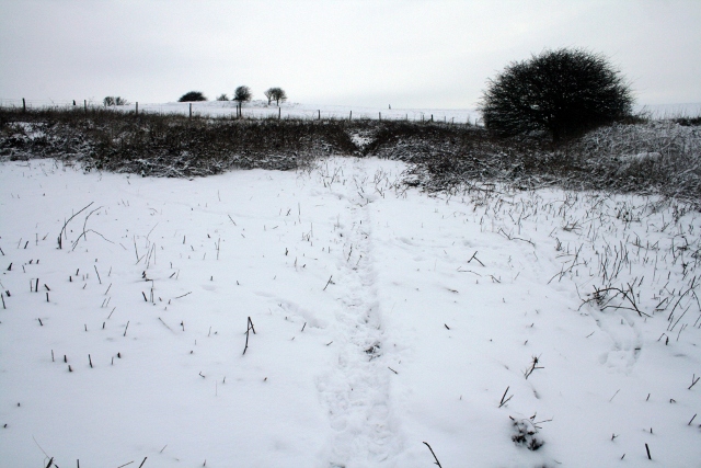
Looking N towards cottage site in brambles on right; January 21st 2013.
I was up on the hill today finishing off marking the major boundary wall junctions using Selbach’s 1921 plan and existing sections of wall lines as a guide. When I started this morning I had just one corner, a projected wall junction, and a half cleared site covered in snow. By the end of the day I had four corners and the two junctions of the internal garden/ farmyard wall. The northern boundary wall appeared to be a couple of meters further south than I expected – which meant it was well inside the modern fence-line. The south-west corner just kissed the modern fence-line. So the complete farm-site may well all be located within the Nature Reserve boundary.
Looking East along northern site boundary; January 21st 2013.
And the best thing of all – after estimating the directions of each of the walls, and attempting to measure off the distances from corner to corner – the corners were only a metre out, which for me is pretty bloomin’ good!
I wasn’t sure until recently the best way to mark out the Archaeological site boundary.
I know from experience that light weight string gets caught up in brambles and that it easily gets tangled, it can trip people up and can easily get accidentally cut.
Heavier duty rope would be better, but would be expensive, and heavy to carry.
Hazard warning tape is another possibility, but it draws too much attention to itself – I would only want to use it when there is a real need to keep people out of an area – which in this case I do not.
I knew that surveyors on Time Team used a spray paint but I wasn’t sure how permanent it was, or toxic – I would be using it on a nature reserve. However, a little Googling on the Internet and I found a spray paint called SylvaMark. This has been approved for use by English Nature (Natural England‘s predecessor) on their own reserves, and after reading the blurb, it looks exactly what I want. I chose a blue colour since it was less fluorescent than the others and a type that only lasts a couple of weeks or more. It should arrive by the end of the week. I just hope the weather stays dry enough for me to be able use it before the next site clearance day.
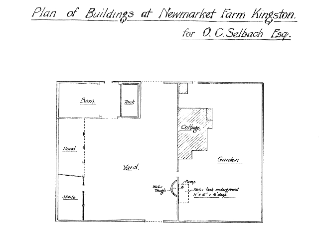
My (nearly) 13 year old niece and my mother, braved the cold to help me find out whether a plan of Newmarket Farm which we had was an accurate representation of the archaeology on the ground. The plan was a copy of the one that was found in documents held in East Sussex Record Office, and was probably drawn in 1921 when Oscar Selbach bought Newmarket Farm.
1921 Selbach plan of Newmarket Farm. From ESRO
The overall aim of the day’s work was to perform (some of) the tasks required to be done before being able to mark the area of the archaeological dig site, approximately 3m beyond the boundaries of the Newmarket Farm site. The extra 3m is to provide public access as well room to place the spoil from the trenches.
The area of the site needs to be marked out before the next date which has been planned for the clearance of the rest of the site.
Based on the dimensions given for the water tank, the scale of the plan has been estimated, and has therefore enabled the lengths of the wall lines to be meassured. My measurements were independently confirmed by my niece.
The next objective was to identify two fixed points of archaeology on the ground to check the accuracy of Selbach’s plan. Previous to the site clearance work of the 9th January, only the SE corner (bottom right on the plan) was visible and some isolated portions of the south and east boundary walls. During site clearance a small portion of the wall which divided the garden from the farm-yard was revealed. Therefore our next task was to uncover enough of this wall to be able to estimate where it met the southern boundary wall, somewhere near a small elder bush.
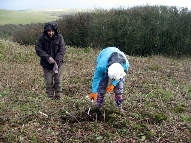
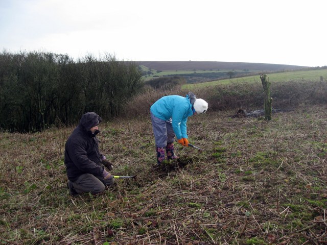
Looking E at my niece & myself finding the wall-line between garden and farm-yard; 13th January 2013.
Did I say that it was cold! Also, almost all of the existing line of the wall was buried under a thick mat of bramble and stinging nettle roots. No wonder Time Team makes it look so easy – they have a mechanical digger to do this part!
Looking SE at my niece & myself finding the wall-line between garden and farm-yard; 13th January 2013.
But with hard work and perseverance we managed to expose enough of the wall to estimate that it met the southern boundary wall immediately to the east (left) of the elder bush.
Next, Selbach’s plan indicated that the distance from this point to the SE corner of the garden boundary wall was about 52.5 feet. When we meassured this on the ground it was found to be about 52 feet. Therefore we felt able to (provisionally) conclude that Selbach’s plan could be used as a guide to estimating the lengths of the other walls.
Just before we left I quickly measured the distance between the elder and the SW corner of the house, and marked it with a peg. There was no sign of any change in ground level in the vicinity of this point. Selbach’s plan will therefore be very importantant for any future attempts to locate archaeological targets on the ground.