Sunday 13th January, 2013
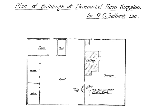
My (nearly) 13 year old niece and my mother, braved the cold to help me find out whether a plan of Newmarket Farm which we had was an accurate representation of the archaeology on the ground. The plan was a copy of the one that was found in documents held in East Sussex Record Office, and was probably drawn in 1921 when Oscar Selbach bought Newmarket Farm.
The overall aim of the day’s work was to perform (some of) the tasks required to be done before being able to mark the area of the archaeological dig site, approximately 3m beyond the boundaries of the Newmarket Farm site. The extra 3m is to provide public access as well room to place the spoil from the trenches.
The area of the site needs to be marked out before the next date which has been planned for the clearance of the rest of the site.
Based on the dimensions given for the water tank, the scale of the plan has been estimated, and has therefore enabled the lengths of the wall lines to be meassured. My measurements were independently confirmed by my niece.
The next objective was to identify two fixed points of archaeology on the ground to check the accuracy of Selbach’s plan. Previous to the site clearance work of the 9th January, only the SE corner (bottom right on the plan) was visible and some isolated portions of the south and east boundary walls. During site clearance a small portion of the wall which divided the garden from the farm-yard was revealed. Therefore our next task was to uncover enough of this wall to be able to estimate where it met the southern boundary wall, somewhere near a small elder bush.
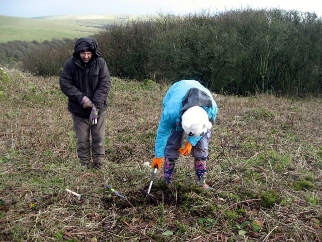
Did I say that it was cold! Also, almost all of the existing line of the wall was buried under a thick mat of bramble and stinging nettle roots. No wonder Time Team makes it look so easy – they have a mechanical digger to do this part!
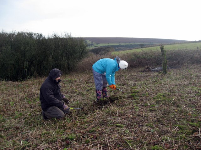
But with hard work and perseverance we managed to expose enough of the wall to estimate that it met the southern boundary wall immediately to the east (left) of the elder bush.
Next, Selbach’s plan indicated that the distance from this point to the SE corner of the garden boundary wall was about 52.5 feet. When we meassured this on the ground it was found to be about 52 feet. Therefore we felt able to (provisionally) conclude that Selbach’s plan could be used as a guide to estimating the lengths of the other walls.
Just before we left I quickly measured the distance between the elder and the SW corner of the house, and marked it with a peg. There was no sign of any change in ground level in the vicinity of this point. Selbach’s plan will therefore be very importantant for any future attempts to locate archaeological targets on the ground.

2 replies on “New Team Member Helps Confirm Site Plan”
[…] My Niece helped me to compare archaeology on the ground with an old site plan (in the freezing cold!): New Team Member Helps Confirm Site Plan […]
[…] My Niece helped me to compare archaeology on the ground with an old site plan (in the freezing cold!): New Team Member Helps Confirm Site Plan […]