Category: Surveying

  • Excavation Routine

    Time Team get a lot done in just 3 days – but they are professionals, and they know what they are doing. Their routines are just that – routine. What we see is really just the tip of a very efficient iceberg.

    I found a guide to this archaeological routine in a publication by the Museum of London Archaeology, which they summarised (with a little simplification from myself):

    1. Clean Area
    2. Identify limits of trench [context] on the ground
    3. Photograph if required
    4. Identify location of trench on site grid
    5. Draw plan of feature (at 1:20)
    6. Use relevant type of ‘context sheet’ to record archaeology (depends on what is being excavated)
    7. Give the trench [context] a unique number (from site context register)
    8. Record this number on the plan(s)
    9. Take relative levels; mark spot heights on plan (record technical surveying details on reverse of context sheet)
    10. Convert relative levels to absolute [Ordnance Datum] levels
    11. Describe context
    12. Prepare ‘finds bag’ and enter site code and context number on label(s?)
    13. Determine suitable method of excavation, need for sampling and method of finds collection
    14. Excavate context, amending and adjusting description as necessary
    15. Take finds to an appropriate place
    16. Determine relationships of newly-recorded context to previously excavated [by overlaying plans]
    17. Cross-reference relationships on context sheet and fill in matrix
    18. Enter date and initials on context sheet
    19. Place plan and context sheet in with relevant ‘to be checked’ files
    20. All plans, context sheets and relationships should be checked before leaving site

    Once the context (trench) has been recorded, and the finds have all been fully described and recorded, the trench needs to be put to bed, and then it must *all* be written up, including their interpretation. Only then is it advisable to open the next trench, based on what has been learnt from the previous trenches.

    This is all new to me, so it may take days, or even weeks to complete all the paperwork. This is not a full time project. So I am proposing that volunteer days should be planned for one day per month, at least to begin with.

  • Excavation Planning

    Happier now! In my last post (pun not intended!) I realised I needed to read about Project Planning in general. As a result I realised I was trying to put my cart in front of the horse; I was trying to timetable an hypothetical end point of one year, and then working backwards towards how to get there, and getting lost along the way.

    Instead I tried brainstorming each of the outcomes I hope to achieve – one trench at a time – mini project stages in and of themselves – and each following on from the one before.

    And it seems to have worked – apart from the timescale part (I can deal with that later) – and so it is that I now have a provisional list of targets:

    1. Find NE corner of garden boundary wall (1x1m trench on corner & extend if required to max 2x2m)
    2. Find S boundary wall junction; including corner of farmyard & garden & possible gdn structure (1x1m trench on estimated junction & extend if required to 3x2m)
    3. Find SW corner of water tank on boundary wall (1x1m trench & extend if required to 2x2m)
    4. Find NW corner of water tank on boundary wall (1x1m trench & extend if required to 2x2m)
    5. Find SW corner of house on boundary wall (1x1m trench & extend if required to 2x2m)
    6. Find NW corner of house on boundary wall (1x1m trench & extend if required to 2x2m)
    7. Find internal house wall lines on W side of house (three 1x1m trenches increased to 1x3m if required)
    8. Find front door and front garden gate (two 2x1m trench enlarged to 3x1m if required)
    9. Find NE corner of house, including ‘wood-shed’ (2x1m trench enlarged to 3x1m if required)
    10. Find SE corner of ‘wood-shed’ & projection of E side of house, possible back-door & internal house wall (2x2m trench enlarged to 3x3m if required)
    11. Find door in internal wall (2x1m trench enlarged to 3x1m if required)
    12. Find fireplace (2x1m trench enlarged to 3x1m if required)
    13. Clear vegetation on mound of demolition rubble & look for chimney pots
    Newmarket Cottage Trench Plan; January 2013.
    Newmarket Cottage Trench Plan; January 2013. Base plan from ESRO.

    This only provisional – but I have to start somewhere.

  • Site Surveying in the Snow

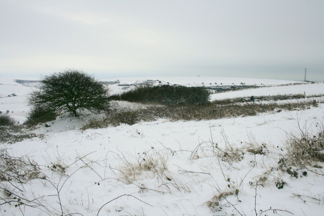
    Looking SE at Newmarket Cottage site in snow; January 21st 2013.
    Looking SE at Newmarket Cottage site in snow; January 21st 2013.

    I like snow – so am looking forward to helping clear the rest of the site of its brambles, etc tomorrow – in about 10cm or more of snow! Malcolm Emery, the Reserve Warden, agreed with me that we should go ahead as planned – unless it snows again in the night.

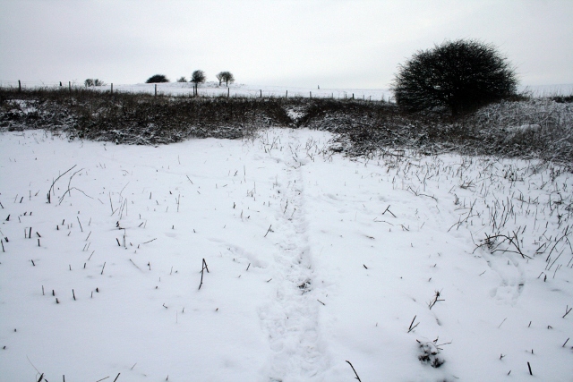
    Looking N towards cottage site in brambles on right; January 21st 2013.
    Looking N towards cottage site in brambles on right; January 21st 2013.

    I was up on the hill today finishing off marking the major boundary wall junctions using Selbach’s 1921 plan and existing sections of wall lines as a guide. When I started this morning I had just one corner, a projected wall junction, and a half cleared site covered in snow. By the end of the day I had four corners and the two junctions of the internal garden/ farmyard wall. The northern boundary wall appeared to be a couple of meters further south than I expected – which meant it was well inside the modern fence-line. The south-west corner just kissed the modern fence-line. So the complete farm-site may well all be located within the Nature Reserve boundary.

    Looking East along northern site boundary; January 21st 2013.
    Looking East along northern site boundary; January 21st 2013.

    And the best thing of all – after estimating the directions of each of the walls, and attempting to measure off the distances from corner to corner – the corners were only a metre out, which for me is pretty bloomin’ good!

  • New Team Member Helps Confirm Site Plan

    Sunday 13th January, 2013

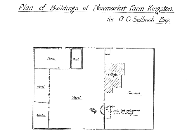
    My (nearly) 13 year old niece and my mother, braved the cold to help me find out whether a plan of Newmarket Farm which we had was an accurate representation of the archaeology on the ground. The plan was a copy of the one that was found in documents held in East Sussex Record Office, and was probably drawn in 1921 when Oscar Selbach bought Newmarket Farm.

    1921 Selbach plan of Newmarket Farm. From ESRO
    1921 Selbach plan of Newmarket Farm. From ESRO

    The overall aim of the day’s work was to perform (some of) the tasks required to be done before being able to mark the area of the archaeological dig site, approximately 3m beyond the boundaries of the Newmarket Farm site. The extra 3m is to provide public access as well room to place the spoil from the trenches.

    The area of the site needs to be marked out before the next date which has been planned for the clearance of the rest of the site.

    Based on the dimensions given for the water tank, the scale of the plan has been estimated, and has therefore enabled the lengths of the wall lines to be meassured. My measurements were independently confirmed by my niece.

    The next objective was to identify two fixed points of archaeology on the ground to check the accuracy of Selbach’s plan. Previous to the site clearance work of the 9th January, only the SE corner (bottom right on the plan) was visible and some isolated portions of the south and east boundary walls. During site clearance a small portion of the wall which divided the garden from the farm-yard was revealed. Therefore our next task was to uncover enough of this wall to be able to estimate where it met the southern boundary wall, somewhere near a small elder bush.

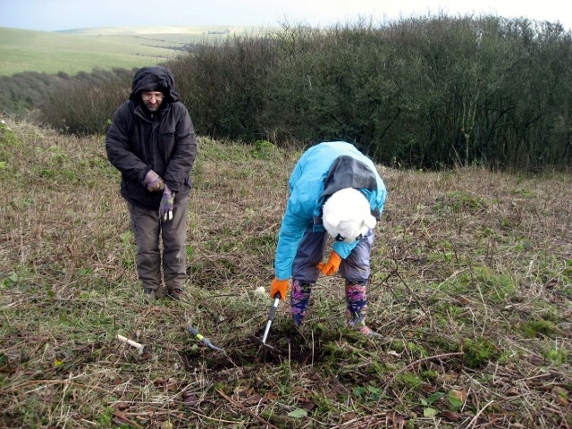
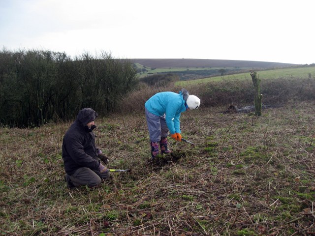
    Looking E at my niece & myself finding the wall-line between garden and farm-yard; 13th January 2013.
    Looking E at my niece & myself finding the wall-line between garden and farm-yard; 13th January 2013.

    Did I say that it was cold! Also, almost all of the existing line of the wall was buried under a thick mat of bramble and stinging nettle roots. No wonder Time Team makes it look so easy – they have a mechanical digger to do this part!

    Looking SE at my niece & myself finding the wall-line between garden and farm-yard; 13th January 2013.
    Looking SE at my niece & myself finding the wall-line between garden and farm-yard; 13th January 2013.

    But with hard work and perseverance we managed to expose enough of the wall to estimate that it met the southern boundary wall immediately to the east (left) of the elder bush.

    Next, Selbach’s plan indicated that the distance from this point to the SE corner of the garden boundary wall was about 52.5 feet. When we meassured this on the ground it was found to be about 52 feet. Therefore we felt able to (provisionally) conclude that Selbach’s plan could be used as a guide to estimating the lengths of the other walls.

    Just before we left I quickly measured the distance between the elder and the SW corner of the house, and marked it with a peg. There was no sign of any change in ground level in the vicinity of this point. Selbach’s plan will therefore be very importantant for any future attempts to locate archaeological targets on the ground.