Brighton & Hove Healthwalks – meet Castle Hill National Nature Reserve Car Park, on the Falmer Road (immediately north of Woodingdean), 1pm Sunday 27th March 2022.
This post is still under construction. Please come back very soon…
Brighton & Hove Healthwalks – meet Castle Hill National Nature Reserve Car Park, on the Falmer Road (immediately north of Woodingdean), 1pm Sunday 27th March 2022.
This post is still under construction. Please come back very soon…
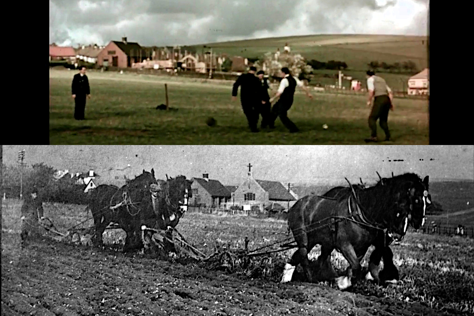
On Wednesday, 19 January, 10:00 am, I will be leading a guided history walk through Woodingdean — an accessible wander back into Woodingdean’s Second World War past. All being well, I hope to be joined by some older Woodingdeaners who were young children at the time of the war. They include Woodingdean local history author, Peter Mercer, and my mother, Peggy Cuthbertson.
To be told are stories of evacuees, the Home Guard, the best shops to spend your sweet ration on, Emperor Haile Salassie’s favourite fish and chip shop, the Queen’s visit (our present Queen’s mother), the tragic shooting of Gnr. Prince at the Downs Hotel, and much more.
The walk starts at the Downs Hotel bus stop (corner of Downsway and Warren Road), Woodingdean, opposite the Church of the Holy Cross (map). Buses 2, 22 stop here from Brighton and the 52 bus stops nearby. Car parking is best at Castle Hill National Nature Reserve Car Park, Woodingdean, off Falmer Road (B2123), just north of the junction with Bexhill Road. Grid reference TQ356063. The Woodingdean Community Centre Car Park is nearer but is often full.
We will start at 10am and I have estimated 2 hours (there may be a lot of shared reminiscences!) to cover a distance of a little over half a mile of easy walking between the Downs Hotel and the Lawn Cemetery bus stop. From here you can either;
May I also propose the Downs Hotel for drinks or lunch, at 1pm, for a post-walk informal chat. Other cafes are also available. Toilets are available for customers in the Downs Hotel and in local cafes, or just inside the main doors of the church.
The walk is organised by Brighton & Hove Council’s Healthwalks team. New walkers are asked to register either:
Please remember that Woodingdean can get very cold, so dress up warm, and please be Covid safe.
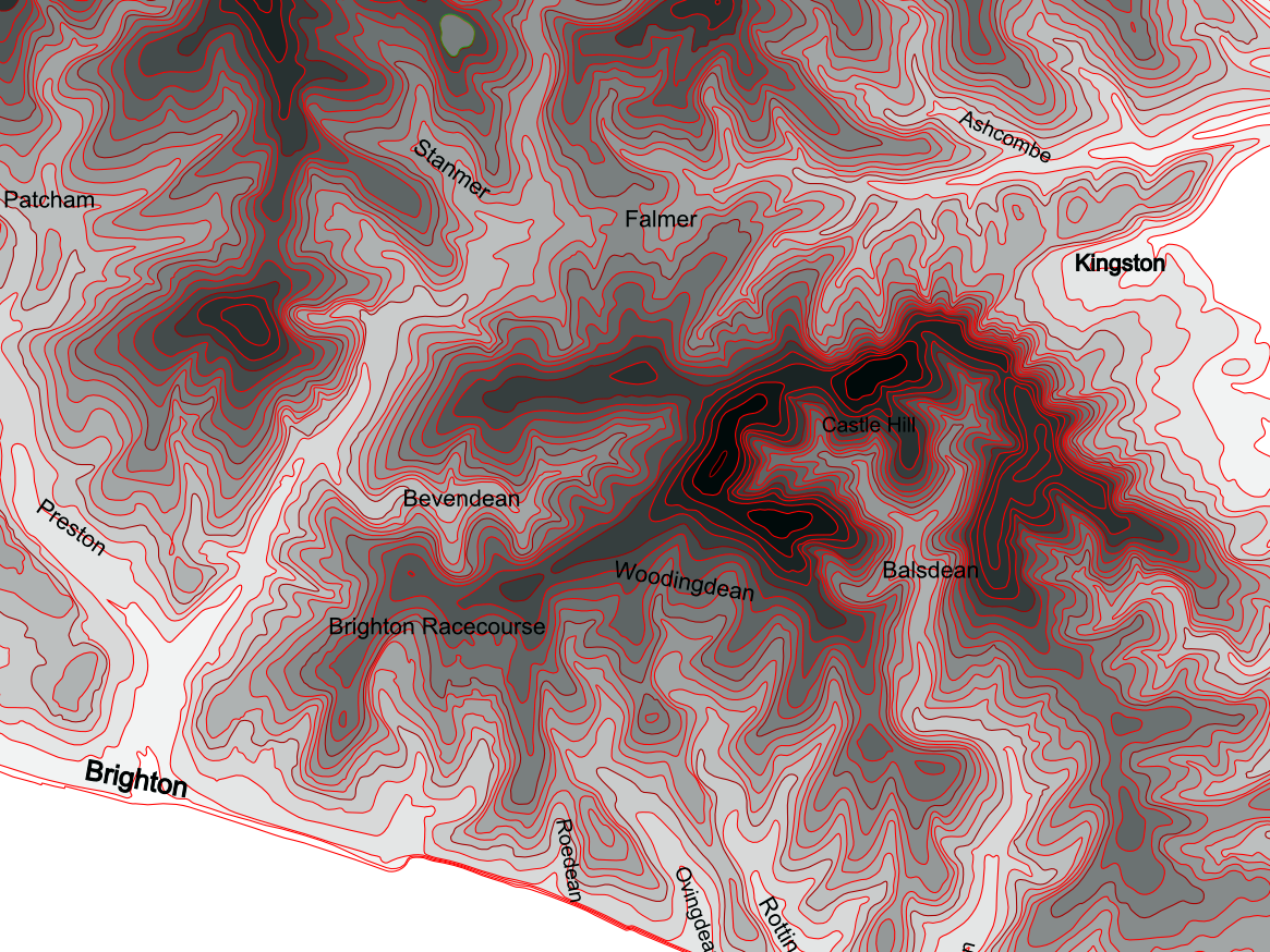
I find it sad that modern surveying has demoted Newmarket Hill. However, Castle Hill is a worthy successor.
The ‘Hill Bagging‘ website is the online version of the Database of British and Irish Hills (DoBIH). It is as near to official as one can find. If they say that Castle Hill is now considered to be higher than Newmarket Hill (about a mile to its west-south-west) I am willing to accept that it is so.
It appears from the DoBIH Change Log that Castle Hill has not grown in height, it is still considered to be 199.8 metres (656ft) high. However, Newmarket Hill’s DoBIH Change Log records that its measured height, in May 2020, has shrunk by 2 feet, from 200 metres (656ft) 199.4 metres (654ft).
I can think of two possible reasons:
My personal belief is that soil erosion due to ploughing may have been a major factor. Castle Hill has been put down to grass — improved pasture. The grass, bramble and nettle cover across the demolished remains of Newmarket Farm had enabled the build up of about 5 centimetres (2 inches) of soil in about 60 years.
However, Newmarket Hill has been under the plough for many years. The sub-surface geology identified from our excavation of Newmarket Farm in 2013, located a short distance from the hill’s major and minor summits, was of a reddish-orange silty clay (clay-with-flints), at least two feet deep (we didn’t excavate deeper). This is reddish coloured acid clay is found on most of the broad backed hills in this area and can be up to 10 metres deep (South Downs Integrated Landscape Character Assessment: Technical Report by Land Use Consultants, December 2005, p. 10). It accounts for the presence of such acid loving plants as sheep sorrel, whose leaves age to a beautiful vivid scarlet, and purple bell heather.
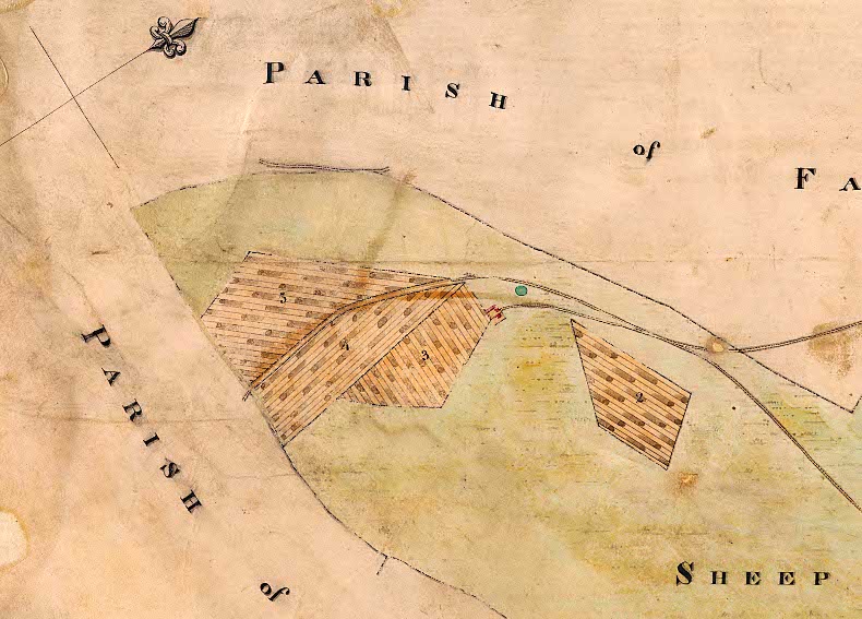
Over recent decades ploughs have become more powerful, with soil erosion on the South Downs recorded as being up to 200 cubic metres per hectare per year. This (if my calculations are correct) would equate to up to 2cm loss per year. Therefore, in a worse case scenario, the Newmarket Hill could shrink in height by 2 feet in just 30 years. Newmarket Hill has been under the plough for about two hundred years (a map dated 1830 showed it as ‘broken up’, i.e. ploughed).
For a technical paper on the subject see: Soil Erosion and Flooding on the Eastern South Downs, Southern England, 1976-2001, John Boardman, Transactions of the Institute of British Geographers, Vol. 28, No. 2 (Jun., 2003), pp. 176-196. Published By: Wiley https://www.jstor.org/stable/3804444.
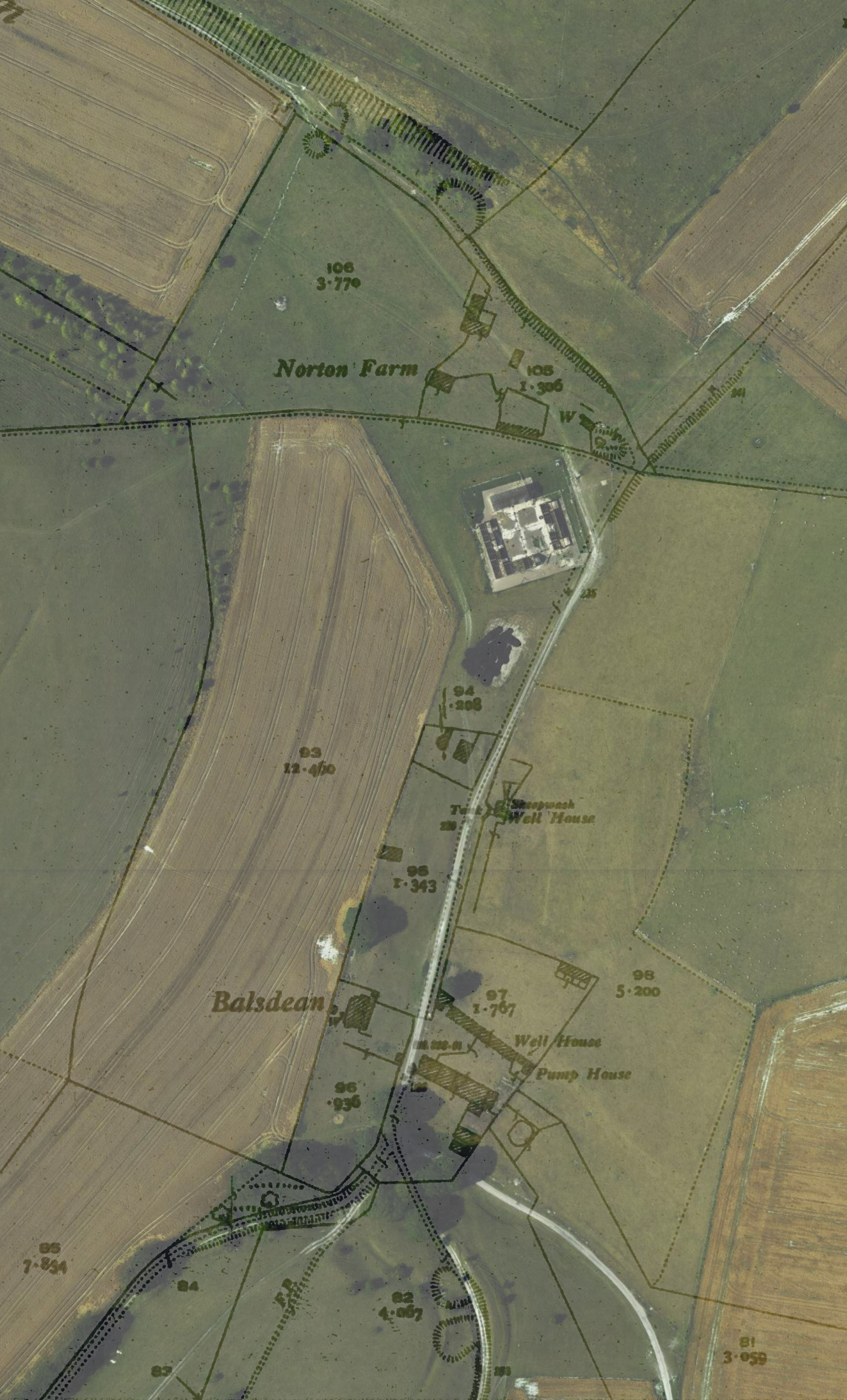
Yesterday’s ‘special’ History Healthwalk seemed to go down well, despite it being a bit breezy and wet under foot. On the walk I promised to add to this blog the composite map overlays I showed people on the walk of the Balsdean and Norton Farm areas.
The National Library of Scotland (NLS Maps) website is an incredible resource for historians and archaeologists and I can strongly recommend visiting it, and playing with their wide range of mapping resources. If I find the time I could post other base maps combined with other overlays. Meanwhile I can strongly recommend exploring their maps yourselves. For the more adventurous/knowledgeable there are an even wider range of Ordnance Survey maps which they have not yet georeferenced. These can be manually copied, resized and overlaid with other mapping using image editing software such as Photoshop or its free, libre and open source (FLOSS) equivalent, Gimp. I have learnt a lot from such exercises.
However, one thing I discovered from overlaying maps is that they are not perfect; they are abstractions and were made by human beings.
A map is not the territory it represents, but, if correct, it has a similar structure to the territory, which accounts for its usefulness.
— Korzybski, Alfred (1933). Science and Sanity: An Introduction to Non-Aristotelian Systems and General Semantics. International Non-Aristotelian Library Publishing Company. p. 58.
We have to walk the map. See, for example:
Eddie Procter (2017) Deep topography practice – landscape walks as PhD fieldwork.
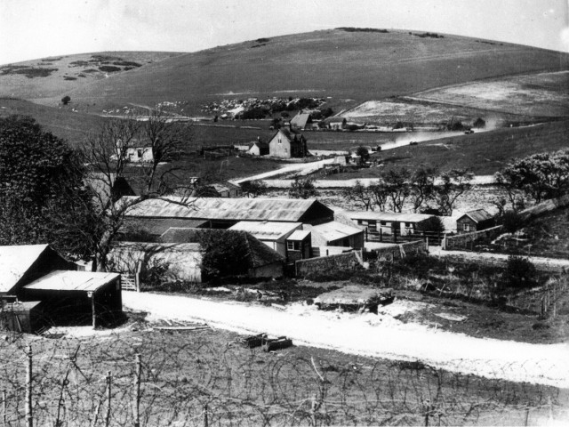
It has been a long time since my last blog. I have been hiding away from the world since Covid writing a book, with the help of my mum, on the WW2 history associated with the Balsdean and Castle Hill Downs, including the associated villages of Kingston near Lewes and Woodingdean. The book was supposed to be finished by Christmas. Last Christmas. But we kept finding new things to research and I kept making the book more detailed, so now we hope it will be ready for people to buy *this* Christmas 🙂
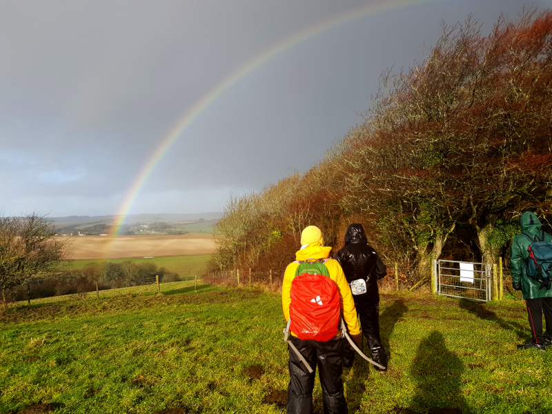
Meanwhile, I have now emerged from hibernation and have resumed being a volunteer Brighton & Hove Healthwalk Leader, more or less exclusively on their Balsdean and Castle Hill National Nature Reserve walks. The scenery is stunning, the company friendly, and I get to share all my local history knowledge with all and sundry! The regular walkers are very tolerant of my enthusiasm which, though I think this is a good thing, I also believe it says more about their generous natures than anything else!
The walks include:
If you are new to the Healthwalks programme I must ask you to sign up via Brighton & Hove Council’s website: https://www.brighton-hove.gov.uk/health-walks
For those who are already registered a copy of the latest Healthwalks programme is available here. May I also ask, in these challenging times, that we take sensible precautions:
These Local Defence Volunteers were (probably) the East Brighton Home Guard Platoon, on a training exercise between Ovingdean and Woodingdean.
British Movietone Newsreel of the 16th (Lewes) Home Guard Battalion (aka the Lewes Cossacks). Mr Arthur W. J. Dalgety, Master of the Southdown Hunt and one of the two Balsdean farmers who employed my mother’s family, was part of the battalion.
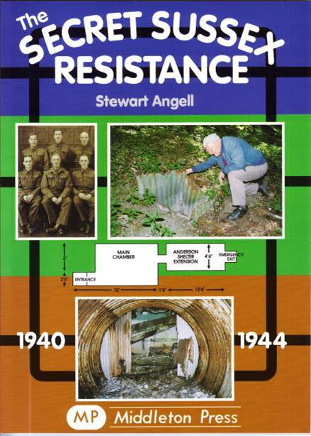
The Auxilliaries were specially chosen volunteers – mostly local farmers with previous military experience. There job was to become Britain’s top secret underground resistance force if Germany invaded. They were predicted to have a life expectancy of just two weeks.
The Rodmell Unit covered the block of downs between Newhaven – Lewes (E. of R. Ouse) – Falmer (S. of Lewes Rd) – Rottingdean (E. of Falmer Rd).
The other branch of the Auxilliaries were responsible for intelligence work. Harold West of Upper Bevendean Farm volunteered for this responsibility across the same downs.
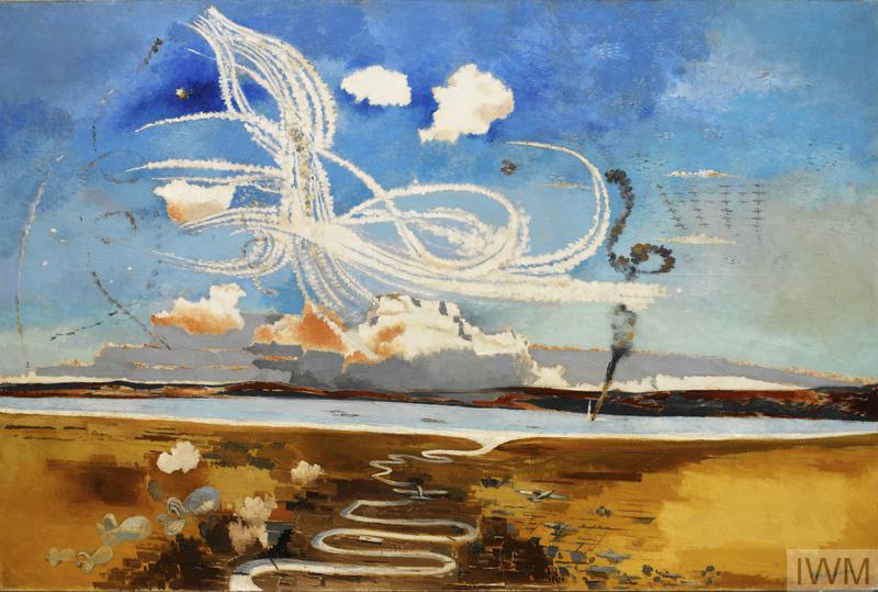
My father said that such aerial acrobatics were enthralling to watch as a teenager.
Flame fougasse defences were developed by the Department of Petroleum Warfare in July 1940. They were installed on the Ashcombe Lane, on both sides of its crossing with Kingston Ridge/ Juggs Road. Peter Hibbs has written about them. They were frightening weapons, designed to slow a German advance.
Our enemy’s enemy is our friend. As a result of Germany opening a new Eastern Front, the threat of invasion was reduced but not eliminated.
By 1941 a new type of training was introduced. It was designed be as close to real battlefield experiences as possible – live ammunition was used. This resulted in casualties, including fatalities.
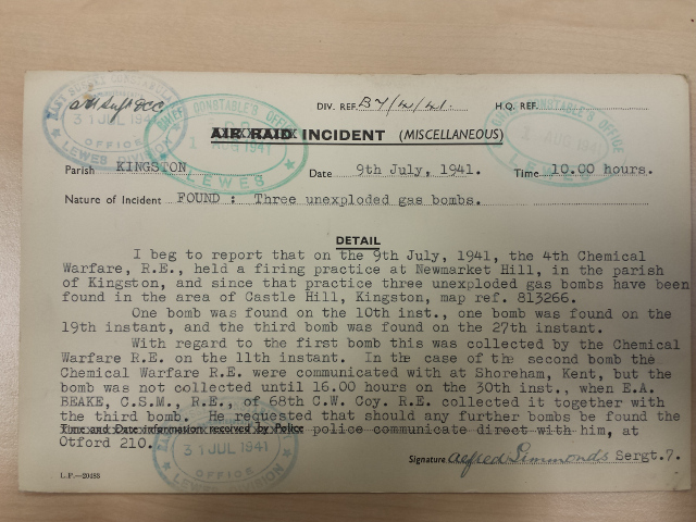
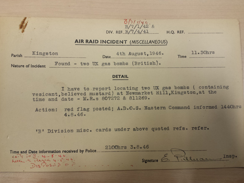
Exercise Exodus was a mustard gas firing training exercise in the Balsdean / Castle Hill area. Winston Churchill had ordered the use of mustard gas if Germany attempted to invade. This would have broken the Geneva Gas Protocol which we signed in 1925. Hopefully these gas ‘bombs’ were empty. My mother’s family were living just one kilometre from where they landed! The training was organised by the Fourth (British) Chemical Warfare Regiment for Canadian officers who had recently arrived in East Sussex.
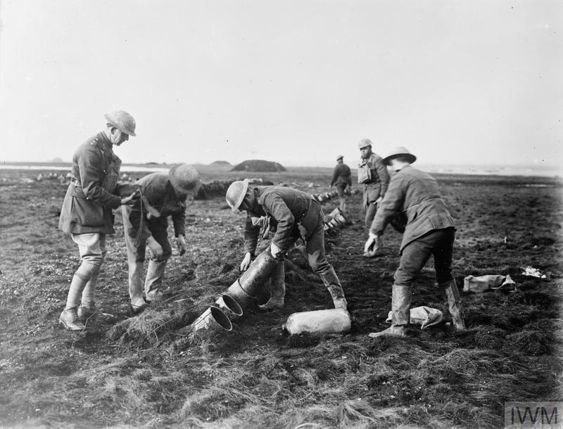
The gas bombs were fired from Livens projectors. These were hollow metal cylinders with a propellant charge at its base. They were buried in a hole in the ground, about 2 feet deep. On the shallow chalk soils of the downs the spoil from their trenches would be easily seen, as in the pictures below.
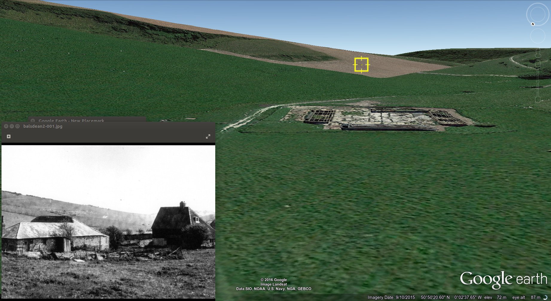
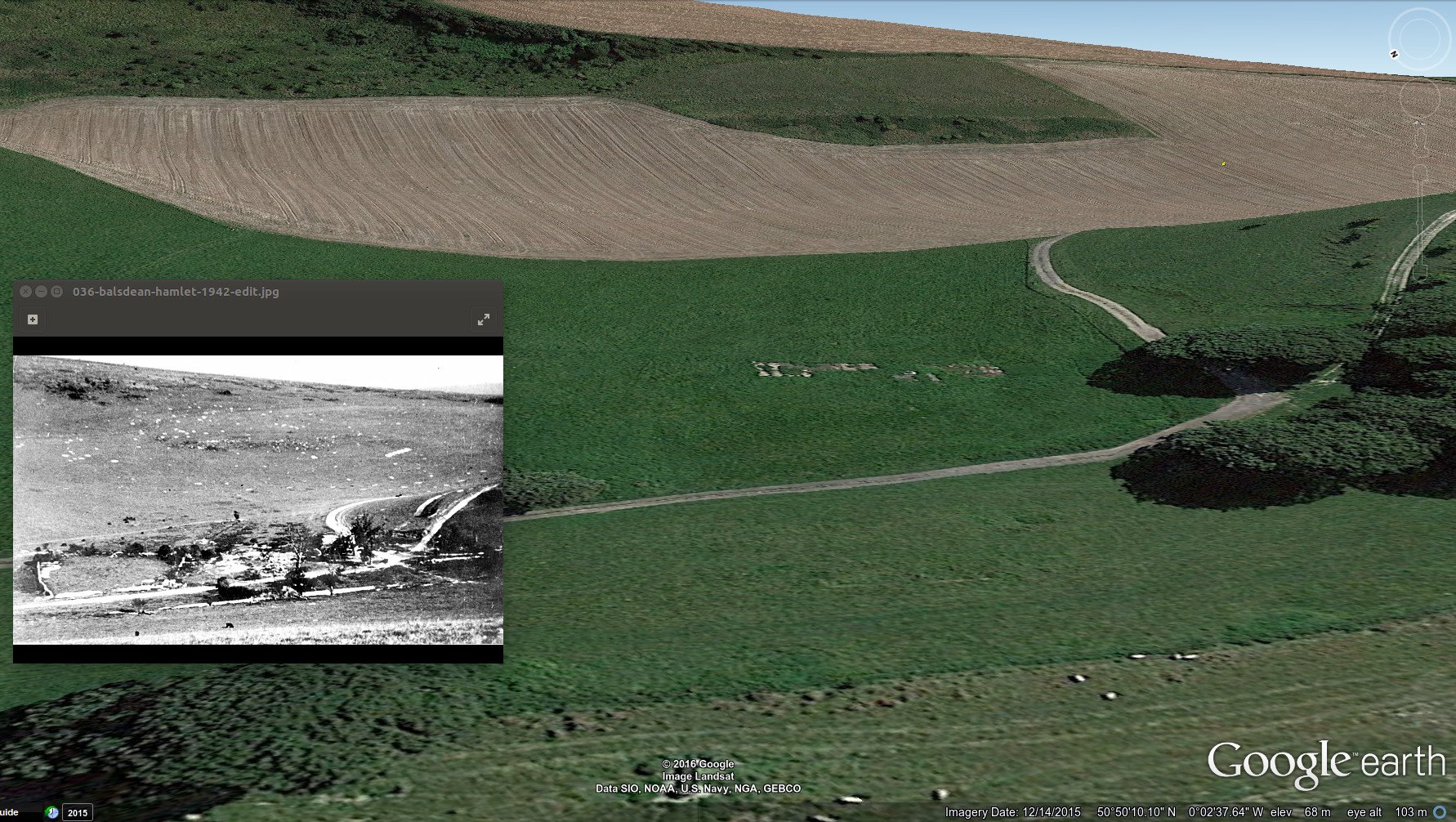
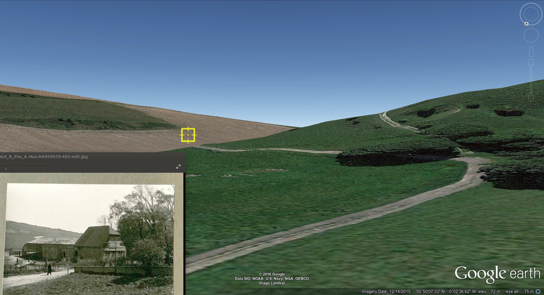
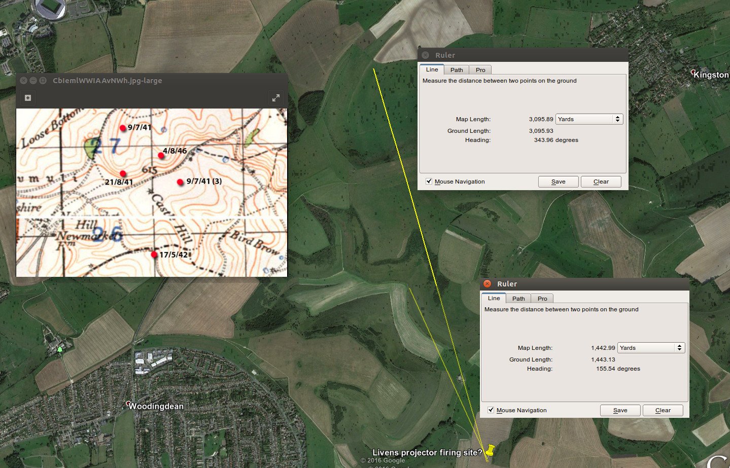
The above three black and white inset photos all show in the background a double row of about 6 chalk excavations; about a dozen in total. When aligned with Google Earth imagery they are clearly the same feature. Those photographs, where the farm buildings are still standing, would have been taken before Balsdean and its surrounding downs were requisitioned in May 1942. The maximum firing distance of a Livens Projector in WW1 was about 1,500 metres. By 1941 significant improvements appear to have been made, but detailed information is difficult to find.
Two tank bases I know of were in Stanmer and Ovingdean. Was this filmed around Stanmer? If so, in 1941, these may well be British units.
Tanks require lots of room to manoeuvre, especially in joint forces exercises. Their commanders wanted large areas of the Downs to be requisitioned for this purpose. Opening and closing gates and keeping to farm tracks was not popular, and compensation to farmers was expensive. One regiment compensated the Balsdean farmers with (illegal?) petrol and marmalade! In the autumn of 1941 negotiations started to requisition large areas of the South Downs for tank training and other exercises.
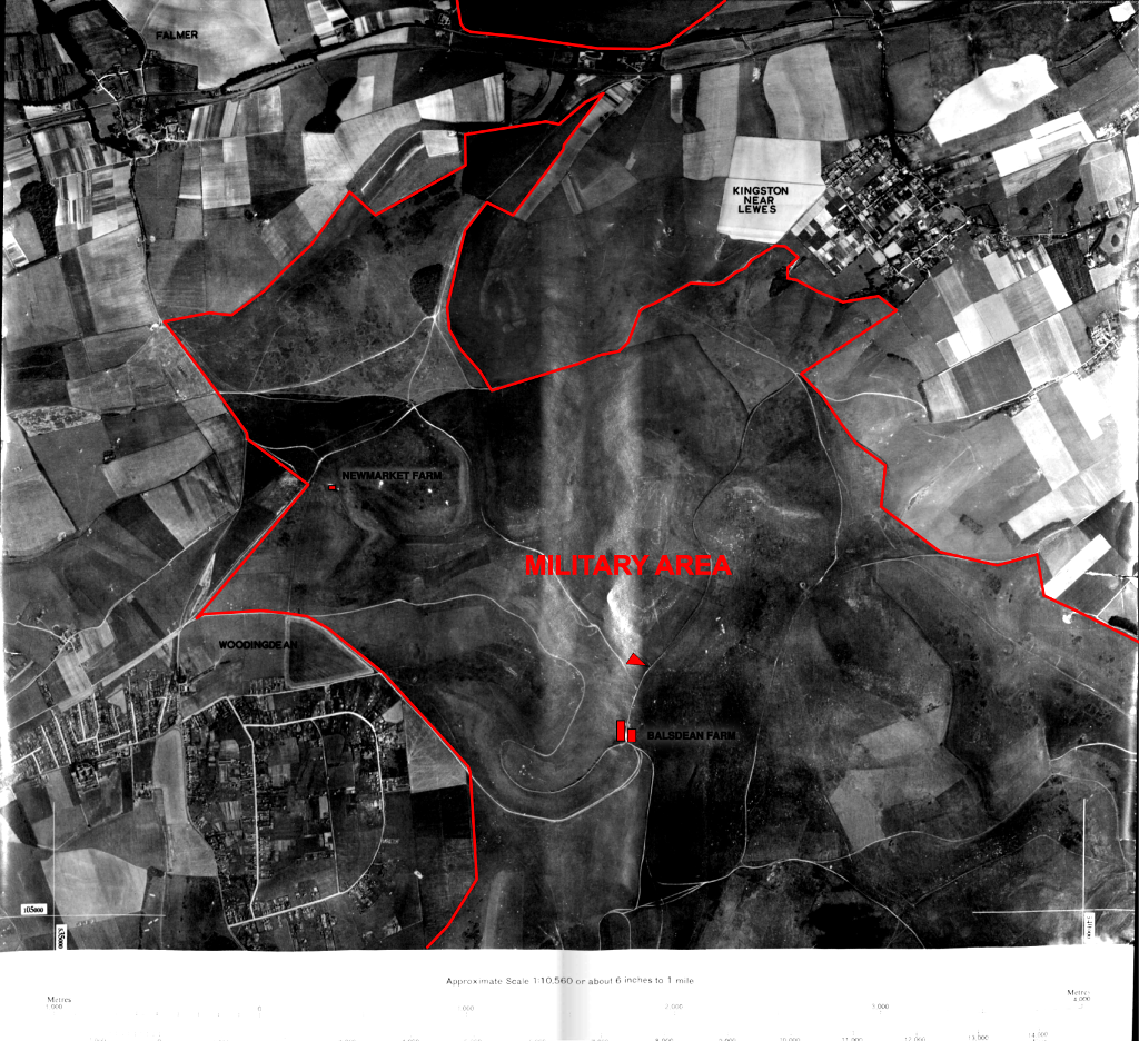
At the end of April 1942 Balsdean Farm received confirmation that their land was to be requisitioned for military training purposes. Kingston and other farms would have also been served similar notices. The final notice gave just two weeks to remove people, stock and machinery.
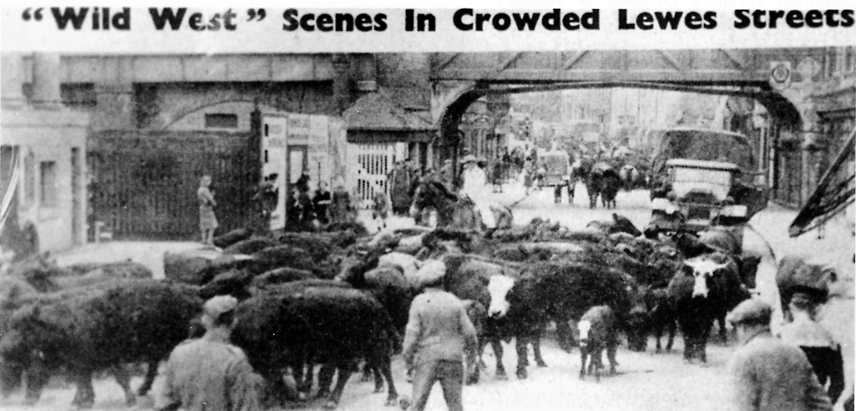
Woodman and Dalgety received financial compensation. Woodman found another farm in the west country. Dalgety sent their cattle via train to Yorkshire. He found work at the nearby Ashcombe Farm. My mother’s family and the other Balsdean labourers also lost their work and homes – but without any compensation. My grandmother had to leave her piano and other furniture behind.
I put this video together as part of a talk I gave on the WW2 military training area in 2017. The audio was downloaded from part of a podcast on military activities through history across the South Downs and was commissioned by the South Downs Joint Committee in about 2008. The series was called “Landshapers. Voices from the South Downs landscape. An Audimus[?] Production.” Sadly it and all the other superb audio documentaries of the series, with the replacement of the S.D. Joint Committee by the S.D. National Park, are no longer available on the Internet. This particular podcast was called “Conflict and War”. I hope the South Downs National Park is able to reinstate them.
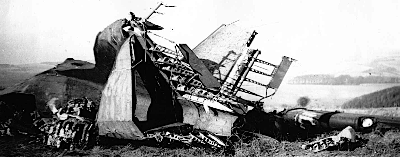
The pictures were not part of the original broadcast. The first was of Balsdean Farm shortly after the military took over; the next few are of a range of Imperial War Museum photos of generic training activities; the tank picture is also from the I.W.M., and was taken in the village of Rottingdean immediately to the south west of the Balsdean military area; the plane crash pictures were of a Dakota (C47) allied troop transport plane which crashed on a hill top near Newmarket Plantation, in the northern part of the training area, killing almost all on board; the last image is of Balsdean towards the end of the war.
One year after Russia became our ally, and they desperately needed our help. Stalin wanted the Allies to cross the English Channel and start a Second Front.
The infamous Dieppe Raid was initiated for many reasons, one of which was to pacify Stalin – to remind Hitler of the threat of a Second Front. Sadly, it suffered one of the worst casualty rates of WW2. The only Canadians involved from Sussex were based in Seaford and Newhaven shortly beforehand. It is highly unlikely that any Canadians based in Kingston were involved in any way. British Pathé newsreel shown to those at home was largely propaganda, and gave no indication of the scale of the tragedy.
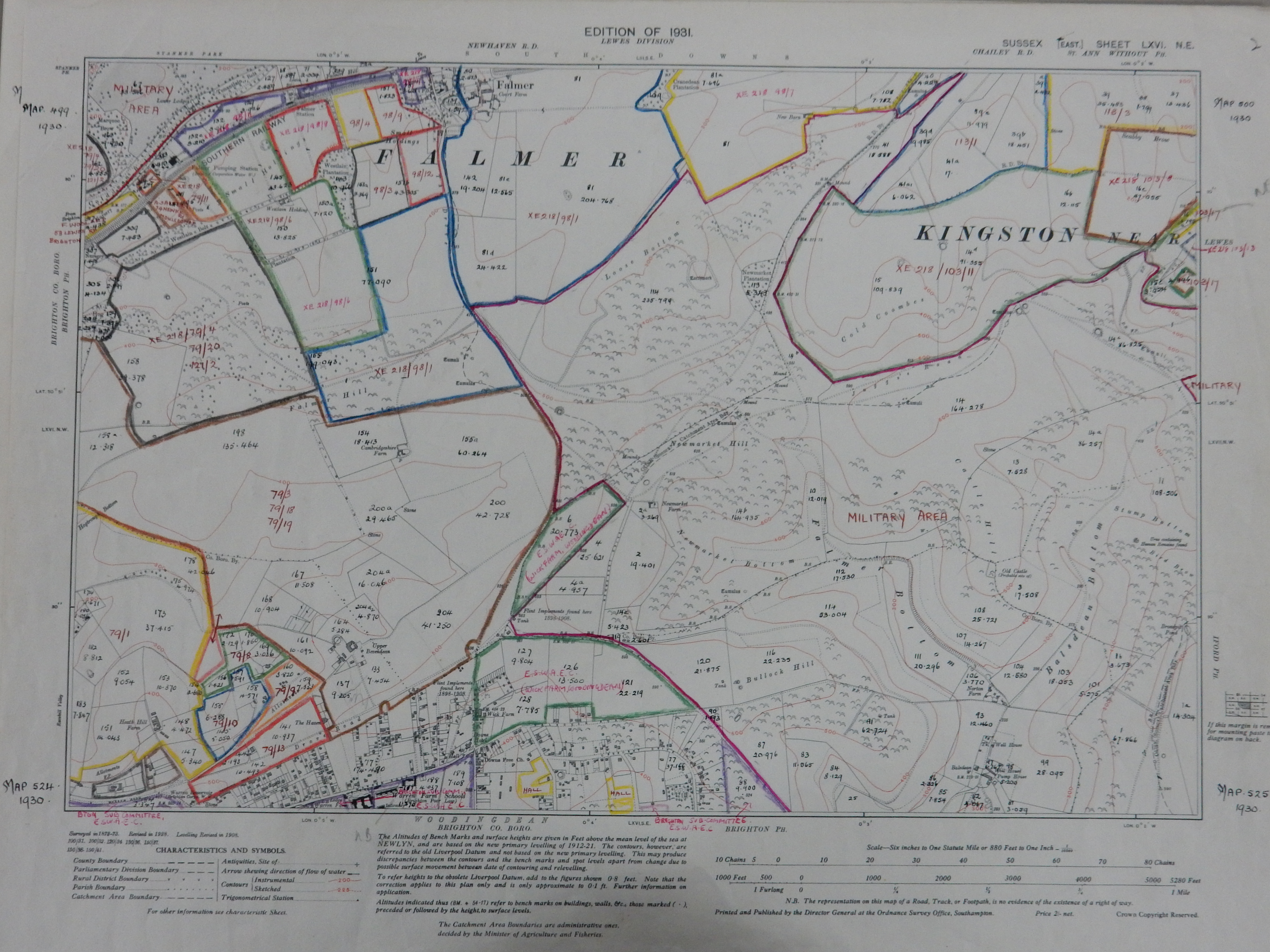
This map shows an agricultural survey map completed in September 1942. The East Sussex Agricultural Executive Committee was responsible for not only assessing an agricultural holding for its potential to feed the nation. It also had the power to take over a farm’s management and /or dictate what land should be put to the plough and what crops should be shown. The Balsdean farmer’s son, Gerald Woodman, said that their demands were often totally inappropriate. Before the war they worked their land with horses. After the start of the war two tractors were required to meet the demands of ESAEC. Similar stories have been told by many other farmers.
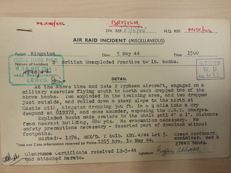
Unfortunately the nature of the exercise, or the unit(s) involved are not given. I spent many long hours in The National Archive at Kew copying as many War Diaries as I could relevant to the area. After many thousands of pages I only reached the start of 1942. One day I may return to complete the job, but not in the foreseeable future.
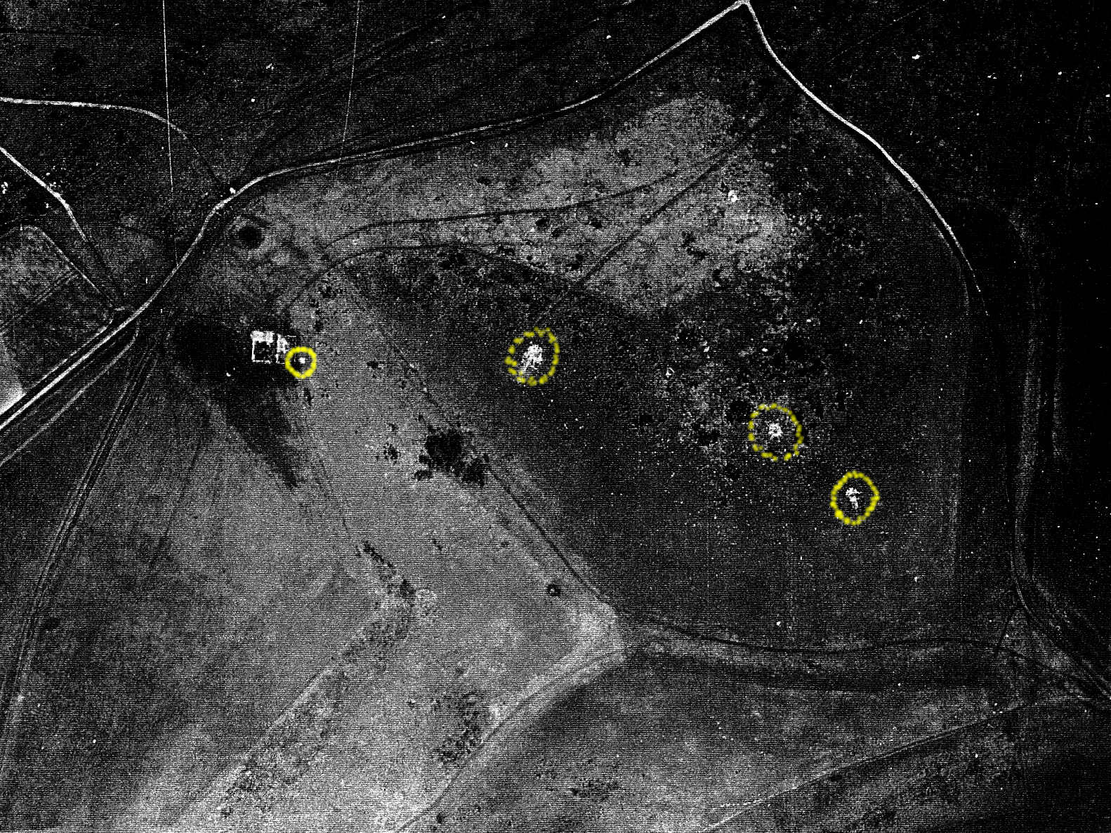
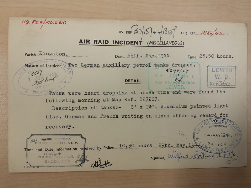
All sorts of things dropped out of skies during the war. Auxiliary petrol tanks were designed to be jettisoned in order to lighten the weight of the plane in an emergency. According to my father, his neighbour told him that during a dog-fight in the skies above Woodingdean, a bullet landed in a saucepan in her kitchen, rattling round and round until it came to halt!
The general public were keen for a second front to start. They were desperate for the beginning of the end of the war. In April a 10 mile exclusion zone to visitors was created around Newhaven and other south coast ports. From late May 1944 huge quantities of troops and equipment were seen building up in the area. Stanmer Park was one of several large Holding Camps in the area. Hyde Manor in Kingston was designated an alternative marshalling area for vehicles for Newhaven. The Americans set up anti-aircraft in nearby Iford.
On the morning of Tuesday 6th June 1944 I have been told that all was eerily quiet. The streets were deserted. All the soldiers had left – it was assumed – for France.
By the summer of 1944 an invasion of the south coast looked increasingly unlikely. However Brighton’s beach wasn’t cleared of mines for another year.
The last evacuees didn’t return until March 1946.

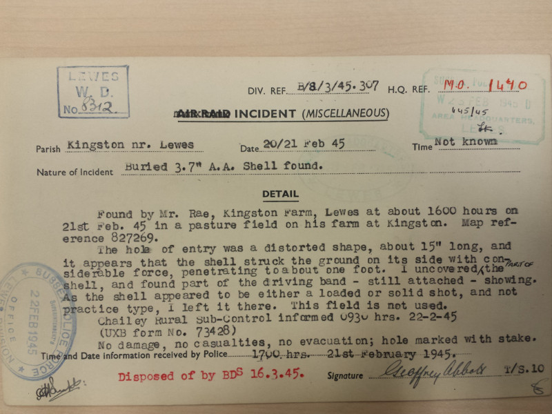
An anti-aircraft gun was placed up on Kingston Hill during much of the war – the probable source of this shell. It was similar in size to a 25 pound artillery shell which Mr Rea would also almost certainly have found on his land.

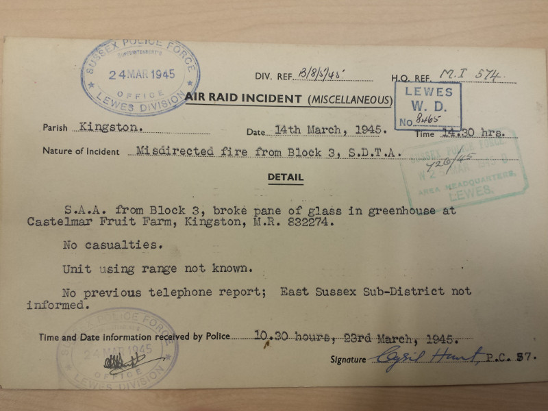
Small arms could be machine guns, rifles, grenades – all hand held weapons – all potentially lethal.
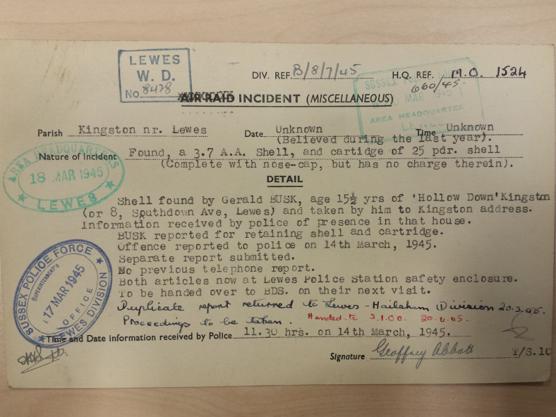
The teenage Gerald Busk may well have been reported to the authorities when they came to investigate Castelmar Fruit Farm’s damaged greenhouse. The collection of shrapnel was a popular pastime with children. Live ordnance was highly valued – but sometimes with fatal consequences.
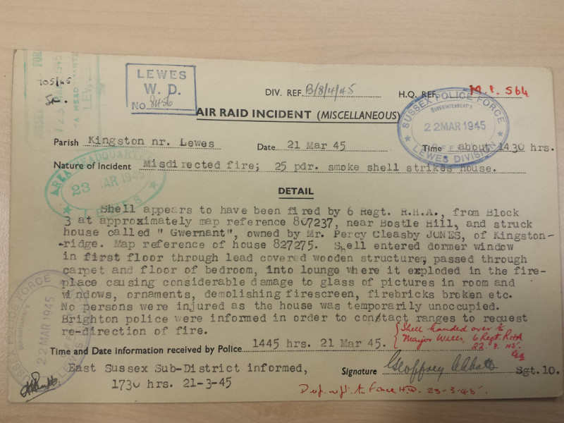
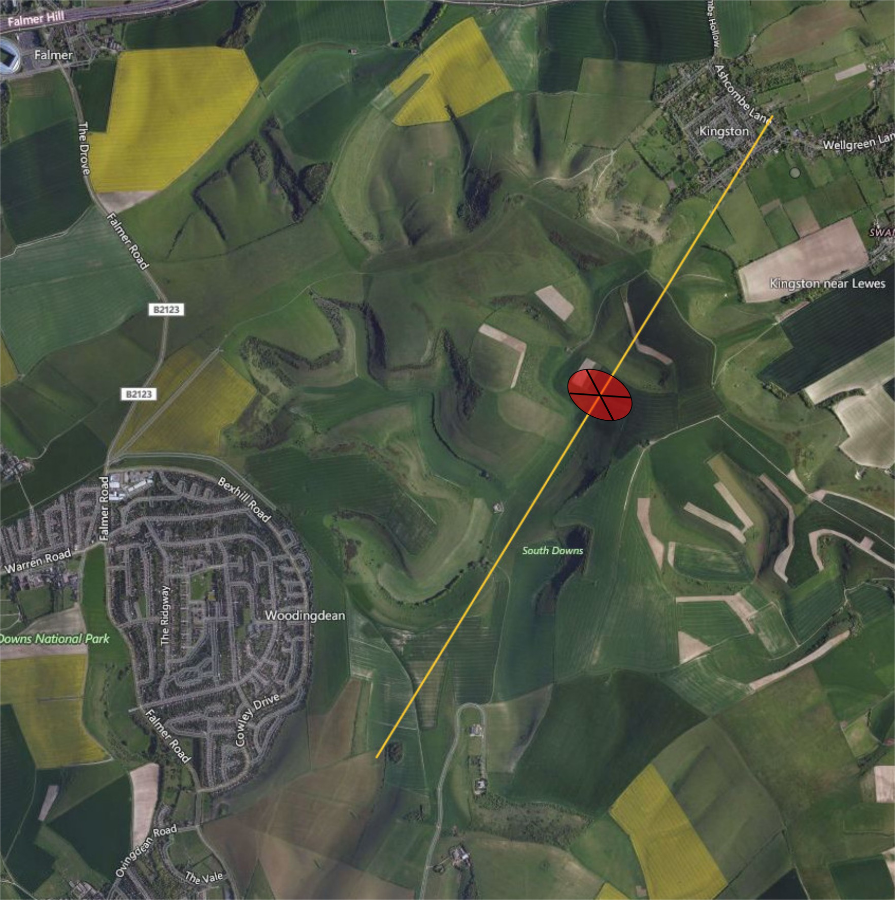
The artillery firing position was hidden behind a ridge south-southwest of Balsdean. The main target (shown in red) was probably the spur (Bird Brow) south-west of Iford Hill, which cuts across the main axis of Balsdean Bottom, half a mile before the ridge above Kingston. The grid reference for where it landed is given at the end of the yellow trajectory line. However, Gwernant was a house about half a mile due west of this location!
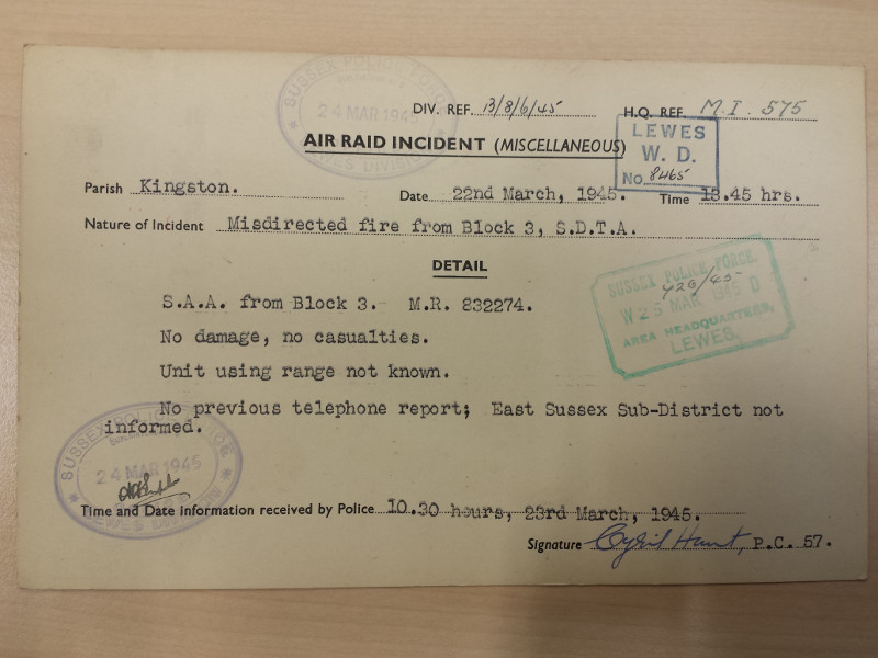
No damage, no casualties this time.
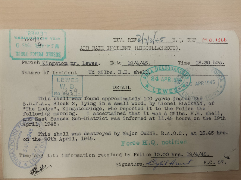
This was found just inside the number 3 South Downs Training Area, near Kingston.
The war was over with Germany.
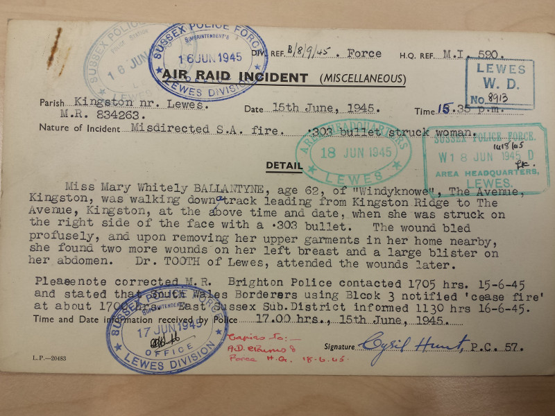
Just one week after V.E. Day, casualties from training for the continuing war in the Far East. Was Miss Ballantyne lucky or unlucky?! The downs associated with the Kingston Ridge were part of the Block 3 South Downs Training Area, so she may have been trespassing. The South Wales Borderers were an infantry regiment. They may have been from the 6th battalion, who had recently returned from fighting in the jungles of Burma, and were due to be sent back to India for an invasion of Malaya.
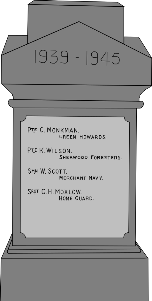
The Hull Daily Mail newspaper, Saturday 21 July 1945, summarised the inquest report:
SCARBOROUGH SOLDIER KILLED
Mortar Practice Accident Pte. Kenerick Wilson, First Battn. Sherwood Foresters, aged 33, one of five soldiers injured during mortar practice on the South Downs on Tuesday, died soon after admission to hospital. At the inquest yesterday soldier witnesses stated that a tree 12ft. away was blasted, suggesting that the bomb had struck it. Wilson, a smallholder in civil life, lived at Flixton, Scarborough. Verdict: Accidental death.
The 1st Battalion of the Sherwood Foresters was part of the 184th Brigade:
Despite being raised for service in war, the brigade never saw active service abroad and remained in the United Kingdom throughout the war, acting in a training role. In July 1945 the division was reorganised as a light division in preparation for a deployment to the Far East to fight the Imperial Japanese Army. However, the Japanese surrendered in August 1945 and the move cancelled.
For me, this makes his death all the more tragic.
The end of active hostilities, but the effects of the war – rationing, unexploded ordnance – were to continue for several years.
More to come very soon…
This is my working timeline – again very much a work in progress. I have a very large amount of stuff which I have collected over the past few years which has yet to be added to these notes. This also includes the books listed below.
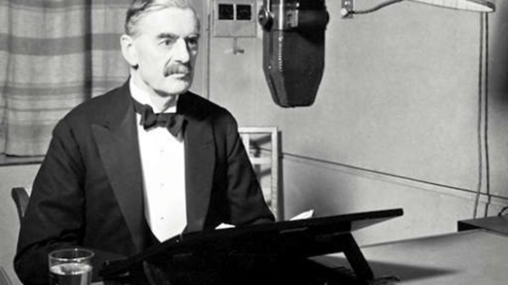
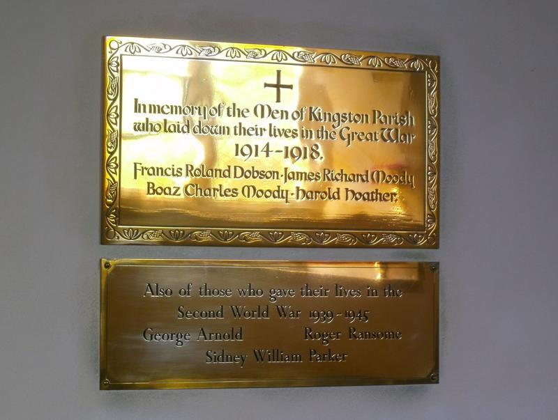
The content of this presentation is intended to illustrate the influences of military activities associated with WW2 on the people of Kingston near Lewes, for a proposed V.E. commemoration later this year. This is very much a work in progress. It will be updated as and when I have time to do so…
I am very much aware that the bite sized statements which go with the slides tell only partial truths. This is merely a quick overview. I have included some links for those who may wish to read further. Further links will be added when I have time to do so. Please feel free to give comments below.
The origins of WW2 lie largely with WW1.
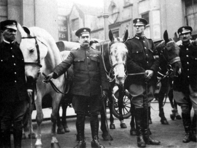
Times were hard after WW1 – war costs money. Guy Woodman, Balsdean Farmer, performing what he believed to be his patriotic duty, at the Battle of Lewes Road, in Brighton, 1926.
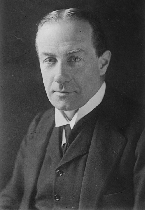
This is part of Stanley Baldwin’s speech to parliament:
Up to the time of the last War,
civilians were exempt from the worst perils of war…
but now… they suffer from the fear,
not only of being killed themselves, but,
what is perhaps worse for a man,
the fear of seeing his wife and children killed from the air.
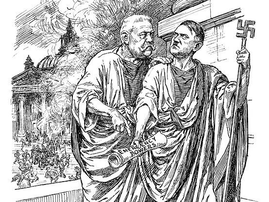
Lewes burnt Hitler’s effigy that bonfire night.
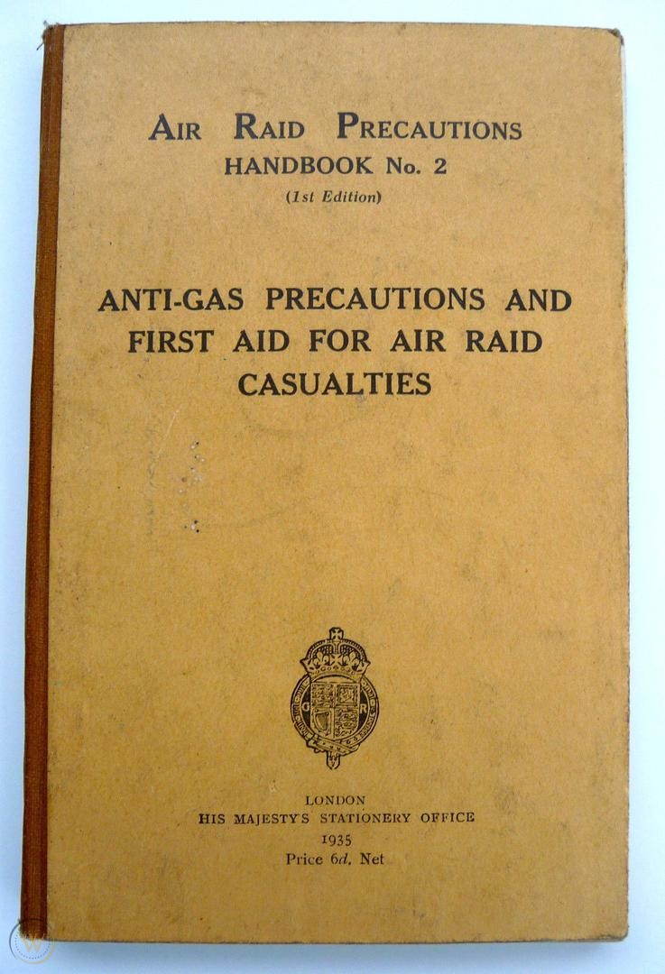
In 1935 Lewes started implementing air raid precautions, following government instructions.
The introduction to Alexander Korda’s 1936 epic film – Things to Come – encapsulated the feelings of terror for a future war. It was not a box office success!
Pathe Newsreel footage of the Munich Crisis, 1938.

Newmarket Farm, was part of the Kingston Estate, far over the downs on Newmarket Hill. A farm labourer’s cottage and barns. In the 1920’s it became part of Balsdean Farm.
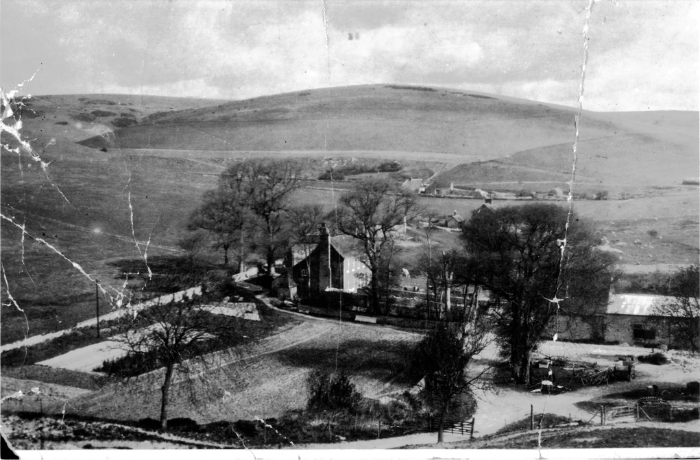
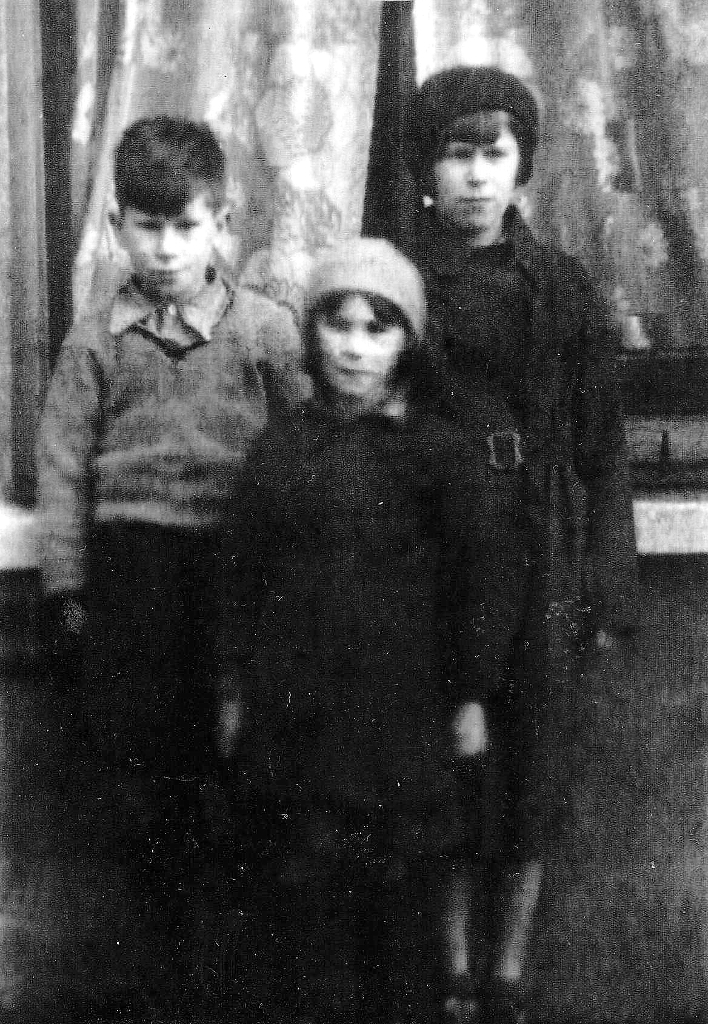
In 1934 the Phipps family worked for Balsdean farmers Woodman and Dalgety, and lived in Newmarket Farm. When their father lost his job in 1938, they lost their home. It was a tied cottage.
This video was made as part of the Woodingdean Then and Now Project. It has been edited by myself.
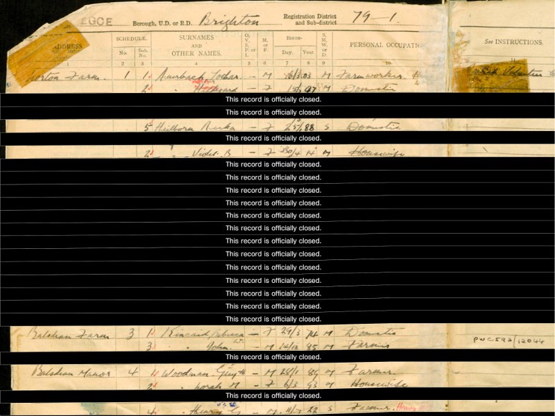
The 1939 Register was taken at the start of the war for the issuing for ration cards, call up papers, etc. Listed here are the Auerbach family – German Jewish refugees, working for board and lodgings for the Balsdean farmer.

The Auerbachs moved to Austria in 1933 when Hitler came to power. Their story is both tragic and heroic. I hope to post what they generously shared with me soon. They moved to Balsdean shortly before the war.

Before the war all local authorities had to test their blackout capabilities. This included Woodingdean. Its effectiveness was tested using spotter planes. The blackout caused many civilian and military deaths on the roads. Preventative methods were proposed.


There are many such extraordinary, futuristic drawings of France’s underground defence complexes which were part of the Maginot Line. These drawings were made for the general public and used for propaganda purposes.

Training hadn’t changed much since WW1 – hence the trench digging – with the main exception of air defences.
Everything changed in May 1940.
Newhaven was the main port for hospital casualties from Dunkirk.
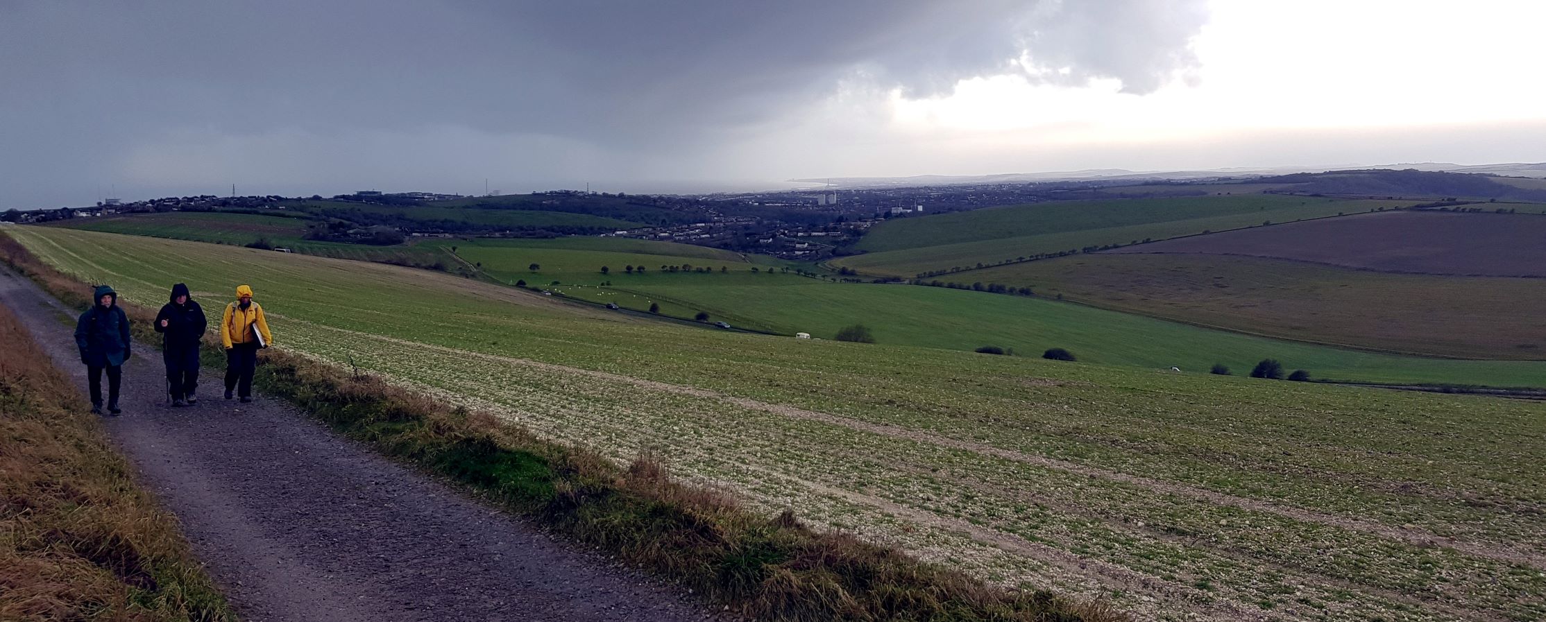
Sunday’s guided history walk was wild, wet and windy, but well worth the challenge. A hardy few joined me for a challenging morning full of life and death through some 5,000 years of history.
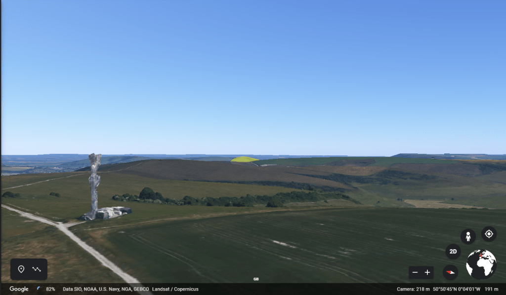
Our first stop was a short excursion of a few yards along the headland of a muddy ploughed field immediately to the south-west of the aerial which dominates the skyline of Newmarket Hill. From this point the iconic Mount Caburn magically appears in a notch between Kingston and Swanborough Hills. Mount Caburn lies about north-northeast of this point. One day I hope to find out if there is an alignment with the mid-summer sunrise.
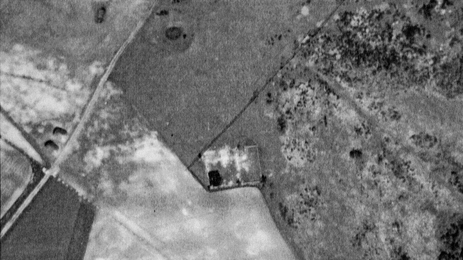
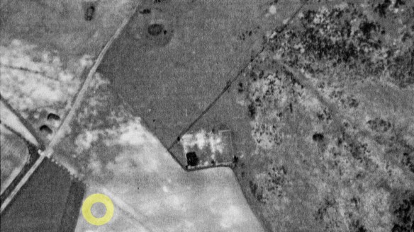
On this spot a Bronze Age bell barrow may have been located, some 5,000 years ago. I spotted the vaguely circular plough mark back in 2012 on the aerial photo, and it was identified by Greg Chuter, then Assistant County Archaeologist for East Sussex.
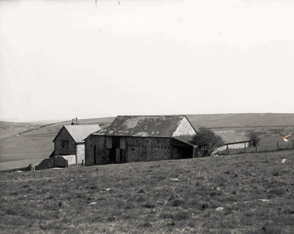
Behind the aerial, due east across the field, in a relatively sheltered hollow, and in what is now the topmost corner of Castle Hill National Nature Reserve, was the birthplace of my mother. In 1942, just one month after my mother’s birth, the cottage and all of the downs to which it belonged was requisitioned by the military for training purposes. As a result it was destroyed and was sadly never rebuilt.
Before that it had been known, at least to the Copper family of Rottingdean, as Baldy’s Cottage. Tragically, this farm labourer’s cottage became famous for David Baldy’s murder in 1868. Continuing my theme of death and destruction, I also told the tragic story of the Rich family. They were the previous tenants to the Baldy’s.
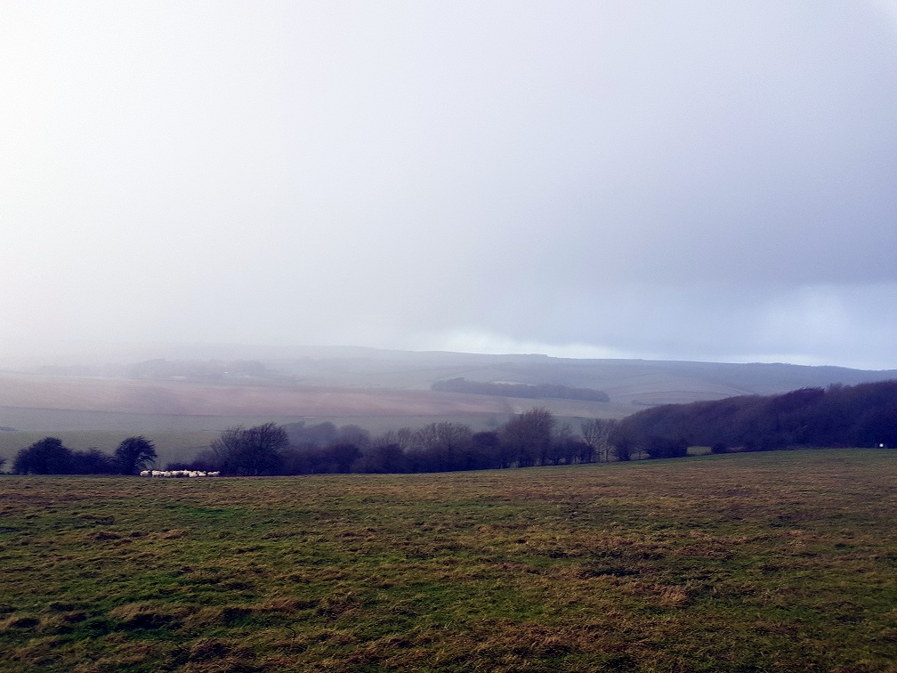
Our walk continued along the Juggs Road to its junction with the turn off to Castle Hill Nature Reserve on the right. But here we turned left, and got well and truly blasted by the hail which was now driven into our faces. But for me it was well worth the effort. Once clear of the ridge we headed diagonally across the field towards the Newmarket Plantation. This little walked path was a highlight of the walk, at least for me. It enabled us to identify the crash site of an American transport plane from the second world war. This was one of the worst accidents across the downs between Lewes and Brighton during the war, and nationally for this workhorse of a plane.
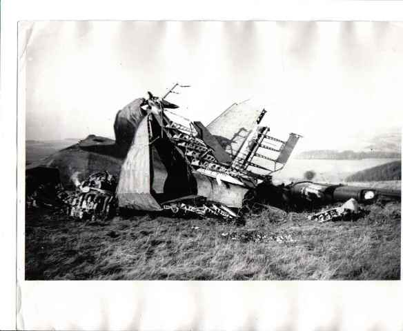
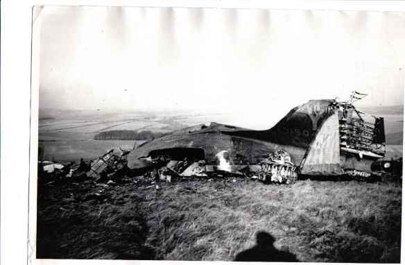
From the above two pictures we were able to line up the two woods and the field boundaries shown in the photographs and so were able to identify the approximate location of the crash. My photograph was taken in bad wind, rain, hail and relatively poor visibility. The original Douglas c-47 (Dakota) plane crash was apparently in similar conditions, though visibility on the 19th November 1944 in these hills was probably worse that day. Other than those who were there at the time, since then, the exact crash site seems to have been forgotten – until its rediscovery on our walk!
Reports on the Internet vary, and occasionally contradict each other, but between them I think I now begin to understand what may have happened.
The accident report stated that it had started to descend after just clearing a 645 foot (195 metre) hill. At the time of the accident, the ceiling was low with a maximum horizontal visibility estimated at 800 meters. In addition, the wind was blowing from the south at an estimated speed of fifteen knots. Witnesses saw the aircraft flying low from west to east and then vanish behind the ridge followed by an explosion. The aircraft was not overloaded and the crew were experienced.
From Key.Aero’s Historic Aviation Forum, a relative of one of the survivors stated that:
the electricity had gone out and although there were electritions on board they were not able to get it fixed. They did not have their lights to see the hill nor the equipment to know thier height or direction. I don’t know if there is any mention of this in any of the reports but that was about all he told us about it, that if they could have gotten it fixed the crash may not have happened.
List of sources:

From the crash site we walked into Baldy’s Wood, otherwise known as Newmarket Plantation, where we sought shelter from the elements, though not from the ghosts of the past. However, just before we entered, the sun – glimpses of which had been seen to our south, north, east and west – made just a very brief but welcome appearance.

It has been called Baldy’s wood by locals because, on the day of David Baldy’s funeral:
a discovery was made which was supposed to have a connection with the murder of Baldey. It appeared that the police, whilst searching in the plantation where part of the gun was found, came across a new-dug cave with a very narrow opening, but sufficiently large to hold two or three men. A pick-axe and a hammer were the sole contents of this mysterious hole, though there was no evidence to show by whom the excavation was made or to what use it was to be put. It was of course suggested that Brown had made the hole intending it as a grave for his victim, and that subsequent events thwarted the carrying out of that part of his purpose. This, of course, was but a popular interpretation of the discovery.
Brighton Guardian Newspaper, 17th October 1868.
Exiting the wood, the sun had deserted us, and we made our somewhat damp way back towards our start at the car park immediately north of Woodingdean, via the cycle path along the Falmer Road. On the way back I told of more history; of a medieval deer park; of Saxon and Bronze age burial mounds; and the faint traces in a ploughed field opposite Upper Bevendean Farm of Cambridgeshire Farm, all that remains of my mother’s family home before they moved to Newmarket Farm at the start of WW2. Understandably though, my fellow travellers may have been close to hypothermia by this point, so I am not sure how much of what I said was being heard by then!!
My next guided history walk is in February. Whilst the days will be slightly longer, it will still be winter, so please dress warmly and join me on a tour of the ambitious plans and material legacy of the German American entrepreneur, Oscar Selbach, involving Woodingdean and Balsdean. Of course, prehistory, Medieval Balsdean’s manor and chapel and their ultimate destruction during the second world war will also be covered. Meanwhile, Happy Christmas!!
Thanks to dougsarchaeology.wordpress.com:
A session for the CIfA conference that we filmed. This one dealing with the local archaeology, for the conference:
Session Abstract
The venue for this year’s CIfA conference is also one of the region’s more interesting and important prehistoric monuments: an early Neolithic Causewayed Enclosure. This sits within a complex urban fringe landscape with a history of neglect in the closing years of the 20th-century. The HLF funded Whitehawk Camp Community Archaeology Project was consequently launched to improve local awareness of the site and its management. This case-study provides a platform for the wider exploration of how local partnerships enhance the appreciation and protection of ancient landscapes. Themes include
• how prehistoric sites become forgotten and suffer disproportionately within urban landscapes
• instances of working with local stakeholders to harness resources for environmental improvement in times of austerity
• the role of archaeological research and community archaeology in the protection…
View original post 98 more words

CLIFFTOPS Writers present OUR OPEN EVENING:
Local Historian David Cuthbertson of the
WOODINGDEAN SOCIAL HISTORY PROJECT
Will be wanting your ***WOODINGDEAN WRITING***
He will speak on the importance of
EVOKING A SENSE OF PLACE:
…writing for future historians…
FOLLOWED BY Q & A SESSION
BRING YOUR QUESTIONS! BRING YOUR STORIES!
………………………………………
Free entry. All ages welcome. Under 16’s adult-accompanied
When? Monday November 4, 2019
Time? 4.45pm for 5pm start. Ends 5.45 pm
Where? Saltdean Library BN2 8SP
Parking? Easy-peasy
Such is the online version of the poster for my next talk. Needless to say, it only tells part of the story. The Woodingdean Social History Project was created by Woodingdean historian, Peter Mercer, to hear contemporary experiences of present day Woodingdean – of potential interest to future historians. I offered to speak on his behalf to the Clifftop Writers who had invited us to give a presentation to the group.
And then I quickly found myself pushing my boundaries – not a bad thing in itself – but scary all the same! I am used to giving illustrated talks – the slides providing me the outline of my presentation. However, in Saltdean Library this does not appear to be possible. So this is an opportunity to try something new. And since I am speaking to creative writers, I am attempting to write down what I wish to communicate – creatively – to be performed with the aim of combing ‘education, enlightenment and edification‘, not to mention entertainment!
As far as content is concerned, apart introducing the aims and background of the project, and telling something of the history of Woodingdean, I plan to introduce the subject of evoking the spirit of a place – and in particular – the village or suburb of Woodingdean. I have attended landscape observation classes, and have even led one or two practical landscape observation walks. But I quickly realised I had been, until now, only really concerned with the natural aspects of landscape.
But we are being asked to write about a built landscape. I need to develop new eyes for not only the physical landscape and the natural one which grows in response to it; I need to find ways of connecting with the ways that my fellow human beings – past and present – have effected the physical, man made material structures which confront me; the ways in which that has effected the movements, the rhythm and flow of things, nature and people in that landscape, the ways in which people think, feel, and act in that space. How does is it effect me?
That is a lot to take in. A challenge to communicate – but creative writers do it all the time – invented worlds, reinvisioned realities…
I can do it – and am even looking forward to doing it. It may not be an easy journey for me. But one thing that I know I can manage – it will be fun 🙂 See you in Saltdean – with a piece of writing about Woodingdean? I hope so.


