Blog

  • Excavation Planning

    Happier now! In my last post (pun not intended!) I realised I needed to read about Project Planning in general. As a result I realised I was trying to put my cart in front of the horse; I was trying to timetable an hypothetical end point of one year, and then working backwards towards how to get there, and getting lost along the way.

    Instead I tried brainstorming each of the outcomes I hope to achieve – one trench at a time – mini project stages in and of themselves – and each following on from the one before.

    And it seems to have worked – apart from the timescale part (I can deal with that later) – and so it is that I now have a provisional list of targets:

    1. Find NE corner of garden boundary wall (1x1m trench on corner & extend if required to max 2x2m)
    2. Find S boundary wall junction; including corner of farmyard & garden & possible gdn structure (1x1m trench on estimated junction & extend if required to 3x2m)
    3. Find SW corner of water tank on boundary wall (1x1m trench & extend if required to 2x2m)
    4. Find NW corner of water tank on boundary wall (1x1m trench & extend if required to 2x2m)
    5. Find SW corner of house on boundary wall (1x1m trench & extend if required to 2x2m)
    6. Find NW corner of house on boundary wall (1x1m trench & extend if required to 2x2m)
    7. Find internal house wall lines on W side of house (three 1x1m trenches increased to 1x3m if required)
    8. Find front door and front garden gate (two 2x1m trench enlarged to 3x1m if required)
    9. Find NE corner of house, including ‘wood-shed’ (2x1m trench enlarged to 3x1m if required)
    10. Find SE corner of ‘wood-shed’ & projection of E side of house, possible back-door & internal house wall (2x2m trench enlarged to 3x3m if required)
    11. Find door in internal wall (2x1m trench enlarged to 3x1m if required)
    12. Find fireplace (2x1m trench enlarged to 3x1m if required)
    13. Clear vegetation on mound of demolition rubble & look for chimney pots
    Newmarket Cottage Trench Plan; January 2013.
    Newmarket Cottage Trench Plan; January 2013. Base plan from ESRO.

    This only provisional – but I have to start somewhere.
  • Project Planning and a hurting head!

    My head hurts! I am new to the formal discipline of Project Planning. I am trying to understand English Heritage’s guidelines on how I might best plan my archaeological excavation. There is so much to get my head around, both regarding the details of Project Planning in general, and the details of my own particular project.

    My Newmarket Farm Excavation Proposal Document was relatively easily to write, because it did not have to go into the small details. It was based on the English Heritage MoRPHE (Management of Research Projects in the Historic Environment) planning guidance. I recently completed a distance learning familiarisation course on the use of MoRPHE, which enabled me to realise that what I had attained was just the tip of the iceberg. Now that the Project Proposal Document has generally been accepted by both Greg Chuter and Malcolm Emery, I need to write the Project Design Document, which is to detail all the stuff that I am not – yet – entirely sure how to do.

    So I sat down and started to learn the subject of Project Management. Oh yes, and I wrote this post.

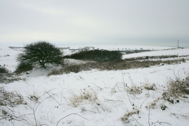
  • Site Surveying in the Snow

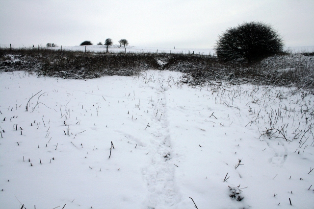
    Looking SE at Newmarket Cottage site in snow; January 21st 2013.
    Looking SE at Newmarket Cottage site in snow; January 21st 2013.

    I like snow – so am looking forward to helping clear the rest of the site of its brambles, etc tomorrow – in about 10cm or more of snow! Malcolm Emery, the Reserve Warden, agreed with me that we should go ahead as planned – unless it snows again in the night.

    Looking N towards cottage site in brambles on right; January 21st 2013.
    Looking N towards cottage site in brambles on right; January 21st 2013.

    I was up on the hill today finishing off marking the major boundary wall junctions using Selbach’s 1921 plan and existing sections of wall lines as a guide. When I started this morning I had just one corner, a projected wall junction, and a half cleared site covered in snow. By the end of the day I had four corners and the two junctions of the internal garden/ farmyard wall. The northern boundary wall appeared to be a couple of meters further south than I expected – which meant it was well inside the modern fence-line. The south-west corner just kissed the modern fence-line. So the complete farm-site may well all be located within the Nature Reserve boundary.

    Looking East along northern site boundary; January 21st 2013.
    Looking East along northern site boundary; January 21st 2013.

    And the best thing of all – after estimating the directions of each of the walls, and attempting to measure off the distances from corner to corner – the corners were only a metre out, which for me is pretty bloomin’ good!

  • Chillington Hoe

    So much exciting news – it is hard to know where to start – so how about with my new ancient digging tool, my Chillington Hoe!

    Chillington Heavy Duty Hoe
    Chillington Heavy Duty Hoe. Photo from http://www.chillingtontoolsonline.co.uk

    It slices through the mat of bramble and nettle roots which cover my archaeological dig site with relative ease. So it is perfect for dealing with the regrowth that will inevitably happen following the initial clearnace work. Cutting back the top growth will result in everything bouncing straight back again – unless I make good use of my Chillington Hoe.

    I had never used them before – though I have often seen them on television used by subsistence farmers/ gardeners in Africa. I can now thoroughly recommend them. They were probably second only to the digging stick in the historical development of agricultural tools (http://en.wikipedia.org/wiki/Hoe). They have variously been called Azadas, Badzas, Grape Hoe, Eye Hoe, Jembe, Mamooty, Mattock or Adze (https://www.quickcrop.co.uk/blog/garden-tools-chillington-hoes-or-azadas). The Chillington Tool Company has a history of over a hundred years of being the biggest manufacturer of such tools in the UK – hence their name in English.

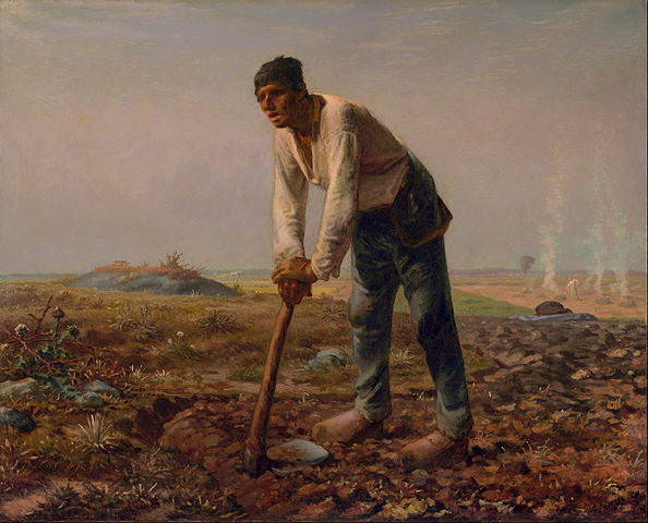
    Further research on the Internet produced Millet’s picture of “The Man With the Hoe”.

    594px-millet2c_jean-franc3a7ois_-_man_with_a_hoe_-_google_art_project
    Millet, Jean-Francois ‘Man with a Hoe’ c.1861; Wikimedia Commons.


    This inspired the American poet, Edwin Markham, to write his most famous poem:

    The Man with a Hoe
    Bowed by the weight of centuries he leans
    Upon his hoe and gazes on the ground,
    The emptiness of ages in his face,
    And on his back, the burden of the world.
    Who made him dead to rapture and despair,
    A thing that grieves not and that never hopes,
    Stolid and stunned, a brother to the ox?
    Who loosened and let down this brutal jaw?
    Whose was the hand that slanted back this brow?
    Whose breath blew out the light within this brain?
    Is this the Thing the Lord God made and gave
    To have dominion over sea and land;
    To trace the stars and search the heavens for power;
    To feel the passion of Eternity?
    Is this the dream He dreamed who shaped the suns
    And marked their ways upon the ancient deep?
    Down all the caverns of Hell to their last gulf
    There is no shape more terrible than this–
    More tongued with cries against the world’s blind greed–
    More filled with signs and portents for the soul–
    More packed with danger to the universe.
    What gulfs between him and the seraphim!
    Slave of the wheel of labor, what to him
    Are Plato and the swing of the Pleiades?
    What the long reaches of the peaks of song,
    The rift of dawn, the reddening of the rose?
    Through this dread shape the suffering ages look;
    Time’s tragedy is in that aching stoop;
    Through this dread shape humanity betrayed,
    Plundered, profaned and disinherited,
    Cries protest to the Powers that made the world,
    A protest that is also prophecy.
    O masters, lords and rulers in all lands,
    Is this the handiwork you give to God,
    This monstrous thing distorted and soul-quenched?
    How will you ever straighten up this shape;
    Touch it again with immortality;
    Give back the upward looking and the light;
    Rebuild in it the music and the dream;
    Make right the immemorial infamies,
    Perfidious wrongs, immedicable woes?
    O masters, lords and rulers in all lands,
    How will the future reckon with this Man?
    How answer his brute question in that hour
    When whirlwinds of rebellion shake all shores?
    How will it be with kingdoms and with kings–
    With those who shaped him to the thing he is–
    When this dumb Terror shall rise to judge the world,
    After the silence of the centuries?

    I found this on Wolfram’s World – Land Hoe! Personal reflections on the subject of returning dignity to hoes and men.

  • Marking Boundaries

    I wasn’t sure until recently the best way to mark out the Archaeological site boundary.

    • I know from experience that light weight string gets caught up in brambles and that it easily gets tangled, it can trip people up and can easily get accidentally cut.
    • Heavier duty rope would be better, but would be expensive, and heavy to carry.
    • Hazard warning tape is another possibility, but it draws too much attention to itself – I would only want to use it when there is a real need to keep people out of an area – which in this case I do not.

    I knew that surveyors on Time Team used a spray paint but I wasn’t sure how permanent it was, or toxic – I would be using it on a nature reserve. However, a little Googling on the Internet and I found a spray paint called SylvaMark. This has been approved for use by English Nature (Natural England‘s predecessor) on their own reserves, and after reading the blurb, it looks exactly what I want. I chose a blue colour since it was less fluorescent than the others and a type that only lasts a couple of weeks or more. It should arrive by the end of the week. I just hope the weather stays dry enough for me to be able use it before the next site clearance day.

  • New Team Member Helps Confirm Site Plan

    Sunday 13th January, 2013

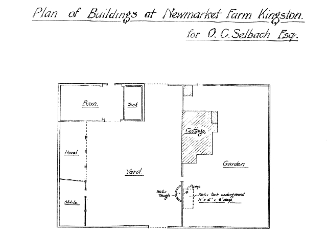
    My (nearly) 13 year old niece and my mother, braved the cold to help me find out whether a plan of Newmarket Farm which we had was an accurate representation of the archaeology on the ground. The plan was a copy of the one that was found in documents held in East Sussex Record Office, and was probably drawn in 1921 when Oscar Selbach bought Newmarket Farm.

    1921 Selbach plan of Newmarket Farm. From ESRO
    1921 Selbach plan of Newmarket Farm. From ESRO

    The overall aim of the day’s work was to perform (some of) the tasks required to be done before being able to mark the area of the archaeological dig site, approximately 3m beyond the boundaries of the Newmarket Farm site. The extra 3m is to provide public access as well room to place the spoil from the trenches.

    The area of the site needs to be marked out before the next date which has been planned for the clearance of the rest of the site.

    Based on the dimensions given for the water tank, the scale of the plan has been estimated, and has therefore enabled the lengths of the wall lines to be meassured. My measurements were independently confirmed by my niece.

    The next objective was to identify two fixed points of archaeology on the ground to check the accuracy of Selbach’s plan. Previous to the site clearance work of the 9th January, only the SE corner (bottom right on the plan) was visible and some isolated portions of the south and east boundary walls. During site clearance a small portion of the wall which divided the garden from the farm-yard was revealed. Therefore our next task was to uncover enough of this wall to be able to estimate where it met the southern boundary wall, somewhere near a small elder bush.

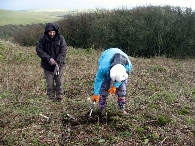
    Looking E at my niece & myself finding the wall-line between garden and farm-yard; 13th January 2013.
    Looking E at my niece & myself finding the wall-line between garden and farm-yard; 13th January 2013.

    Did I say that it was cold! Also, almost all of the existing line of the wall was buried under a thick mat of bramble and stinging nettle roots. No wonder Time Team makes it look so easy – they have a mechanical digger to do this part!

    Looking SE at my niece & myself finding the wall-line between garden and farm-yard; 13th January 2013.
    Looking SE at my niece & myself finding the wall-line between garden and farm-yard; 13th January 2013.

    But with hard work and perseverance we managed to expose enough of the wall to estimate that it met the southern boundary wall immediately to the east (left) of the elder bush.

    Next, Selbach’s plan indicated that the distance from this point to the SE corner of the garden boundary wall was about 52.5 feet. When we meassured this on the ground it was found to be about 52 feet. Therefore we felt able to (provisionally) conclude that Selbach’s plan could be used as a guide to estimating the lengths of the other walls.

    Just before we left I quickly measured the distance between the elder and the SW corner of the house, and marked it with a peg. There was no sign of any change in ground level in the vicinity of this point. Selbach’s plan will therefore be very importantant for any future attempts to locate archaeological targets on the ground.

  • Newmarket Farm Site Clearance

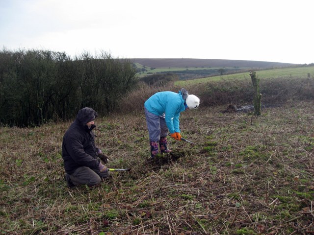
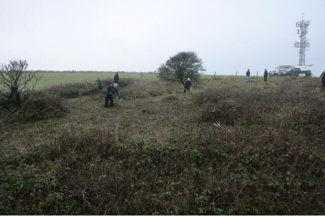
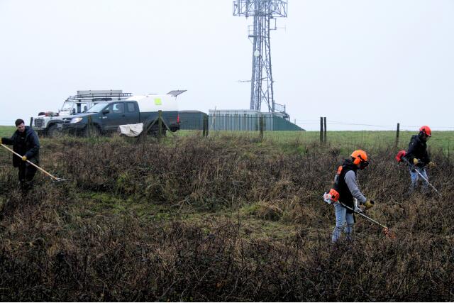
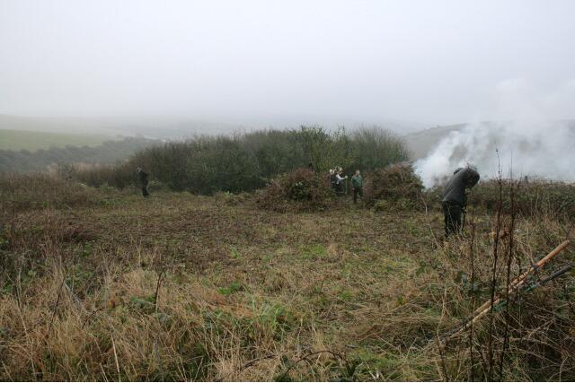
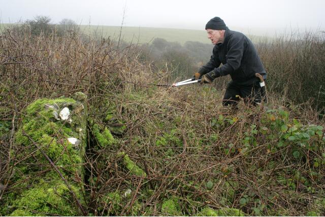
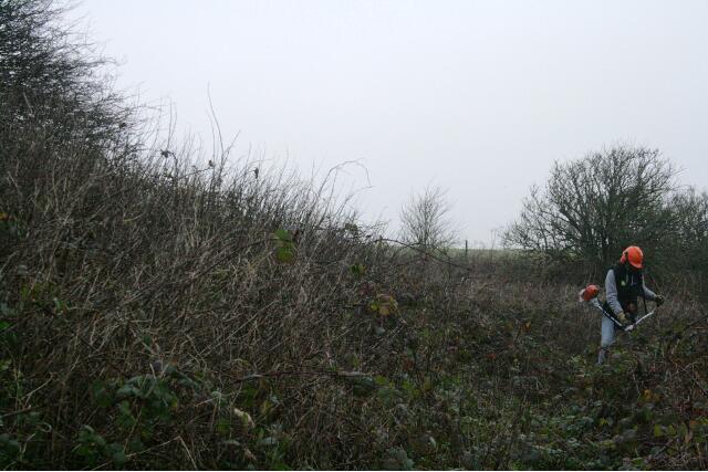
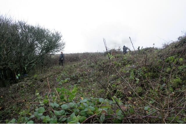
    Thanks to Malcolm Emery and a couple of colleagues from Natural England, as well as a group from the South Downs Volunteer Ranger Service, at least half the site was cleared yesterday (Weds 10th January 2013), and a second day has been planned to complete the job.

    View WSW from demolition rubble mound E side of the house site looking SW across back garden towards S farmyard boundary between the trees left and centre; 10th January 2013.
    View WSW from demolition rubble mound E side of the house site looking SW across back garden towards S farmyard boundary between the trees left and centre; 10th January 2013.
    Looking slightly W of S from bulldozed mound of rubble to E of house site looking towards SE corner of the garden just under the Prunus scrub; 10th January 2013.
    Looking slightly W of S from bulldozed mound of rubble to E of house site looking towards SE corner of the garden just under the Prunus scrub; 10th January 2013.
    Looking S along bulldozed mound of demolition rubble partially hidden by brambles. The side of the house would have been on the right of the picture. The small elder bush to the right of the fire marks the junction of the wall dividing the garden to its left from the farmyard to its right, and the wall which bounded both to the south; 10th January 2013.
    Looking S along bulldozed mound of demolition rubble partially hidden by brambles. The side of the house would have been on the right of the picture. The small elder bush to the right of the fire marks the junction of the wall dividing the garden to its left from the farmyard to its right, and the wall which bounded both to the south; 10th January 2013.
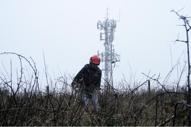
    Clearing NW corner of the site, the site of a barn. Looking towards what has become an a major landmark – a television aerial marking the top of Newmarket Hill; 10th January 2013.
    Clearing NW corner of the site, the site of a barn. Looking towards what has become an a major landmark – a television aerial marking the top of Newmarket Hill; 10th January 2013.
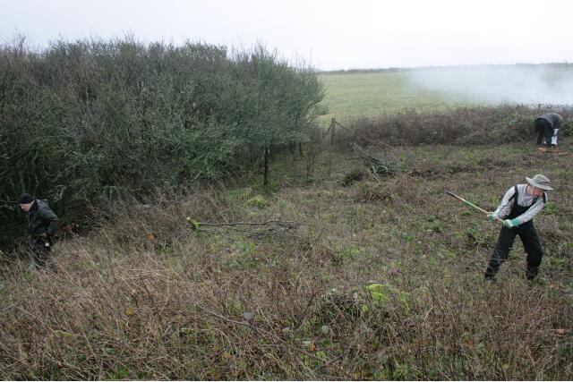
    The chap on the right is raking the mowings, which were burnt. Removing the debris reduces the fertility of the soil, which reduces the vitality of the rank vegetation; 10th January 2013.
    The chap on the right is raking the mowings, which were burnt. Removing the debris reduces the fertility of the soil, which reduces the vitality of the rank vegetation; 10th January 2013.
    Looking W at Newmarket Farm site being cleared of brambles; 10th January 2013.
    Looking W at Newmarket Farm site being cleared of brambles; 10th January 2013.
    Photo taken from within the house site looking to the SW at elder bush marking site of S end of wall dividing house and garden. The chap on the right is Malcolm Emery, taking a welcome break from his desk; 10th January 2013.
    Photo taken from within the house site looking to the SW at elder bush marking site of S end of wall dividing house and garden. The chap on the right is Malcolm Emery, taking a welcome break from his desk; 10th January 2013.
    Taken from under the spreading hawthorn near the NE corner of the house site, looking slightly west of south, with the elder (centre back near the fire) marking the site of the back wall between garden and farmyard; 10th January 2013.
    Taken from under the spreading hawthorn near the NE corner of the house site, looking slightly west of south, with the elder (centre back near the fire) marking the site of the back wall between garden and farmyard; 10th January 2013.
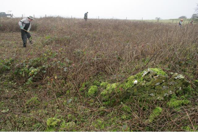
    A view of the site looking to the NW with a piece of demolished masonry revealed from under the brambles; 10th January 2013.
    A view of the site looking to the NW with a piece of demolished masonry revealed from under the brambles; 10th January 2013.
    View from location of barn on NW side of site looking SE across the farmyard towards distant Prunus scrub marking SE corner of the garden; 10th January 2013
    View from location of barn on NW side of site looking SE across the farmyard towards distant Prunus scrub marking SE corner of the garden; 10th January 2013
    Volunteer clearing back some of the vegetation from the mound of demolition rubble, just inside the east boundary wall of the garden, looking E - upright piece of masonry is not in situ - 10th January 2013.
    Volunteer clearing back some of the vegetation from the mound of demolition rubble, just inside the east boundary wall of the garden, looking E – upright piece of masonry is not in situ – 10th January 2013.
    Looking N towards the NE corner of the site, just outside the garden wall, clearing the vegetation about 3m wide of the site boundary to allow for public access as well as room for spoil from any trenches; 10th January 2013
    Looking N towards the NE corner of the site, just outside the garden wall, clearing the vegetation about 3m wide of the site boundary to allow for public access as well as room for spoil from any trenches; 10th January 2013
    Looking S towards SE corner of the garden boundary wall just under the Prunus scrub; 10th January 2013
    Looking S towards SE corner of the garden boundary wall just under the Prunus scrub; 10th January 2013
    View beyond the site, towards Castle Hill to the NE, from on top of the mound of demolition rubble; 10th January 2013
    View beyond the site, towards Castle Hill to the NE, from on top of the mound of demolition rubble; 10th January 2013
    Looking approx WSW from SE corner of house towards distant hawthorn near SW corner of farmyard showing surface contours of site being revealed; 10th January 2013
    Looking approx WSW from SE corner of house towards distant hawthorn near SW corner of farmyard showing surface contours of site being revealed; 10th January 2013

    The farmyard, in the centre of the photo, was discovered to be on a terrace, with the farm buildings – stables and cow barn – at a higher level (to the right), and the garden at a lower level (to the left).

    Photo taken approx SE corner of house site looking SW towards tree stump marking junction of dividing wall separating the garden on left, from the farmyard on right where it met the S property boundary; 10th January 2013.
    Photo taken approx SE corner of house site looking SW towards tree stump marking junction of dividing wall separating the garden on left, from the farmyard on right where it met the S property boundary; 10th January 2013.
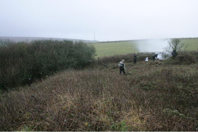
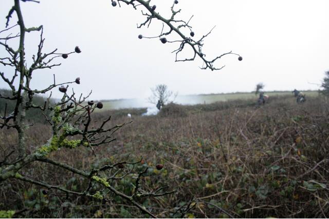
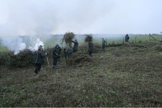
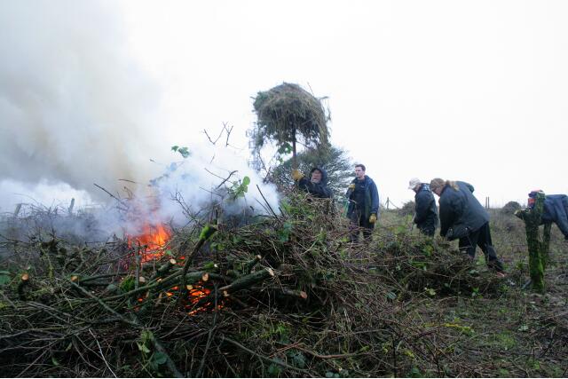
    Looking NW at site clearance by burning of the cut vegetation; 10th January 2013
    Looking NW at site clearance by burning of the cut vegetation; 10th January 2013
    Looking NW at burning of wet vegetation; 10th January 2013
    Looking NW at burning of wet vegetation; 10th January 2013

    It would have been nice if the cleared vegetation had been removed from site and composted. Better for the environment. But it would have involved a lot of work, a lot more transport, and a lot less of the site would have been cleared.

  • Newmarket Farm

    Just off to visit Malcolm Emery (E Sussex Reserves Manager, Natural England) at Castle Hill Nature Reserve – helping with the clearing of the Newmarket Farm site. I thought it might be useful for me to quickly post some more images of the site before heading off.
    newmarket_farm_dougs_painting-640

    This is an artist’s impression of Newmarket Farm. My great-uncle Dougie Holland used to visit his sister’s family, though when he painted it – about ten years ago – he admitted he didn’t really remember very much of what it used to look like.

    Newmarket_Farm_location-CropSmall

    This is an overlay map of the site I created based on old and recent Odnance Survey maps and a Google satelite image showing Newmarket Farm’s approximate location.

  • New WWII Archaeology on the Downs?

    Really excited that after a walk to Castle Hill nature reserve, on the side of Newmarket Hill, I may have found some new archaeology!

    At TQ36470682, just above the edge of the steep sided Newmarket Bottom, was a spread of small (about 1cm diameter) pebbles associated with a 5m diameter roughly levelled off platform. It was sited just at the point of maximum visibility down into the valley bottom.

    Apparently during the Second World War there was a particular concern that paratroopers would drop down into remote downland valleys at night. Therefore big lights were stationed at suitable positions to spot them.

    I have as yet no idea what they looked like, but I have been informed there was one on the corner of the Falmer Road looking down into Bevendean valley.

    I guess the next thing to do is to pass these details on to the East Sussex Historic Environment Record Officer (HER), who is based in Lewes.

    Most of the Downs beyond Brighton were requisitioned by the armed forces during the last war. There should certainly be lots of archaeology dating to this time. Only since I started to study the history of Newmarket Farm have I become aware of the importance of modern archaeology, and how easily it can be lost.

  • Some pictures of Castle Hill Nature Reserve

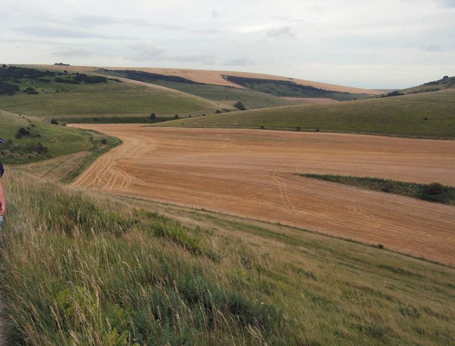
    Just visited the picture website Geograph. It has lots of wonderful pictures people have taken of geographical locations all over the UK. I thought I would load all those that people have taken of Castle Hill Nature Reserve.

    Taken in 2005…

    Falmer Bottom by Simon Carey
    Falmer Bottom by Simon Carey.
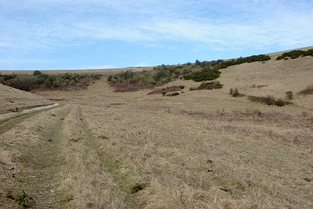
    Looking north towards Castle Hill. (10 September, 2005)
    Newmarket Bottom by Simon Carey
    Newmarket Bottom by Simon Carey.
    Looking east towards Castle Hill. (10 September, 2005)

    Taken in 2009…

    Castle Hill by Paul Gillett
    Castle Hill by Paul Gillett.
    (23 June, 2009)
    Castle Hill plantation by Paul Gillett
    Castle Hill plantation by Paul Gillett.
    (23 June, 2009)
    Castle Hill looking SW by Paul Gillett
    Castle Hill looking SW by Paul Gillett.
    Castle Hill is located 1 mile from Woodingdean, north east of Brighton. It comprises a series of valley-side slopes and is a good example of ancient, traditionally managed chalk downland. (23 June, 2009)

    Taken in 2010…

    Old well - Falmer Bottom by Robin Webster
    Old well – Falmer Bottom by Robin Webster.
    All very knocked about, but the part on the right looks like a wellhead, the central part like a pump, and the other part like a winch. All very perplexing. Made by F.E. Myers & Bro., Ashlan…. [?] U.S.A. The pump-like part has also cast on it “Self-oiling bulldozer”. A little further research found that the two brothers Francis and Philip set up the company in 1870 in Ashland, Ohio, and the company is still there, producing pumps and trading as Myers, although now part of the Pentair group. (27 February, 2010)
    Castle Hill National Nature Reserve by Robin Webster
    Castle Hill National Nature Reserve by Robin Webster.
    The public bridleway through the reserve curves round the slope to the left, although the rather hypothetical legal line is somewhat to the right at first. (27 February, 2010)
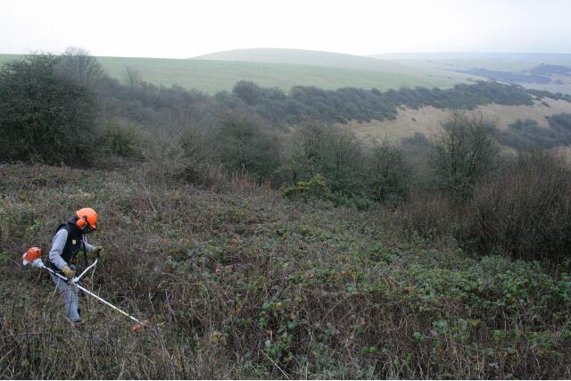
    Castle Hill NNR - scrub clearance by Robin Webster
    Castle Hill NNR – scrub clearance by Robin Webster.
    One of two bonfire sites seen on this shoulder of the hill. (27 February, 2010)
    Falmer Bottom by Robin Webster
    Falmer Bottom by Robin Webster.
    A good view to illustrate the vagaries of the selection of CROW public access land. The criterion should be down: unimproved grassland. The foreground fields up to the fence with the single tree are public – but certainly rather improved. The near shoulder on the right is not CROW-public but is unimproved (although possibly partly ploughed in the past). The far shoulder on the right is correctly public and unimproved. Both shoulders are in the Castle Hill NNR. The slopes on the left are correctly selected as public access unimproved downland. However, the non-CROW part of the NNR is now mapped as access land under some other non-CROW arrangement. (27 February, 2010)
    Vegetation investigations, Castle Hill National Nature Reserve by Robin Webster
    Vegetation investigations, Castle Hill National Nature Reserve by Robin Webster.
    Within the enclosure are many 1 m square areas marked out with green string. Castle Hill itself is the hill straight ahead – this part of the reserve is on the slopes of Newmarket Hill. (27 February, 2010)
    Welcome to Castle Hill National Nature Reserve by Robin Webster
    Welcome to Castle Hill National Nature Reserve by Robin Webster.
    The Natural England website still says “Access to the reserve is limited to public rights of way”. This is at variance both with this sign and with OS maps which show the reserve as public access land. In any case, the lower bridleway gate, just to the left of this sign, is away from the legal line which is well to the right and blocked by the fence. (27 February, 2010)

    The information on the Natural England website is very out of date and, as far as I know, there are plans to update it sometime soon.

    Industrial artefacts in Falmer Bottom (1) by Dave Spicer
    Industrial artefacts in Falmer Bottom (1) by Dave Spicer.
    Robin Webster’s explanation TQ3706 : Old well – Falmer Bottom is feasible bearing in mind there has to be water down there somewhere. (14 May, 2010)

    Taken in 2012…

    Newmarket Bottom by Paul Gillett
    Newmarket Bottom (30 July, 2012) by Paul Gillett.
    (30 July, 2012)
    Newmarket Bottom by Paul Gillett
    Newmarket Bottom by Paul Gillett.
    (30 July, 2012)
    Newmarket Bottom by Paul Gillett
    Newmarket Bottom by Paul Gillett.
    (30 July, 2012)
    Newmarket Bottom by Paul Gillett
    Newmarket Bottom by Paul Gillett.
    (30 July, 2012)
    Castle Hill by Paul Gillett
    Castle Hill by Paul Gillett.
    (30 July, 2012)
    Entrance to Castle Hill Plantation by Paul Gillett
    Entrance to Castle Hill Plantation by Paul Gillett.
    (30 July, 2012)

    [I think Paul was thinking of the nearby Newmarket Plantation, tried writing Castle Hill and so made his mistake – for there is no plantation on Castle Hill.]

    Newmarket Bottom by Simon Carey
    Newmarket Bottom by Simon Carey.
    Beginning at the end of Falmer Bottom before climbing Newmarket Hill to the left. (15 September, 2012)
    Bridleway, Castle Hill National Nature Reserve by Simon Carey
    Bridleway, Castle Hill National Nature Reserve by Simon Carey.
    Climbing up from Falmer Bottom to meet Juggs Road to the east of Newmarket Hill. (15 September, 2012)
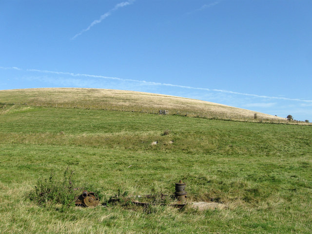
    Remains of a Pump, Balsdean by Simon Carey
    Remains of a Pump, Balsdean by Simon Carey.
    The only remnant of Norton Farm which originally lay out of shot to the left. The farm was apparently vacant by the early 20th century and was commandeered by the military during the Second World War used for target practice. The machinery was used to pump water from a well. Beyond is the southern slope of Castle Hill which is largely open access as evident by the gate in the fence. (15 September, 2012)
    Site of Norton Farm by Simon Carey
    Site of Norton Farm by Simon Carey.
    Other than TQ3706 : Remains of a Pump, Balsdean the only other clues to the site of the former farm is the depression to the left where the farmhouse was once located. Originally part of the small hamlet of Balsdean which originally included Sutton Farm which later became Balsdean Farm, the farm survived into the 20th century but had become uninhabited by the First World War. The buildings remained and were commandeered by the military during the Second who used it and the neighbouring buildings in Balsdean for target practice. Any remains were cleared after the war with the farm reborn a mile to the south and TQ3706 : Ruined Barns, Balsdean erected to service it. What was once a populous valley is now thoroughly deserted. Beyond is Falmer Bottom. (15 September, 2012)
    Falmer Bottom by Simon Carey
    Falmer Bottom by Simon Carey.
    Running northwards from TQ3706 : Site of Norton Farm to Newmarket Hill. (15 September, 2012)
    Falmer Bottom by Simon Carey
    Falmer Bottom by Simon Carey.
    The continuation of TQ3706 : Falmer Bottom as it rounds the corner to head towards Newmarket Bottom. (15 September, 2012)
    Castle Hill National Nature Reserve by Simon Carey
    Castle Hill National Nature Reserve by Simon Carey.
    A small nature reserve above Falmer Bottom that has been managed as chalk grassland. It was set up in 1975. (15 September, 2012)

    A big thank-you to Simon Carey, Paul Gillett, Dave Spicer, and Robin Webster.