This is a post to test the Open Source offline capable blog app., QTM, which I have installed on my Ubuntu laptop.
It works!
This is a post to test the Open Source offline capable blog app., QTM, which I have installed on my Ubuntu laptop.
It works!
A belated thank you to all the volunteers who came out in some very cold weather to help complete the clearance of the site. Just as important was the clearance of brambles and scrub to provide easier access for visitors and volunteers to the site from the main body of the nature reserve.
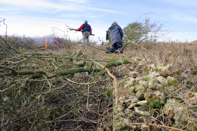
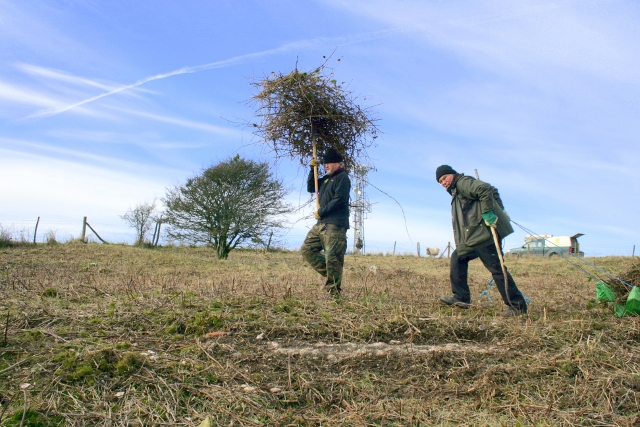
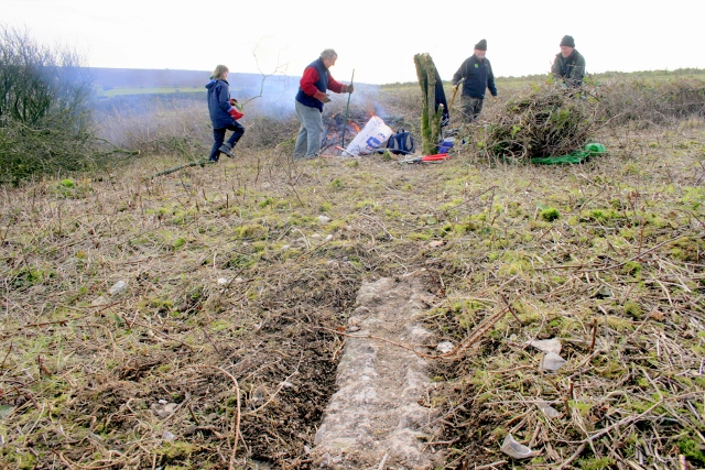
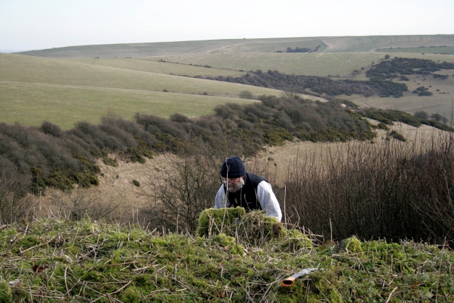
Malcolm Emery, is now not only Natural England’s Senior Reserves Manager for East Sussex, he is also responsible (please correct me if I have this wrong) for Surrey and Oxfordshire as well – a very busy man.
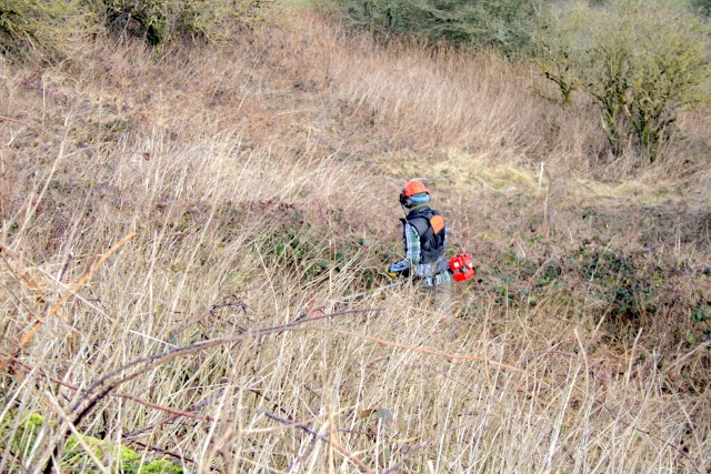
Louise (Lou) Parkinson, hiding under all her protective gear, is now the Natural England’s Reserves Warden for East Sussex. It is planned to have bullocks in this part of Castle Hill NNR for the end of the winter. Opening up a wider area beyond the farm site may make this remote corner of the reserve more attractive for them and thus they would be more likely to help keep down some of the new growth which will inevitably spring back. Because small birds may start nesting in any tall regrowth, I understand (again, I hope I am corrected if I am wrong) that site clearance may continue through the summer.

It all looks so different after the brambles were cut and removed. The east part of the farmyard can now be seen to have been terraced, with a slope leading up to the farmbuildings on the western side of the farmyard, which extended to the right from the stable which was between the fence corner and the prominent hawthorn bush.
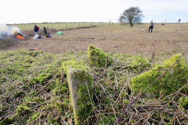
These may possibly be from a water trough shown in a plan of the farmyard.
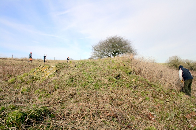
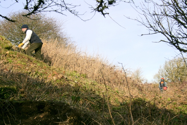
The rubble mound is quite steep on the east side, with some large pieces of masonry in it. I am interested in partially excavating it to identify, if possible, parts of chimneys, window frames, doorways and other architectural features which may be buried inside it. Since lifting gear is beyond this project, any masonry heavier than 20Kg would be left in situ. The mound would be excavated around it, such that the local slope is not more than 45°.
Last year, on a site visit, I found what I thought might have been a WWII live bullet. But when it was pointed out to me that it may be both dangerous and even illegal to possess I decided it was time to hand it in to the police.
Before doing so I recorded it the best I could with just a simple ruler and a camera – and noticed what might be some writing on its green copper and rusty iron coloured corroded base. Being without specialist solvents, I chose to use some household methylated spirits to clean its base.

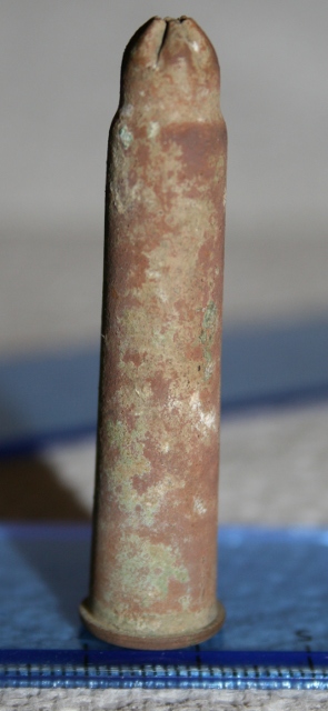

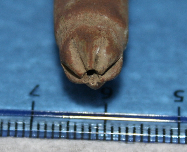
Case type (Rimmed, bottleneck)
                    Find      .303
Bullet diameter     ~8mm      7.9mm
Neck diameter       ~9mm      8.6mm
Shoulder diameter   ~10.5mm   10.2mm
Base diameter       ~11mm     11.7mm
Rim diameter        ~13mm     13.7mm
Rim thickness       ~1.5mm    1.6mm
Case length         ~54mm     56.4mm
My approximate measurements indicate this is a .303 cartidge. The Headstamp – R ^ L C II – shows it was made by The Royal Laboratory, Woolwich Arsenal, 1893-1904, and was a Mark 2 cartridge with cordite as the propellant. The rosette crimped nose means it was a blank.
My research was entirely from the websites of passionate experts, the best of which I give below:
So how might a blank rifle cartridge marking the very end of Queen Victoria’s Reign and the start of the Edwardian Period get to be associated with a farm labourer’s cottage and farmyard? I need to do a little research but I recall seeing photographs of army camps in both Kingston and Falmer of around this time. My idea is that it was probably used in army training exercises on the Downs, children may have taken it, and hidden it, until it was found by me a hundred years later. The Davey family in the 1901 Census had no children, but by 1911 the 12 year old schoolboy Leonard Morris, nephew of Frederick and Fanny Moon, was staying in Newmarket Farm. He is definitely my favourite as the person who secretly possessed this dangerous treasure.
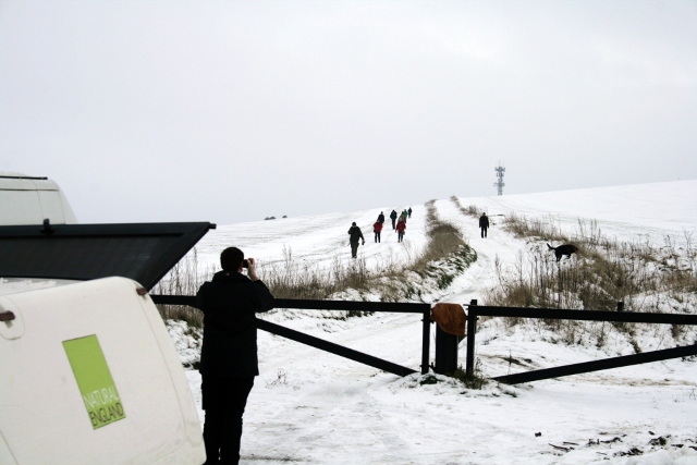
Just catching up on a post I meant to write a while back – the day after I surveyed the site in the snow.
Whilst the site itself was only covered in a shallow few inches of snow, the snow on the Juggs Road (Drove Avenue) just on the northern side of the ridge leading towards the top of Newmarket Hill had drifted considerably. Also, working on-site in slippery conditions whilst using sharp slashing tools is not sensible from a Health & Safety point of view so, after a quick look around and history lesson, we all went home!
Here I am making public the dates of my forthcoming volunteer dig days! The next three days are:
| Location | When | Summary | Description |
|---|---|---|---|
| Castle Hill car park, Sea View Way, Brighton and Hove, Brighton BN2 6NT, UK | 2026-10-27 at 10:30 – 11:30 | Castle Hill Healthwalk | Castle Hill Healthwalk: Explore this stunning chalk grassland National Nature Reserve. (When conditions are muddy, and on the last Tuesday of the month, the walk follows an alternative route around Bullock Hill, opposite the reserve.)Meeting Place: Castle Hill National Nature Reserve Car Park, Woodingdean, off Falmer Road (B2123), just north of the junction with Bexhill Road. … |
| Castle Hill car park, Sea View Way, Brighton and Hove, Brighton BN2 6NT, UK | 2026-11-03 at 10:30 – 11:30 | Castle Hill Healthwalk | Castle Hill Healthwalk: Explore this stunning chalk grassland National Nature Reserve. (When conditions are muddy, and on the last Tuesday of the month, the walk follows an alternative route around Bullock Hill, opposite the reserve.)Meeting Place: Castle Hill National Nature Reserve Car Park, Woodingdean, off Falmer Road (B2123), just north of the junction with Bexhill Road. … |
| Castle Hill car park, Sea View Way, Brighton and Hove, Brighton BN2 6NT, UK | 2026-11-10 at 10:30 – 11:30 | Castle Hill Healthwalk | Castle Hill Healthwalk: Explore this stunning chalk grassland National Nature Reserve. (When conditions are muddy, and on the last Tuesday of the month, the walk follows an alternative route around Bullock Hill, opposite the reserve.)Meeting Place: Castle Hill National Nature Reserve Car Park, Woodingdean, off Falmer Road (B2123), just north of the junction with Bexhill Road. … |
We work on site every Friday and Sunday, 10am-4pm, from April to December 2013. Volunteers and other visitors are most welcome. We meet at the Falmer Road Car Park, Woodingdean (just N of the junction with Bexhill Rd) but please contact me beforehand in case we have to cancel for any reason.
David Cuthbertson: scienceinthegreen@yahoo.co.uk
I just found this inspiring webpage:
Drawing Archaeology, by Helen Wickstead.
It is a very good essay on the difference between looking and seeing – and how seeing involves interpretation, which is enabled by means of practical experience.
Detailing my archaeological plans, trench by trench, has enabled me to realise just how much work will be involved in order to better understand how the cottage may have functioned:

If I start at the beginning of March, and manage two trenches per month, then I would have finished an investigation of the internal features of the house by the end of October.
The location of the outside toilet has been disputed, between Lucy and Bob Phipps who lived there as children from 1934–1938. One recalled it as being next to the garden gate, the other as being next to the front door. Old Ordnance Survey maps and Mr Selbach’s plan show a suitable structure next to the front garden gate. Trenches 3, 7 and 11 may be able to confirm its location.
The other big target(s) is the “well(s?)” where both the Lathams’, and the Phipps’ got their water. However, this is shrouded in mystery! Neither family has been able to recall anything about a water-tank. Yet this is clearly marked on the plan found with Mr Selbach’s papers dating 1921. There is a patch of water-loving spearmint growing in a rubble filled depression in the vicinity of this tank. Trenches 4 and 5 are to attempt to determine the nature of this feature. It is always possible that Mr Selbach’s plan was for a proposed water tank that was never actually built, and the spearmint is growing on the site of a well. Bob Phipps recalled a shallow well, outside a window, to the south of the house. However, Anne Latham (who lived there from 1938-1942) recalled the well being outside the kitchen window to the north of the house. It may be that a geophysics survey, or even a dowser, may able to help with the location of an extra 1x1m trench or so.
Personally I am especially interested in locating the fireplace(s). There were two rooms downstairs described in 1868 as a kitchen and a wash-house. The wash-house would probably have been on the north side of the house, and the kitchen to the south, with a single dividing wall between the two. The nineteenth century cooking would have been on an open fire, and the wash-house would almost certainly have had a copper for heating water. This was common in agricultural cottages, especially in one so remote – there would be no neighbours to share laundry facilities with. I have not been able find anyone who clearly remembers the location of the fireplace(s). There were certainly none upstairs in the three bedrooms. Therefore a single central chimney would have been ideal; all three bedrooms would have benefited from any radiant heat; and the flue for the copper could have been on the opposite side of the kitchen/washroom wall from the kitchen fireplace and thus may have shared the same chimney. This is speculation though. Even if someone does have a memory of its location, we know from the outside toilet and the well/water-tank, that this information may not be reliable. Trench 16 has been planned to find its most probable location.
However, if the bulldozer driver was a little too active in this part of the house, there may be no evidence left of the fireplace. ‘Trench‘ 17 has therefore been planned for a systematic exploration (a partial excavation) of the large mound of demolition rubble to look for any chimney pots. This would be a very large target – about 28 metres long, several metres wide and a metre or two deep. It contains some very large pieces of masonry. The strategy would be to clear the demolition mound of its vegetation, and to strip it of some of the smaller debris, to search for identifiable chimney fragments. This could be a winter project.
Based on this first year of digging, a possible second year’s programme may be considered. This would involve excavating down through undisturbed archaeology. Possibilities include:
The last two excavation targets may possibly be revealed during this year’s programme of work to the south of the house. If something is found, it would be recorded, but it would not be followed down into undisturbed archaeology – at least not until a formal project plan review point was reached.
Rainwater guttering should certainly be looked for in the bulldozed mound of rubble.
My finds policy has yet to be planned – this will have to wait for another post – I need to get some expert advice on this.
It is (almost) always a good idea as part of a planning process to review and revise – flexible planning! English Heritage‘s MoRPHE planning process recognises this, which I like very much. But I have had problems trying to follow their product based planning, based on the PRINCE2 project planning methodology.
English Heritage’s MoRPHE planning process is to identify outcomes, then to work backwards to discover what intermediate steps may be required to meet that end point. They use the term product to characterise each of the outcomes. Then the tasks are defined which are needed to generate these products. However, I have previously studied David Allen’s ‘Getting Things Done‘ (GTD) methodology, which emphasises a more task orientated approach. His main focus is on the actions required to complete a task. In practice, at the initial stages of project planning, both are required. Both top-down and bottom-up. My study of the hermeneutic circle helped me with this. How can you know where you are going if you don’t know how you might get there?
Knowledge of how you might get somewhere can help in deciding where you want to go – and – knowledge of where you want to go can help in deciding how you might get there. And so one performs a dance between the two – except this dance is rarely made explicit. It is this dance that I am performing right now – and – in public!

