A guided tour of the Newmarket Farm dig site has now been planned for 10am, Saturday 2nd November 2013! By popular request it will also be given on Sunday 3rd November. Full details are given below.
Watercolour of Newmarket Farm, painted from memory by Desmond (Bob) Phipps, in about 2010.
The Newmarket Farm was just an ‘out-farm’ of Kingston near Lewes, built in 1830, and destroyed during allied exercises in the last half of WW2. What makes it important is its iconic location. It was situated just below the top of the highest hill between Brighton, Lewes and the sea, on some of the best examples of chalk downland in Europe.
As a result the area has attracted a surprising amount of history and pre-history. It is a story of great extremes; of shepherds and smugglers, of riches and debt, of hunting and mock battles, of Princes and paupers, of commons and enclosure, of ghosts and murder, of health and disease, of open downs and housing development. It was also the location of the happiest of times in families’ lives, and important for me, it was birth place of my mother, Peggy, in 1942!
‘Newmarket Farm Dig’ by Dominic Sladden.
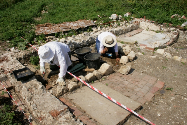
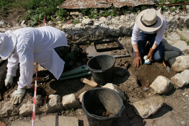
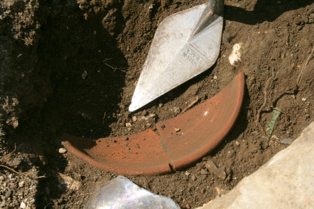
The excavated remains of the cottage are definitely worth a visit; substantial flint and brick built walls, floors paved with beautiful terracotta tiles and imported stone. And a variety of finds have reflected the quality of the lives of the farm labourers and their families that lived there. There is good evidence that, almost without exception, they suffered from extreme poverty, but they clearly did what they could to improve the quality of their lives.
We have been researching its history for the past few years and a draft copy of our book, as well as the progress of our dig, can be read on this blog.
The tour starts at 10am at the car park just north of the junction of Bexhill Road and Falmer Road in Woodingdean, on Saturday 2nd November. It can be very windy so it is recommended to dress warmly and to wear sensible shoes or boots as the ground is a little uneven, but the walking is relatively easy and may be possible for an off-road mobility scooter. If the weather is bad a shorter version of the tour will be made.
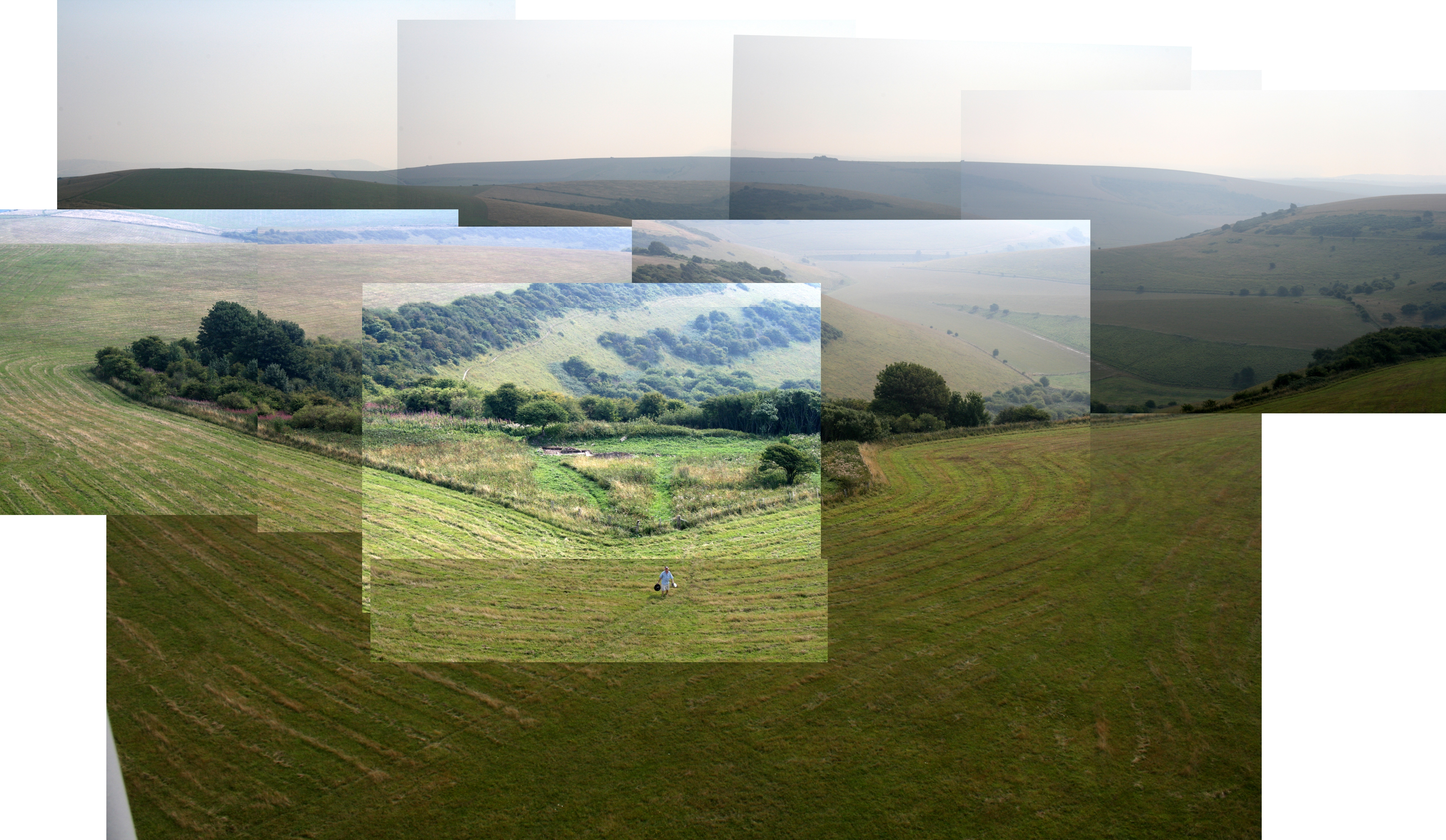
View SE over site from half-way up aerial on Newmarket Hill; click to enlarge!
And just to wet your appetite, here is a selection of some of the best photos of the dig:
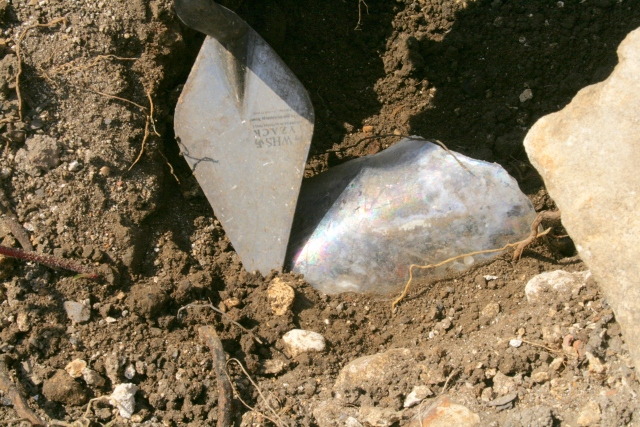
Looking NE at unusual iron object; 21st June 2013.
Looking W across excavated area N of house from bulldozed rubble mound; 16th August 2013.
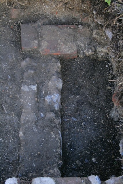
Looking N at N boundary wall E of toilet; 21st July 2013.
Painted dolls foot wearing a shoe; 13th September 2013.
Looking S at part of front door – N gable end of house – 3rd May 2013.
Looking SE at excavation of chalk rubble surface against side of house; 28th April 2013.
Map of the Downs between Brighton and Lewes: Contour data courtesy of OS Maps
Looking NW at excavated outside toilet; 7th July 2013.
China doll face; 26th July 2013.
Looking N at excavation of wood – possibly remains of stairs; 28th April 2013.
View to W – family visit – digging the toilet site! 3rd July 2013.
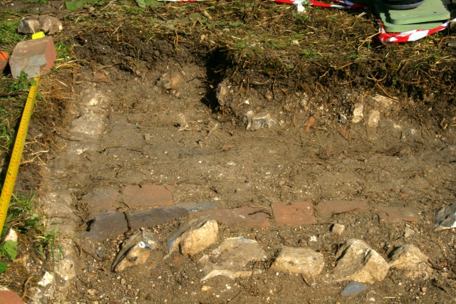
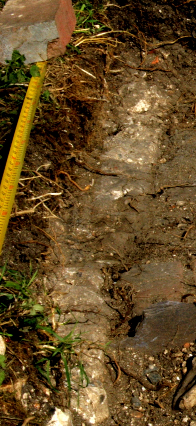
Looking W at trench 1A showing un-mortared bricks on E edge; 7th April 2013
Newmarket Farm location. Overlay of old and new O.S. maps and Google Satellite images.
SW end of house looking N; 17th May 2013.
Looking S at digging E and SE of toilet; 26th July 2013.
Heel of child’s boot or shoe; 8th September 2013.
.303 cartridge; 16th August 2013.
Clay pipe stem with star shaped makers mark on heel, 19th c.(?) from rubble mound; 7th April 2013
Looking East along northern site boundary; January 21st 2013.
View SE towards trench following line of water-pipe from water-tank at NE corner of barn diagonally across entrance to farmyard to NW corner of house; 26th May 2013.
Looking SW at corrugated iron sheet and other finds; 14th June 2013.
Limb of ceramic figurine, pen nib, light bulb, and piece of red plastic; 14th June 2013.
Looking S from garden boundary wall down path to front door; 9th August 2013.
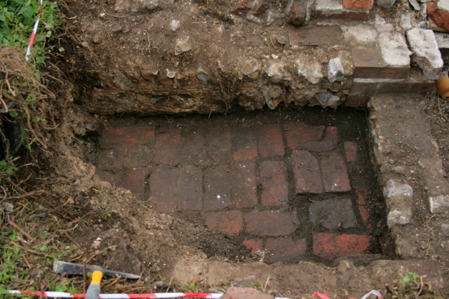
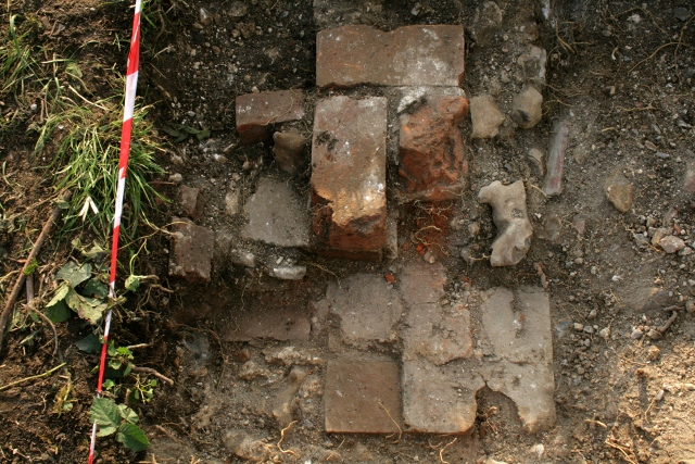
Looking S at tiled floor near front door; 3rd May 2013.
A button from the drain; 30th August 2013.
Fragmented cast iron grating, probably for our gully drain; 22nd September 2013.
Part of a cast iron coal grate? 22nd September 2013.
Mortise lock in base of demolition fill over path to front door; 28th July 2013.
Looking W from top of demolition rubble mound at N front of cottage, including shed; 22nd September 2013.
Lucite(?) bead, on floor of trench 1B; 7th April 2013
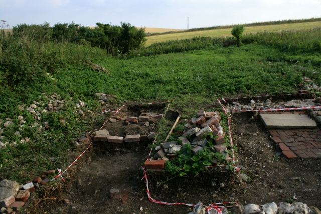
Looking NE at excavation of W side of Cottage; 7th April 2013
Ceramic drain in front of junction of scullery/kitchen and shed from the drain; 30th August 2013.
Looking NW at brick edged stone floor of outside toilet; 3rd July 2013.
Looking W at junction of internal wall with external house wall; 7th April 2013
Porcelain cup shards with colourful flower design and intact handle; 22nd September 2013.
SW end of house, looking N; 10th May 2013.
Decorated clay pipe bowl, 19th c.(?) from rubble mound; 7th April 2013
Looking S at excavation of fill of ‘lean-to’ construction; 3rd May 2013.
Mortise lock; 16th August 2013.
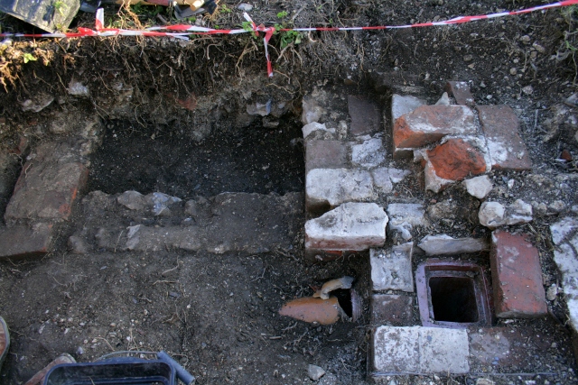
Photo looking SE at NE corner of cottage, including gully drain; 20th September 2013.
Black rubber screw threaded stopper for Ballard’s beer bottle; 13th September 2013.
Child’s cup or mug; 9th August 2013.
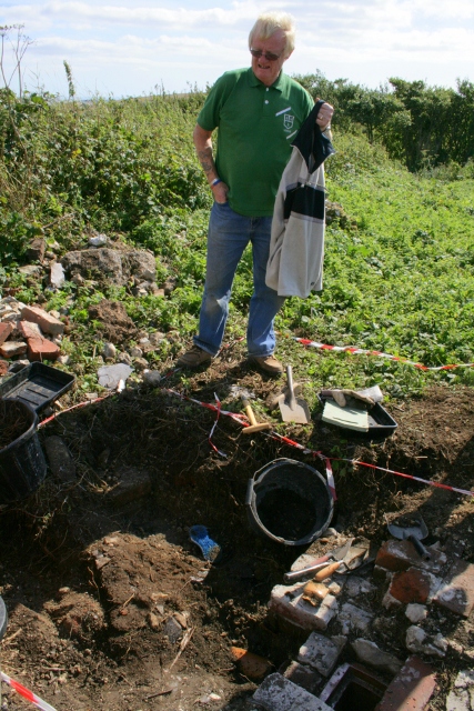
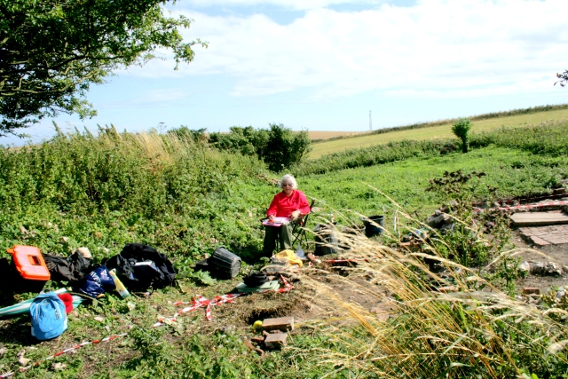
Bob Phipps and myself on a tour of the east side of the site; 28th April 2013.
Looking SSE from outside front door to cottage to ‘woodstore’ at its NE corner; 13th September 2013.
Looking S at my father, cousin and his children excavating outside toilet; 3rd July 2013.
Looking E at excavation of E side of toilet; 7th July 2013.
Looking NNW at west side of outside toilet; 3rd July 2013.
Newmarket Cottage, looking SE; 3rd May 2013.
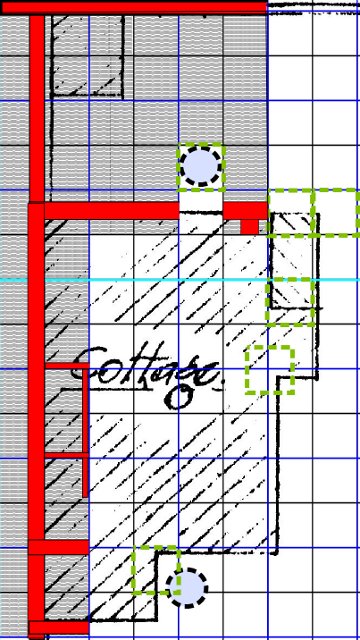
Plan of dig site progress, with next area to be dug in green – 22nd September 2013 – base plan from Selbach’s 1922 papers in East Sussex Record Office.
Looking SE at diggers & Peggy’s brother, former resident Reg Latham visiting Newmarket Farm; 19th July 2013.
Enhanced image of Smith’s milk bottle; 22nd September 2013.
Looking SW at partially excavated path (yard?) towards front door; 28th July 2013.
View SW over front garden from N edge of rubble mound near NE corner of garden; 11th August 2013.
No. 36M Mills bomb base; 26th July 2013.
Digging the site of the toilet! 7th June 2013.
Dramatic sky beyond aerial W of site; 8th September 2013.
Close up of decorated pipe stem; 16th August 2013.
Rosette crimped blank .303 cartridge, made by The Royal Laboratory, Woolwich Arsenal, 1893-1904.
Milk bottle shards from Woodingdean Dairy and other finds; 14th June 2013.
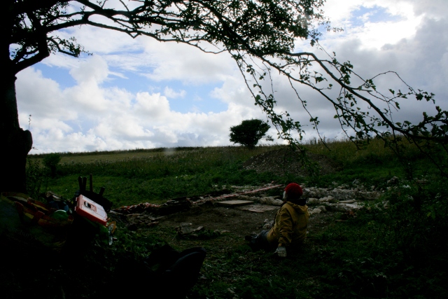
View E across dig site and Castle Hill NNR; 28th April 2013.
Tautz button from surface of rubble mound; 7th April 2013
Newmarket Farm by Douglas Holland.
Looking SE from site of toilet to site of missing well! 8th September 2013.
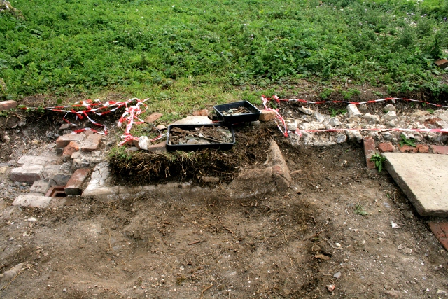
Finds tray from the drain; 30th August 2013.
Finds, including brown teapot spout; 14th June 2013.
Looking W across front wall of house; 11th August 2013.
Looking SE towards dig site & Castle Hill NNR; 10th May 2013.
Looking E from garden/farmyard wall across area to front of house, including unexcavated area over possible water tank; 1st September 2013.
Looking S at ‘woodstore’ against E side of cottage’s N frontage; 22nd September 2013.
Looking W at drain, NE corner of house, and entrance to shed; 20th September 2013.
.303 cartridge from under corrugated iron sheet; 16th June 2013.
Looking W from top of demolition rubble mound at N front of cottage, including front half of ‘woodstore’.
We continued excavating the small woodstore, or “cubby-hole” as a former tenant described it, on the east side of the gable frontage of the cottage. And, at the bottom of its 0.5m deep fill of demolition rubble, we came across a ‘shed load’ of finds!
Looking S at ‘woodstore’ against E side of cottage’s N frontage.Looking W at ‘woodstore’ against E side of cottage’s N frontage.
It was only about 1m wide and a more or less accurate plan (from papers dated 1922) indicated it may be about 2m long. So we have so far excavated about 2/3 of it, and it is a real gem! Just inside the threshold we found a compacted earth floor, but further digging revealed that this lensed out to reveal a brick paved floor underneath. Immediately under the earth surface was a large quantity of coal and some charcoal.
Was this ‘in situ’ charcoal evidence for the cottage having been burnt down during its WW2 destruction by allied exercises after the last tenants were forced to leave in October 1942? The evidence is that this is unlikely. The coal was unburnt, a fragment of unburnt wood was excavated early in the dig from inside the house under a layer of collapsed masonry, and no in-situ masonry has as yet shown any signs of fire scorching. Nevertheless, occasional fire burnt flints, charcoal and other burnt material has been excavated across the front of the site, but they were isolated finds – perhaps from bonfires, fire ash from the cottage’s hearth, and extreme heat from military ordnance.
Enhanced image of Smith’s Woodingdean Dairy milk bottle.
The finds included a large quantity of milk bottle shards – mostly from the nearby Woodingdean dairy, which dated from the early 1920’s when it was called the Warren Farm Dairy Farm, run by the West family who also ran Bevendean Farm, then, in the 1930’s(?) as Woodingdean’s population grew, a Mr Smith was able to turn the delivery of the milk into a separate business, which he ran until the end of the war. They are easily identified by their red painted writing/design, and have especially turned up right across the area in front of the cottage in large numbers. It is interesting to see the name changes recorded on our bottles shards. Woodingdean author Peter Mercer has recorded local people’s memories of the dairy – but its full story has yet to be told.
Porcelain cup shards with colourful flower design and intact handle.
No military ordnance was found, nor were any shards of ‘blue and white’ willow pattern ceramics. We can’t remember a grid square without either them for a long time! However, some very nice ceramic finds included most of a porcelain cup with a brightly coloured floral design – and with its handle intact – a first for the dig.
Metal finds included a larger than usual quantity of rusty nails. More exciting for me were two metal grates;
Fragmented cast iron grating, probably for our gully drain.
One was the fragmented remains of the missing cover to the gully drain
Part of a cast iron coal grate?
The other is possibly a large part of a nicely moulded grate to a coal fire. This could be a very important find *if* it is part of a coal fire grate and can be dated to when the cottage was built in about 1830. Unlike a wood fire, a coal fire requires air from underneath to keep it going, which is enabled by a grate. There was very little wood over this part of the downs so imported coal was likely to have been cheaper than wood as a fuel source. It was certainly brought by ship to Brighton during the 19th century.
Plan of dig site progress with wall lines in red and next area to be dug in green, on top of an old plan of the farm from East Sussex Record Office.
What will the far end of the woodstore contain? And is the structure shown on the 1921 (or earlier) plan beyond it a cupboard, a fireplace, or even a backdoor? Only further digging will tell. We would love you to join us – no experience required! We meet at the car park near the junction of Bexhill Road and Falmer Road, just north of Woodingdean, at 10am, and if the weather is too bad to dig we are still happy to give a quick tour for anyone interested. Also, we now have a date for our official guided tour of the site; it will be on Saturday 2nd November,at the same time and place as above.
A really nice day, digging the drain, shed and north east corner of the kitchen/scullery, on the east side of the north gable front of the house.
Photo looking SE at NE corner of cottage, including gully drain and outlet drain-pipe.Looking S at gully trap and drain in front of NE corner of house and the ‘woodstore’.
Our retired plumber/volunteer digger confirmed that the salt glazed stoneware gully drain had a trap to collect sediment at its base. Further excavation to its east quickly revealed a buried drain pipe, which had apparently been very poorly connected to the gully trap’s outlet. He explained that the joint should have been sealed with tarred rope as well as mortar, but he had expected to have seen more mortar – which in his opinion indicated a shoddy job! The drain pipe was fairly near the surface and continued at a relatively shallow downwards angle in an eastwards direction. The only new find of interest from out of the gully trap was a minute blue bead.
Looking W at drain, NE corner of house, and entrance to shed
The ground surface on top of the drain – the path to the ‘wood-shed’ – was found to continue sloping downhill in an eastwards direction. This supports the possibility that this drain was used to water the vegetable garden to the east of the house. The vegetable garden was at a lower level, but it is now completely buried by the bulldozed mound of demolition rubble.
Looking E across entrance to shed.
Immediately to the south-east of the drain, the front of the wood-shed was further excavated, and its east wall was uncovered. Luckily the shed was not as wide as was expected so its east wall was just clear of the base of the demolition rubble mound. The wall was just one brick wide, so this was definitely a ‘lean-to’ structure and not part of the main fabric of the building, which has been found to be half again as wide.
Finds were not numerous, but we can’t be too greedy! A few of them were quite intriguing though. A large number of milk bottle shards, mostly from the Woodingdean’s Warren Farm Dairy, but one shard seemed to be from a dairy in Lewes – the first for the dig. A fairly large bead was also found, painted(?) in a mat green colour and possibly made of plaster. WW2 finds were just a single .303 cartridge and a short length of barbed wire. Only a few small ceramic shards were found, including the inevitable pieces of blue and white. The first intriguing find was an ivory coloured rectangle, a little shorter than a domino piece. The other looked like a black plastic modern household electric lamp fitting, screw threaded inside and out, which is strange since there was no mains electricity, though the farm that the Phippses and Lathams worked for did have an electric generator installed, but it was a mile and a half away. There are also reports of WW2 camps elsewhere installing generators for electric lighting.
Worked sandstone windowsill?
Also found were two fragmented slabs of sandstone, one of which consisted of 4 joining pieces, 20cm wide, both of which had a narrow grove 2cm from a slightly radiused edge. Could they have been window sills?
The next dig, Sunday, we continue exploring the garden shed, looking for any further secrets it may contain.
Looking SE at concrete gully outside kitchen/washhouse window.
The first target of the day was the beautifully preserved concrete gully which fed into the salt glazed stoneware ‘gully drain’. Situated directly outside the kitchen/washhouse window, the most likely location for the kitchen sink, this suggests it is likely to have been used as a drain for ‘grey-water’ rather than to collect rainwater for a water-tank or well.
Looking W from ‘woodstore’ doorway at ceramic drain and concrete gully outside kitchen/washhouse.Looking S from near front garden gate at ‘woodstore’ doorway, ceramic drain and concrete gully outside kitchen/washhouse.View SW of NW corner of ‘woodshed’.
Next, a new grid square was opened to the east of the drain, over the entrance to what we have been told was a woodstore, at the east end of the gable frontage of the cottage. We were very surprised to discover the threshold for the doorway, and the earth floor beyond, was about half a metre below the floor level of the kitchen next-door.
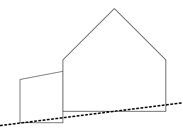
Cottage and shed frontage showing approximate level of ground.
The front of the cottage was built on a slope, and the floor inside the cottage, at its east end, was much higher than that of the ground surface outside. It can now clearly be seen that the bulldozer, following the slope of this outside ground surface, cut away most of the floors inside the cottage. However, because the bulldozer cut was merely to tidy up the site after its WW2 ordnance demolition, everything at a lower level (except the areas which took a direct hit from military ordnance) has survived under a layer of demolition rubble, including our woodshed.
Having further cleaned up the adjoining north end of the east wall of the kitchen, we now know it was of the same thickness as the other external walls of the house. This strongly indicates it was a load bearing wall. It was also inline with the gully drain, suggesting it received the outfall from a rainwater gutter downpipe. These two observations strongly indicate that the woodshed was not an integral part of the main body of the house. Therefore the two bedrooms in the roof – across the width of the front gable of the cottage – only extended over the kitchen/washhouse, and not over the woodshed as well.
Finds were not particularly numerous, but made up for it in quality.
Painted dolls foot – wearing a shoe.
A small painted doll’s foot was the find of the day. The most surprising find was a short length of pencil lead next to a shorter length of extremely thin, partially folded, yellow glossy plastic like material – perhaps paint? The distance between each of the fold lines was about that of the width of a hexagonal face of a wooden pencil. Was this all that remained of the stub of a pencil, after all the wood had decomposed?
Black rubber screw threaded stopper for a Ballard’s beer bottle.
Also nice was a hard black rubber screw-top stopper with the name ‘Ballard & Co. Ltd. Lewes’; this was from a brewery in Southover, Lewes, which apparently was in business from at least 1900 but had stopped production by 1930.
Plastic snap on lid of Lipton’s Bramble Jelly.
Whilst the Lipton brand is famous today for its tea, its stores sold many other products including, apparently, bramble jelly. The lid is almost certainly made of a flexible PVC which first became commercially useful from 1926. It is unlikely to be made of polythene because commercial production was only developed by 1939, and all of its wartime production was to diverted to military uses.
Shard of ‘mochaware’ ceramic.
This nice ceramic shard of shows a tree or moss-like ‘dendritic’ plazed patterned glaze and is known as mochaware. It was first developed in the 18th century and is still used as a design today.
Next Friday we will continue exploring the woodstore, before moving further down the east side of the house looking for the possibility of a back door, as well as for the fireplace (if it hasn’t been removed by the bulldozer). Round the corner, to the south of the cottage we will be looking for another well. Friday’s weather may or not be wet, but we will be at the car park near the junction of Bexhill Road and Falmer Road, just north of Woodingdean, at 10am, and if the weather is bad will make our final decision whether to dig then. Even if it is too wet to dig we would be happy to give a quick guided tour for anyone interested. Please don’t hesitate to give me a call for further info.
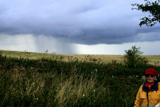
Looking SW across site of Newmarket Farm, between rain showers.Looking at rain shower NNE of Peggy standing on site of front garden gate.Dramatic sky, looking SW at hawthorn near SW corner of farmyard.
Dramatic sky beyond aerial W of site.
Friday’s dig was cancelled because of rain, but luckily the showers on Sunday, though spectacular, were short enough for us to get some good digging done.
Looking SE from site of toilet to site of missing well!
Between the front door and the wood shed, directly outside the kitchen window, Peggy’s oldest sister clearly remembers there was a well. So when we succeeded in clearing the last part of the original ground surface from its blanket of WW2 demolition rubble, across the front of the cottage to the east of the front door, my mother and I couldn’t help being disappointed that there was no sign of it. It may have been back filled for safety reasons, or perhaps it was located elsewhere.
Looking S at concrete drain/gully in front of house between front door and woodstore.
We weren’t entirely disappointed though. Directly under the probable kitchen window we did find and partially excavate a substantial but shallow concrete open gully or drain, about 3 foot long and a foot wide, which fed into the ceramic ‘gully drain’ we found last week. This may have taken grey water from the kitchen sink to feed the vegetable garden, or rainwater collected from the cottage and/or barn roofs to feed a water-tank, or a well, further to the east.
Next dig day we plan to extend a trench across the front of the woodshed, whose north-east corner should be located at the foot of the large mound of bulldozed demolition rubble – if it is not too deeply buried to be safely excavated! Was its outer wall load bearing; was it sufficient strong to carry the weight of the eastern side of the gable end of the cottage roof which enclosed two of the three upstairs bedrooms, or was it merely a lean-to type structure with just its own roof to support? And can we trace the outlet of our ‘gully drain’? Did it feed a water-tank? It is even possible that the demolition fill on top of our shallow concrete drain/gully, which we have yet to fully excavate, may be hiding something exciting; we need to keep digging for answers!
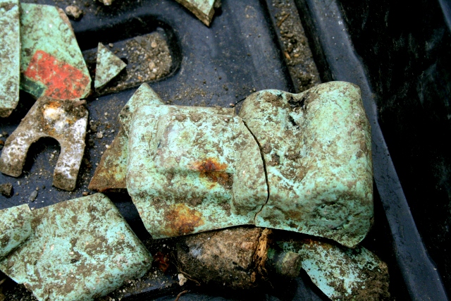
Green painted(?) plaster(?) shards of mystery object.
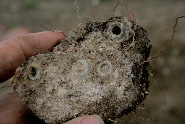
Nearly forgot to mention our finds – kilos(!) of glass, ceramics (some very nicely decorated), nails and other pieces of miscellaneous metal. Amongst the ceramics we found some interesting examples of shards of a green painted(?) plaster(?) mystery object, which we have regularly found on/in the ground surface under the demolition rubble in front of the house. Several shards had rounded 90 degree corners, and one of the pieces in the above photo clearly had a scroll-like form such as for a moulded pillar or leg – either its top or its base. Exceptionally we have found shards with a red painted(?) decoration, such as in the top left of this photo.
Our small bones may be rabbit – perhaps shot by bored WW2 soldiers with some the .303 cartridges we found, or more likely, with the first two 12 bore shot-gun cartridges(?) we excavated out of the base of the demolition rubble.
Heel of child’s boot or shoe.Eyelets from uppers of a child’s boot or shoe.
The star find of the day was the heel and part of the uppers, with a row of eyelets, of a child’s boot or shoe.
Friday’s weather may or not be wet, but we will be at the car park near the junction of Bexhill Road and Falmer Road, just north of Woodingdean, at 10am, and if the weather is bad will make our final decision whether to dig then. Even if it is too wet to dig we would be happy to give a quick guided tour for anyone interested. Please don’t hesitate to give me a call for further info.
Email: scienceinthegreen@yahoo.co.uk
Photos: http://www.flickr.com/photos/scienceinthegreen/
Looking E from garden/farmyard wall across area to front of house, including unexcavated area over possible water tank.Looking N out of approx location of kitchen window over unexcavated area possibly containing underground water tank.
A relatively quiet day – archaeologically speaking. Cleaning up the grid squares surrounding the 1x1m area where we most expected the opening to a water tank may have been in front of the house.
Looking N from out of site of kitchen window at possible site of a water tank in front of house (drain hidden under corrugated iron).
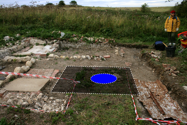
This enabled us to better see the contours of the original ground surface and identify the possibilities of an approximately 6’x6′ square backfilled cut which was just inside the paths between the front door, the outside toilet, the front garden gate, and the woodstore on the east side of the house.
Relatively few finds were uncovered – (a rim of a pretty pink glass container, perhaps a small vase or a bowl, was one of the nicest, and part of a WW2 hand-grenade was one the least nice) – which when compared with recent dig days was almost a relief – digging was quicker, and also meant less to record, to carry back, process, and store! It is now September so the clock is ticking to get the rest of the house excavated, cleaned up, and recorded by – hopefully – mid-October. Then perhaps a guided tour of the site might be arranged for the end of October/beginning of November – before the trenches are back-filled by Christmas – to prevent the winter frosts from damaging the site.
Friday’s weather is forecast to be wet, but we will be at the car park near the junction of Bexhill Road and Falmer Road, just north of Woodingdean, at 10am, and will make our decision whether to dig then. Even if it is too wet to dig we would be happy to give a quick guided tour for anyone interested.
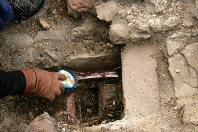
Ceramic drain in front of junction of scullery/kitchen and wood-store.Excavating ceramic drain in front of junction of scullery/kitchen and wood-store.
To put things simply – our dig has gone down the drain – and some really nice finds were recovered out of it!
Looking E from path between toilet and front door to house; excavating 1m x 1m square midway between front garden gate and front of house.
Our main objective for this part of the dig is the location of a reported ‘well’. So the excavated area in front of the house was extended by 1x1m – midway between the front door and the front garden gate – and still no sign of any such structure was found. There is now just an area of 1.5 x 1.5m directly in front of the house where this illusive structure might be located. A yellow bead, a button, a small variety of glass shards, a few nice ceramic shards, a live .303 bullet dated 1940, a very small quantity of bone, an even smaller quantity of wood, and lots of rusty nails made up most of our finds.
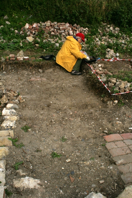
Looking S at drain in front of house at junction of scullery/kitchen and wood-store.
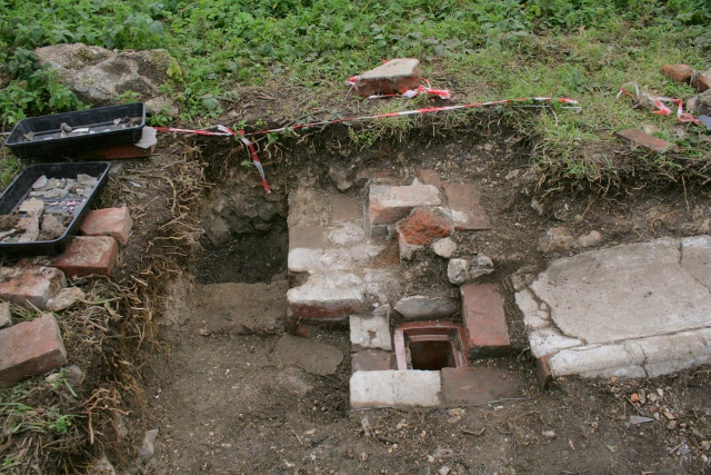
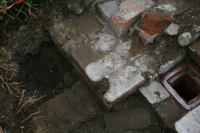
Meanwhile, last Sunday’s grid square, over the junction of the kitchen and woodshed walls at the front of the house, was further cleaned up – and a ‘beautiful’ shiny brown salt glazed stoneware(?) drain was revealed. It was a pity that a volunteer who is a retired plumber had called earlier to apologise that he couldn’t join us – just when we needed him!
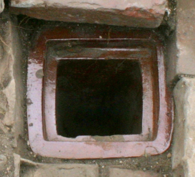
Gulley drain in front of junction of scullery/kitchen and woodshed; (W at top of photo).
It was square in cross-section, but with very slightly rounded edges and corners. It had a recessed lip which would have held a grating. Its external width was about 9″, with its lip about 1″ in from the edge, about 1″ deep, and 1″ wide, suitable for a grating of about 7″.
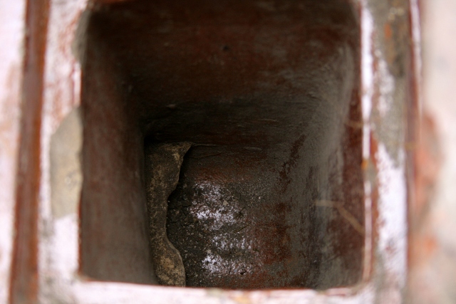
Looking down gully drain with openings at base to east.
It was about 12″ deep, narrowing down to its base at a width of approximately 4″. It seemed to have two outlets; the lower one leading off horizontally from its base, about 2″ high; and a second outlet approximately 1″ above it with an opening of about an inch high. A little Internet research has revealed this was a ‘gully drain‘ to divert rainwater from a gutter and/or down-pipe to a drain-pipe beyond. The Paving Expert website suggests that the lower outlet may have been to trap silt, whilst the upper outlet may have been to enable rodding through any blockages in the drain-pipe beyond. The whole was contained by bricks and mortar.
To its west, and at a slightly higher level was a wide shallow concrete gutter abutting the front of the house. It had an outlet to the east, presumably diverting rainwater under the path to the wood store, via a drain-pipe, in the direction of the vegetable garden – where it would have been much appreciated.
Was this an overflow drain from a water-tank directly in front of the house? It may have been filled by rainwater from both the house roof and an overflow from the big rainwater tank in the nearby barn to the north-west – it was from this direction that a cast-iron pipe has been found heading in front of the west side of the house, though it had been chopped off, within a foot or so of the west end of the house.
Finds tray from drain.
Just as exciting were the finds which were found buried in the drain and its immediate vicinity – they were notable for both their quantity & quality.
…
Enamel cup from drain
An entire enamel cup;
…
“OXO” bottle from drain
an entire “OXO” bottle;
…
Blue enamel saucepan handle
a blue enamel saucepan handle;
…
A button from drain.
a button;
…
Woodingdean dairy milk bottle shards from drain
a number of shards of Woodingdean dairy milk bottles;
several revolver cartridges;
two badly corroded, but entire, tin cans
and much more…
The finding of this drain has led to my earlier plan being revised, and I now feel we need to excavate all of its adjoining grid squares in front of the house to enable a full understanding of its context, including whether it was part of an overflow system from an underground water-tank located in front of the Latham’s kitchen, between the front door and this drain.
Looking NE from corner of Pantry to opposite corner of kitchen/scullery (being excavated).
A sunny day, with some archaeological ups and downs.
Looking S from W side of front gateway towards front of house.
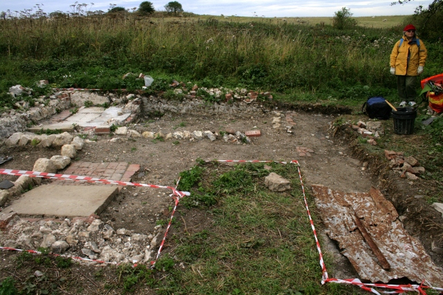
We worked on both ends of a 1x3m trench which was 2m south of the front garden gate, the southern most 1m of which was over the front wall of the house. The main purpose of this trench was to find the ‘well’ which the last residents of the cottage (Peggy’s family) have said was directly outside the kitchen window, to the east of the front door.
On excavating the northern 1m of this trench down to the ground surface immediately below the WW2 demolition rubble, there was no sign of any well or related structure.
Looking W from door of ‘woodshed’ at brick quoin of junction with kitchen/scullery front wall.
The southern most 1m of the trench revealed the eastern corner of the Phipps and Latham family’s kitchen. A very nice T-shaped brick quoin (in an otherwise flint built wall) was discovered which would have been built to strengthen the junction of the north and east walls of the kitchen and that of a ‘wood store’ which was at the eastern end of the gable frontage of the house, adjacent to the kitchen. This moves the location of the kitchen window further west than we thought.
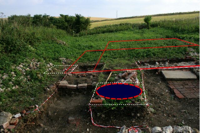
Photo of excavation looking S overdrawn with plan-lines showing known and probable wall lines, grid squares to be excavated and possible location of a well.Excavation plan (orientated N at top) showing main excavated areas – dark shaded; main excavated wall lines – red; possible wells – dashed circles; minimum of 1 x 1m grid sq.s planned to be excavated – dashed green lines. Base plan from ESRO.
This meant that the kitchen was slightly narrower than a surviving plan had indicated, and that the kitchen window would have been further west than we thought. So this Friday we plan to start excavating the last 1m wide baulk of soil left to be dug in front of the house.
Amongst the usual metal, glass, and ceramic finds we had some very nice decorated ceramics, including the arm of doll which had a looped hole for attachment to the rest of her body. A very special reminder that at least some of the families gave their children toys (Peggy and her older sisters had none bought for them).
Friday’s weather looks like it will be mostly cloudy, but should stay dry. We will be at the car park near the junction of Bexhill Road and Falmer Road, just north of Woodingdean, at 10am. Even if it is too wet to dig we would be happy to give a quick guided tour for anyone interested.
Cleaning up trench in garden W of front door step.
A sunny day for our 4 volunteers, some nice finds, ‘aerial’ photographs of the site, and a little closer to finding the Latham family’s well.
Aerial on Newmarket Hill.Aerial on Newmarket Hill.Engineer taking photos from aerial on Newmarket Hill.
On arrival we met people working on the tall TV/mobile/emergency services communications aerial which dominates the top of the hill a little over a hundred metres from our site. They very kindly took photos from about 2/3 of the way up; and the view was stunning. It very much helped put the site into its landscape context.
View from NE to SE over the site from 1/2 way up aerial.
The photos taken, and compiled into a montage (if you click on the image above you can see a high-resolution copy), show how the site is beautifully situated in a hollow, right above the top end of a steep-sided valley. Only partially shown is that it is situated just below the ridges of the hills to its west and north, and further protected by other nearby hills both to the south and the east. It was only open to the south-east, with views across to Seaford Head and Cuckmere Haven, though these were hidden by haze at the time of our photos. Unfortunately, because of the slope of the land, the height of the vegetation, and that the older parts of the site are being recolonized by encroaching brambles and creeping thistles, it is hard to make out much of the dig site itself.
Garden W of front door, S of toilet.
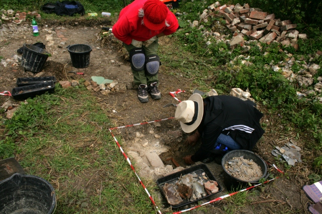
The relatively small garden area – bounded by the front of the house, the garden/farmyard wall and the edging stones to the path between the front door and the toilet – was further cleaned up. This was a location where a lot of rubbish had been deposited, and finds were plentiful.
Possible ink pot
The best of these was a complete glass pot – in just 2 pieces – probably an ink bottle.
‘Who killed Cock Robin’ saucer or tea plate
A number of very nice ceramic shards included another 2 pieces of a saucer from our ‘Who Killed Cock Robin’ set;
Ceramics and pink glass.
some nice glazed shards;
Terracotta bowl.
and half of an unglazed shallow terracotta bowl.
Rainbow patina on old glass bottle shard.
Many of our glass bottle shards looked old though none of the older shards had names. A first for the dig was a screw threaded rubber bottle stopper with the words ‘[?]NION’ and ‘BRIGHTON’.
Clay pipe stems.
Two undecorated clay pipe stems were also found. This area of garden soil under the demolition rubble showed no clear horizon, with small quantities of building rubble turning up below the original ground level, which proved a challenge to our diggers when distinguishing between the two contexts of the demolition fill, and the garden soil fill below it.
3x1m wide trench S of path from front garden gate
The quantity (and quality) of finds in this area inevitably slowed down progress on our other dig target – the location of the Latham’s (alleged) well. Finds from this area were few, but included another possible stirrup pump. Also nice was our 2nd screw threaded rubber bottle stopper – this time from a Gaymers cider bottle.
Looking S past site of garden gate towards E side of front of house.
A sunny day, a visit from John Funnel – Brighton & Hove Archaeological Society’s head of field archaeology – and good archaeology. Wow!
Just about all of the west side of the house has now been excavated, a small area of the farmyard, and a large part of the front garden, with its associated structures. Enough for me to feel able to make some observations on the landscape as whole.
Looking E over path and front garden gateway.
We finished cleaning up the inside edge of the front gateway – the main entrance to the site. The gate posts, which most likely were of brick, have been lost – possibly to the 1950’s bulldozer whose cut was here just a few centimetres above the original ground surface. The surface of the path sloped down to the east. Part of the surface of the mortar threshold of the gateway was slightly below the earth surface of the path. In the above photo a darker area of the path can be seen next to the edge of the gateway. This was associated with small pieces of charcoal. Since none of the stones or finds in this area showed signs of having been scorched, this suggests that any burning in this area was not intense, and it may be that much of the ceramic, glass, and metal rubbish we have found, as well as the remains of fires, were scattered over the path to make up its surface, as well as to provide a better, less muddy, surface for walking.
The bricks, which are likely to have originally paved the entire width of the path, were only found on its west side. These may easily have been lost due to a natural tendency for them to creep downhill. This is especially likely if the eastern side of the path had no heavy edging stones to hold a paved surface in place. The original ground surface to the east is expected to fall away fairly steeply beyond this path. The vegetable garden on the east side of the property has been reported as having been at a lower level by some of the surviving children from both the Latham and the Phipps families.
The original ground surface of the site as a whole sloped downwards from west to east, though this is hard to see, both because of its covering vegetation, and because almost all of the garden to the east of the house has been covered by the large bulldozed rubble mound which consists of the demolished remains of the house, walls, outbuildings,and all the other structures in the machine’s path.
When the whole site was first cleared in the late winter/early spring of its tall covering vegetation, signs of a terrace were observed at the highest, far western side of the farmyard across the former location of the stables and cattle hovel, and a lower terrace was observed at the eastern side of the farmyard, adjacent to the house. Our excavation has shown that this side of the farmyard was at a higher level than that of the house, front garden and toilet, on the western side of the wall which divided the working farmyard from the domestic part of the site. Both the platform which would have been dug for the foundations of the house and its associated structures – paths, etc. – would have had a big effect on the contours of the original ground surface – resulting in a terrace effectively being formed. Immediately to the east of the house, as was recorded above, a steep slope or bank is believed to have existed, below which was a vegetable garden, whose soil would naturally have also crept downhill – held in place by the eastern boundary wall – and so another terrace would also have formed. Further evidence for this is a dotted line shown on the 1873 Ordnance Survey map running from the approximate location of the garden gate to the north east corner of the house. The ground level of the garden next to the site’s boundary wall at its far east side, is remembered and in places can still be observed, as having been much higher than the ground surface below, at the head of the extremely steep sided Newmarket Bottom.
The bulldozer, which in the early 1950’s cleaned up the shelled ruins of the site, seems to have averaged out the slope of the site. It has cut through the boundary wall between the farmyard, and the house and garden. It cut through the top of the ground surface on the farmyard side, removing both the rubble from the destruction of the house that would have collapsed onto it, as well as any cobbled surface which we have been told had existed. On the other (east) side of the wall the 1940’s ground surface was at least a foot lower, and so here the bulldozer only cut through the surface of the collapsed, military ordnance destroyed, rubble. As has previously been reported, about a metre wide strip of the northern two thirds of the floor of the western side of the house, which was at a lower level than the adjacent farmyard, survived intact, but as the bulldozer continued at a downhill angle it progressively cut through the layers of the foundations below the floors and of the walls. The garden and associated features to the north of the house were all at a deeper level still, and so survived with a particularly deep covering of demolition rubble, sealing the 1940’s ground level from further damage. This area in front of the house is therefore most likely to have the best preserved archaeology.
Inner threshold of garden gateSite of front garden gateSite of front garden gate.E side of site of garden gate.E side of site of garden gate.Site of garden gate.
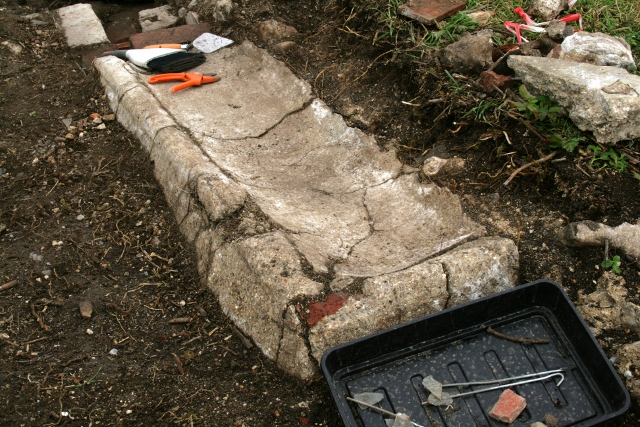
The sill of the gateway was of an uneven mortar surface – part of the wall foundations – worn smooth by over a hundred years of the tenants’ feet. The light coloured parts of this structure showed no wear from peoples’ feet – so were probably the site of the pillars between which the garden gate would have been affixed.
What is special for me is that from our research we know almost every one of the names of those who would have regularly passed through their garden gate. The path from the gate was opposite the east end of the house – and would have been overlooked by the washhouse/kitchen window. After about 2 yards it turned to the right towards the toilet, and after a little over 2 yards, immediately before the toilet, it again turned to the left towards the front door, which was a little over 2 yards further on. Somewhere between the house and this dog leg in the path, Peggy (my mother, who was born in the cottage)’s older siblings clearly remember a well outside the kitchen window to the left (east) of the front door.
View S from garden gate towards site of E side of house frontage and possible well between Peggy and pile of bricks.
So we have continued the trench from the garden gate due south, beyond the path’s southern edge, towards the front of the house in the hopes of finding the *ground level* remains of the well – remembered to have been directly outside the kitchen window.
This coming Friday should be a big day in the course of the dig – the excavation of the location of the (probable) well at the front of the house. So why not join us – we should even have biscuits! No experience required. Or just come for a visit.
We dig Fridays & Sundays, 10am – 4pm, and meet at the car park near the junction of Bexhill Rd & Falmer Rd, just north of Woodingdean. Weather permitting!