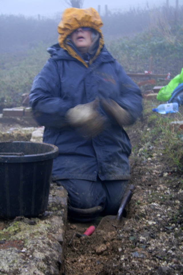
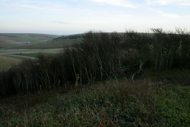
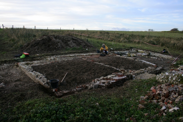
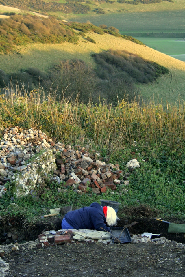
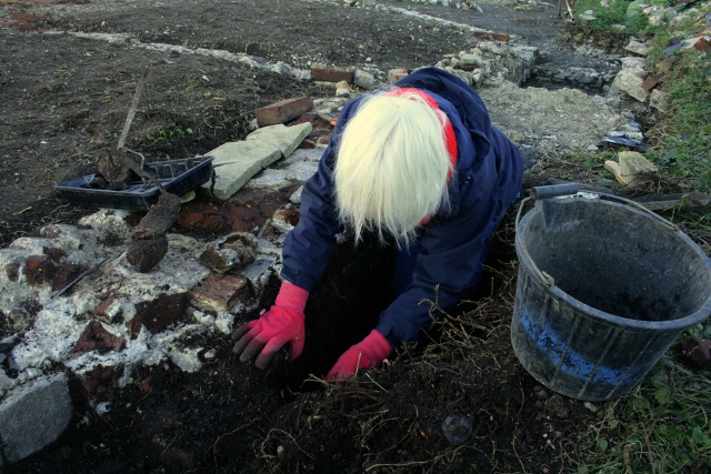
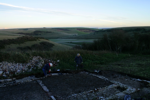
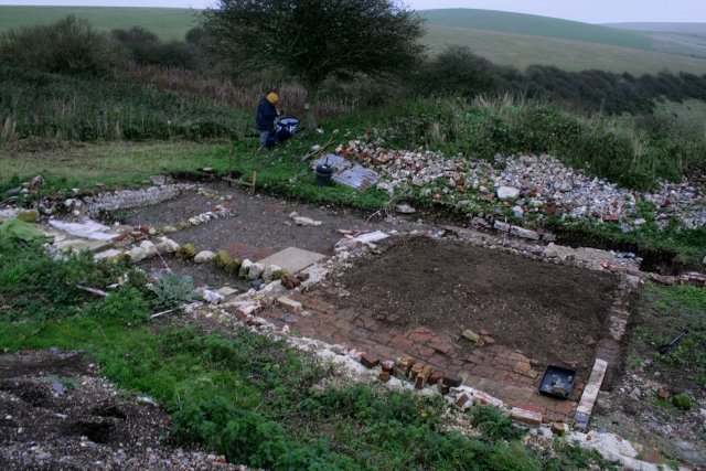
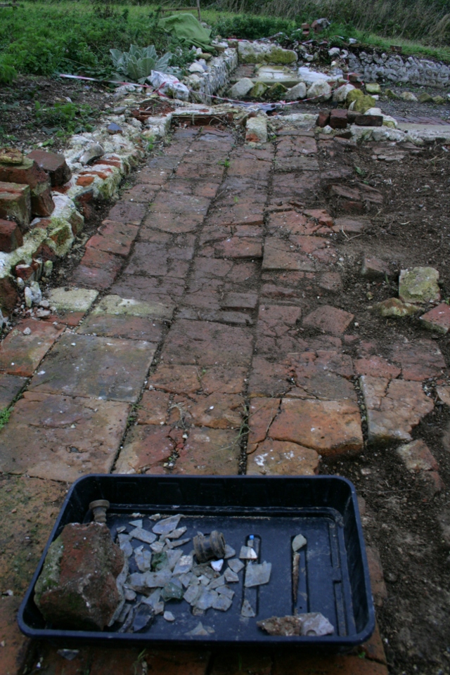
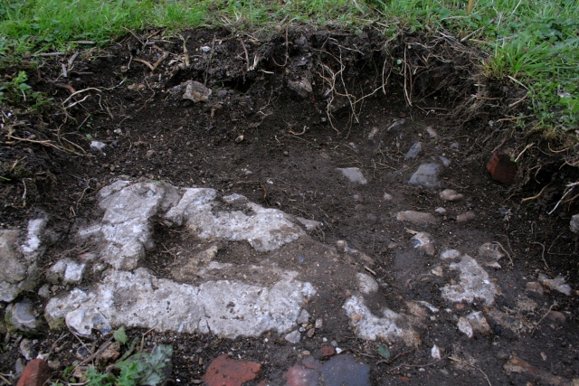
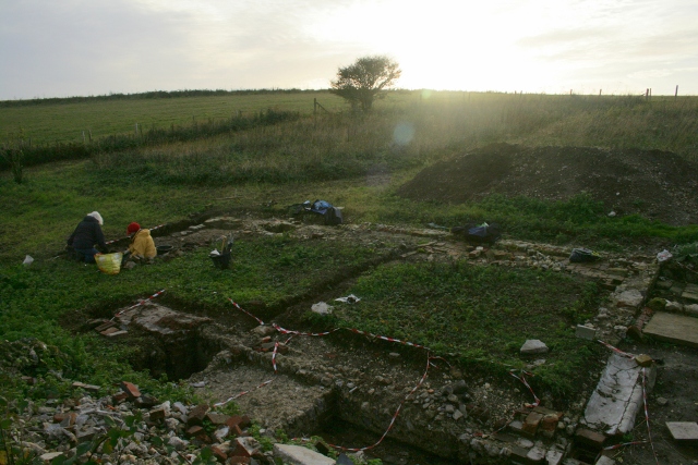
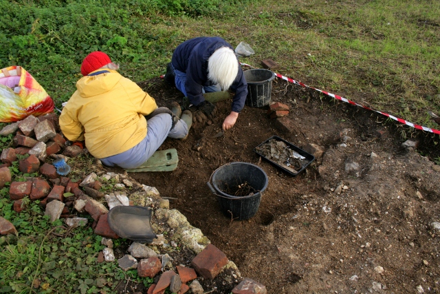
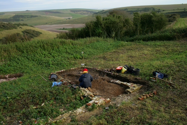
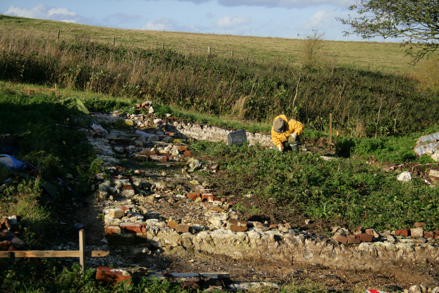
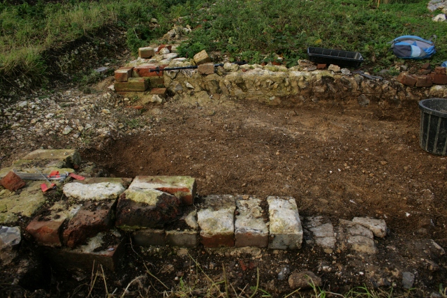
A grey damp misty day, but some very good archaeology made it all worthwhile, though the photo above may suggest otherwise!
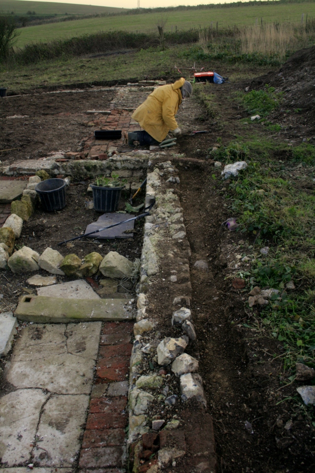
Looking N at SE end of cottage.
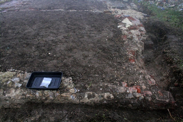
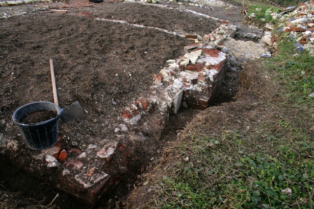
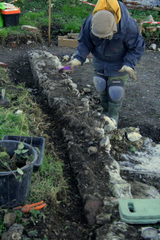
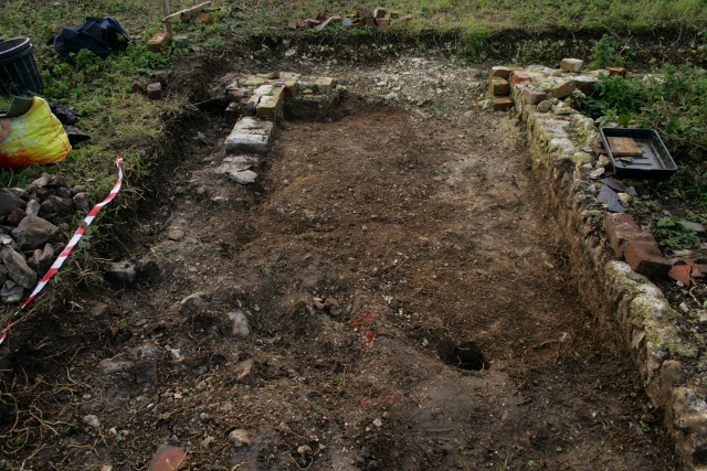
The complete outside face of the south wall of the cottage has now been excavated down to the original ground surface. The trench was just a shovel’s width, but apparently this is adequate for a laser scan of the site which is to happen sometime soon. A few finds, but nothing exciting, mostly window glass.
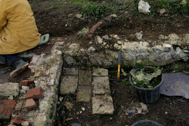
Looking S at W side of cottage wall.
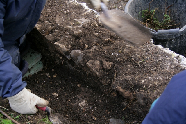
On the west side of the cottage a good job is being done defining the outer face of its outer wall, cut flush with lower levels of the farmyard nextdoor by the 1950 bulldozer. This involved excavating compacted chalk rubble backfill overlying a mortar buttress at the base of the wall.
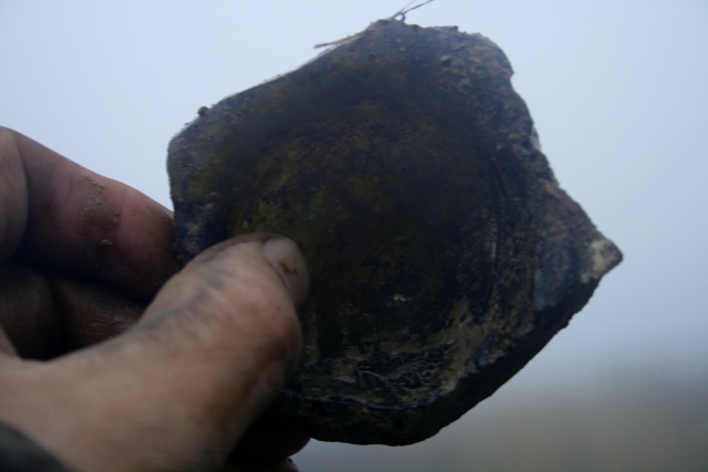
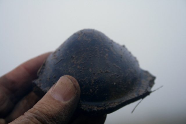
Bottle base.Bottle base.
Some well stratified finds were excavated; a few pieces of bone and the base of a green glass bottle with a high push or kick-up. These should date from the time of the construction of the cottage in about 1830.
The north side of the garden boundary wall was also further excavated. Yet more flint cobbles were discovered on the pathway immediately in front of the front garden gateway. There were strong indications, based on wear and iron staining, of flints having been added on top of an older cobbled surface by way of repairs. Protected by an adjacent bank, it had accumulated an overlying fill of demolition rubble, which included a number of finds.
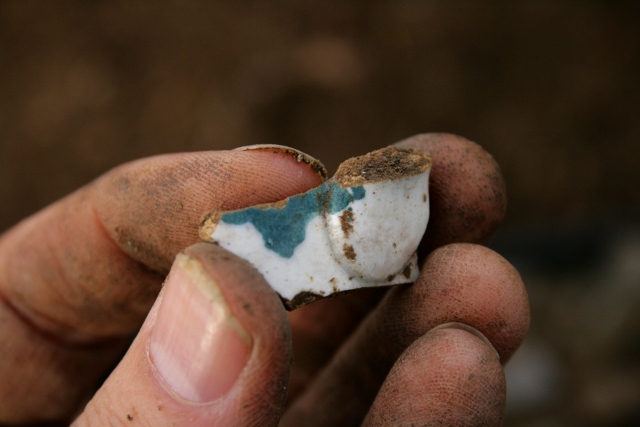
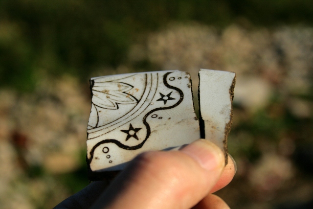
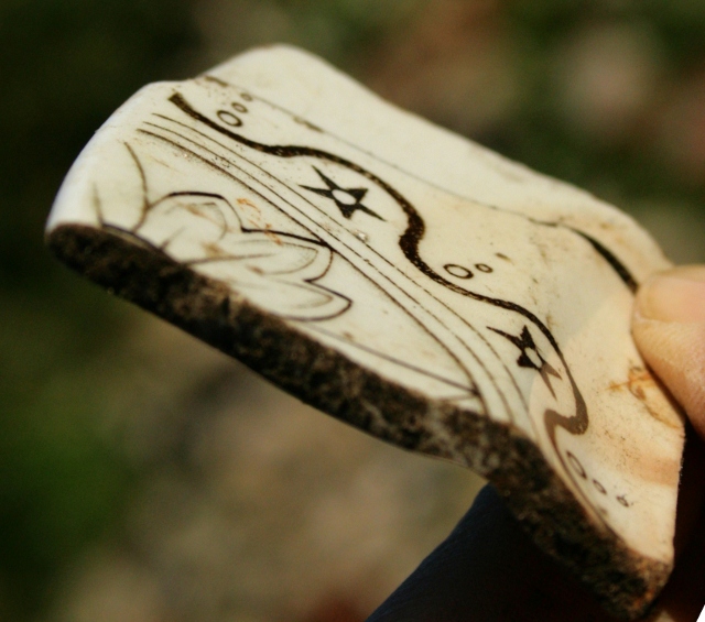
Decorated ceramic shard.
A range of very small decorated ceramic shards, bottle glass, and a .303 cartridge was found.
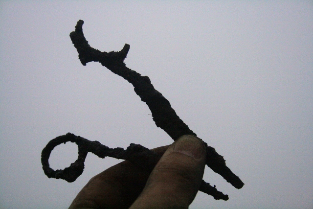
Broken pair of scissors.
Best of all, amongst the rusty metal finds, two halves of a pair of scissors.
There is plenty more to do before we shut down for the winter, so we would love you to join us – either for a site visit, or to help us dig – no experience required! We meet at the car park near the junction of Bexhill Road and Falmer Road, just north of Woodingdean, Fridays & Sundays at 10am, and if the weather is too bad to dig we are still happy to give a quick tour for anyone interested. Please don’t hesitate to give me a call for further info.
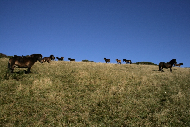
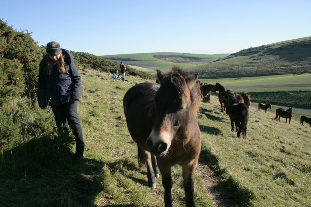
Exmoor ponies on Castle Hill NNR.Looking NW at N wall of outside toilet damaged by ponies.
The past few dig days have been spent cleaning up the site ready for a hi-res 3-d laser scan from SeSurveying.co.uk. So we were somewhat frustrated to discover that Castle Hill nature reserve’s 15 Exmoor ponies had been partying all over our (almost nearly) clean archaeology! Hopefully our new strategically placed hazard tape will restrict their access to this corner of the reserve.
Hazard tape blocking access to dig site via path through prunus scrub.Hazard tape blocking access to dig site via path through prunus scrub.Looking NW at cottage site from demolition rubble mound.Looking S at boundary wall between toilet/garden/cottage and farmyard.
The west side of the garden/farmyard wall was further cleaned up, between the cottage and the front boundary of the site. This wall butted against a chalk backfill, overlying a thin layer of mortar which may have formed part of the wall’s foundation. Its level was about a foot higher than that of the garden to its east.
Looking W at water pipe over garden/farmyard wall a short distance in front of cottage.Looking S over water pipe, garden/farmyard wall, stone blocks, and NW corner of cottage walls.
The end of the previously excavated iron water-pipe was also cleaned up, where it started to cross the wall; where it was cut by the bulldozer. It had been detected as having one end in the vicinity of (the site of) a big rain water tank in the east end of the nearby big barn. Its other end had previously been excavated, close to the modern ground surface directly above the cut flint wall, and was found to have been cut by the 1950’s bulldozer as it turned to run in an easterly direction parallel to the front of the cottage, just as it met the dividing farmyard/garden wall. This was a little over a foot to the north of the front corner of the cottage (see Second, Sixth, Tenth and Twelfth dig days).
Directly against the front of the house, in the corner with this wall, 3 courses of stone blocks were horizontally laid, forming a roughly rectangular solid base. The pipe ended just a little over a foot above the centre of this base. Whilst I don’t rule out other possibilities, I now believe the most probable purpose of this pipe was to divert overflow from the barn’s rainwater tank to feed a relatively small water tank or barrel (perhaps 50 gall.), which sat on this stone platform, conveniently situated by the washhouse/kitchen door. Rain water was soft and so preferred for washing than that of the hard water obtained from wells.
Looking NE at SE corner of cottage.Looking NW at S end of E wall of cottage.
At the opposite end of the site, the outer faces of the south and east walls of the cottage were also cleaned up. An area of the outer face of the east cottage wall between the chimney base and the south-east corner had been very badly damaged, probably by explosive ordnance. However, since the object was merely to clearly outline the width of the cottage’s walls, the full extent of the damage has yet to be excavated down to the original ground surface.
At the base of the surrounding demolition fill there will be finds, but their excavation would have significantly slowed down our progress – they can be saved for later – if we get more volunteers. As it was, no finds were unearthed to the north of the cottage; to the east, just 1 rusty spring & the top of a glass bottle; to the south, just 2 shards of pot, a shard of milk bottle, a small metal spring and a rusty nail. Our first dig day in a long time with no blue & white ceramics or .303 cartridges!
And our best sunset yet, with full moon in the east!
Loking E at sunset and full moon over dig site and Castle Hill NNR.
A beautiful sunny day, quality finds, and some interested visitors.
A couple of people who missed our official tours got a private tour today. One of them joined us digging and wishes to return as a new volunteer.
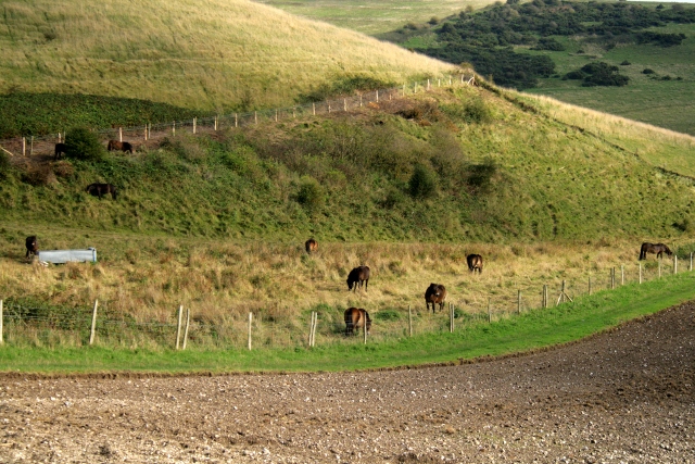
View of Exmoor ponies on Castle Hill NNR from demolition rubble mound.Exmoor ponies Castle Hill NNR.Exmoor ponies Castle Hill NNR.Exmoor ponies, Castle Hill NNR.
A walk was taken to visit Castle Hill NNR’s Exmoor ponies. They are mostly a little nervous of visitors, but one or two are friendly enough to introduce themselves. However, when the ponies later came up to the dig site and started to investigate our archaeology, they were somewhat less welcome.
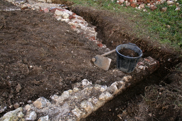
Looking WSW at garden boundary wall to N of cottage.Looking ESE at garden boundary wall N of cottage.
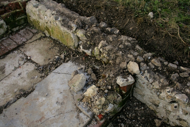
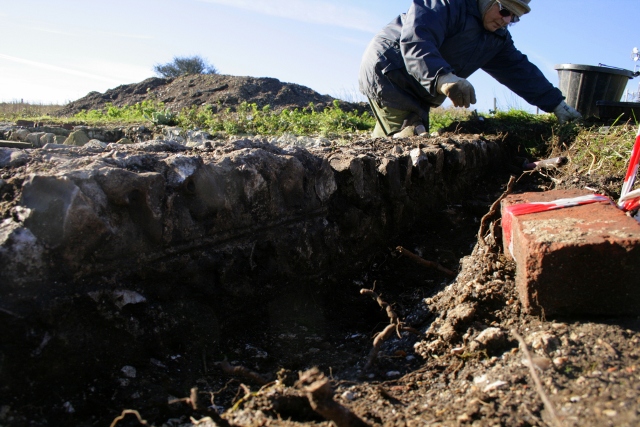
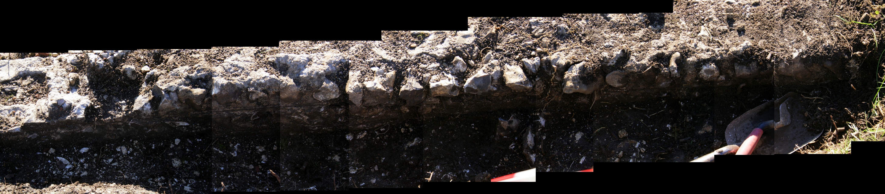
The north side of the front garden wall has now (just about) been completely excavated down to the surviving 1942 ground surface. At its western end it was about a foot above the ground surface on the other side of the wall. The chalk rubble found beside the remains of this wall was backfill; when a small sondage was dug down through it, a mortar base was discovered underneath it, part of the wall’s foundations.
Looking SW at garden boundary wall N of cottage.Composite of photos looking S at garden boundary wall, N of cottage; click for enlargement.
The ‘double struck’ lines in the pointing between the courses of flints roughly followed the contours of this ground surface, indicating that the top of the garden wall was not horizontally stepped, but sloped downhill.
Finds were few, but included a metal object which resembled either a latch to a door, or more likely, a hoof pick; it had a nicely wrought twisted iron handle.
Looking E at excavation of external face of chimney.Looking NW at excavation of external face of chimney base.
The immediate area outside of the chimney was also further excavated, continuing the previously dug trench in a southerly direction, along the east side of the cottage.
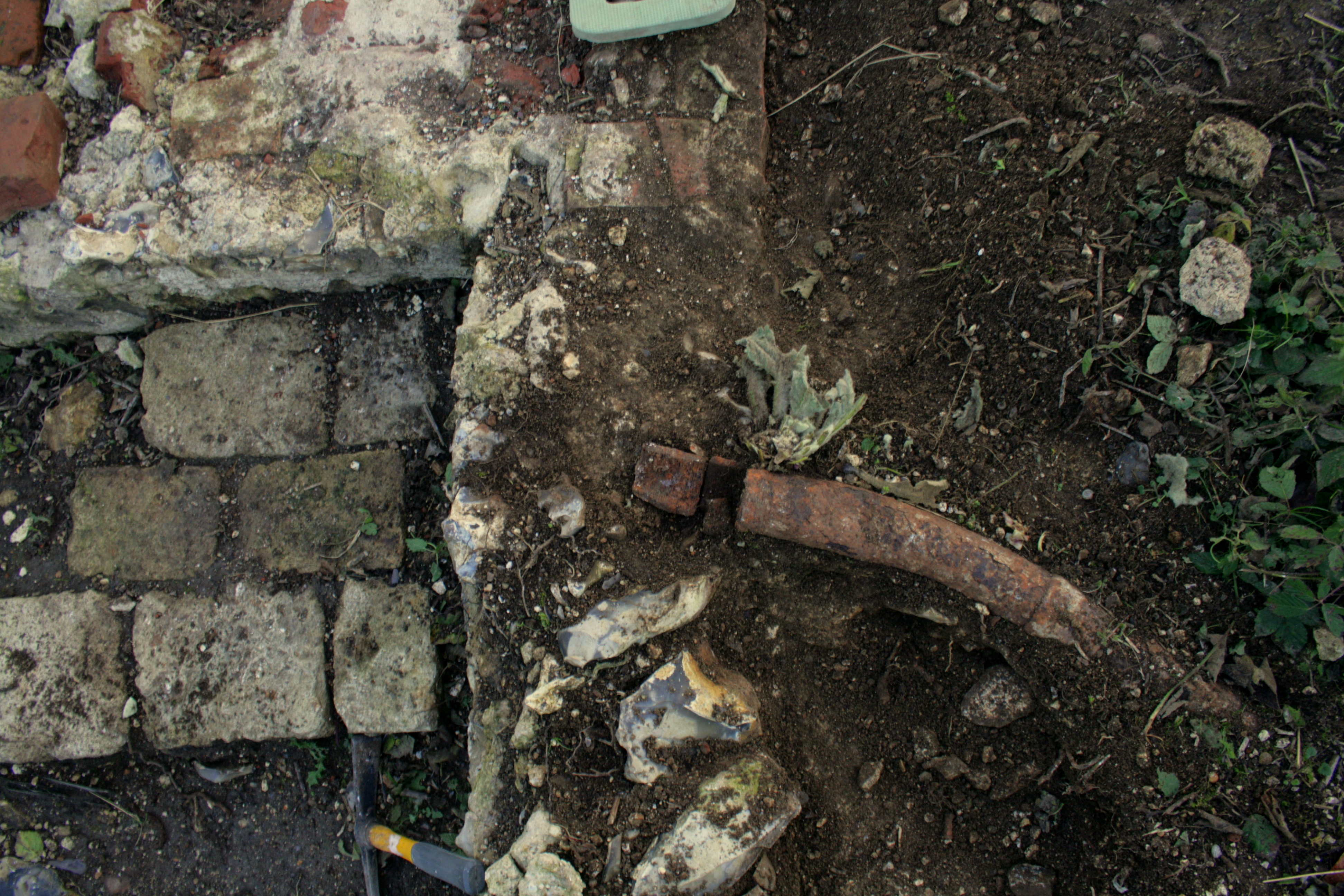
Strange find from demolition rubble beside chimney base.Strange object from demolition rubble beside chimney base.
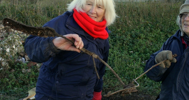
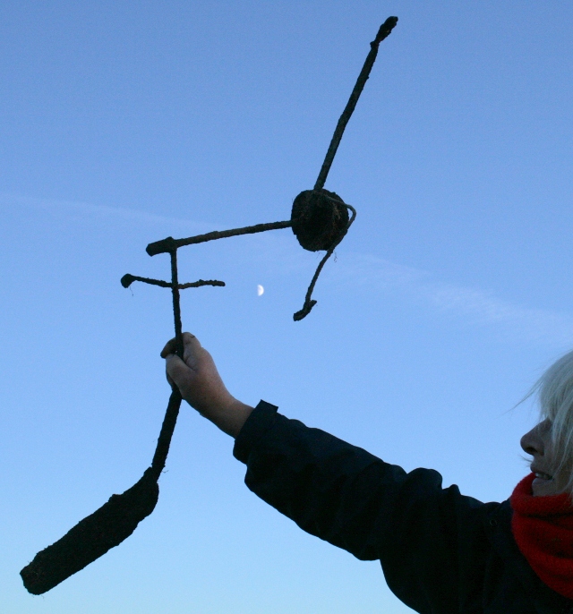
An exceedingly strange, over 2 foot long, piece of rusty iron ‘something-or-other’ was excavated out of the deep layer of demolition rubble. It consisted of several pieces of metal, all connected together, as if it was a tv aerial designed by Heath Robinson to communicate with E.T.!!
Looking SE across dig site.Looking SE at view beyond dig site.
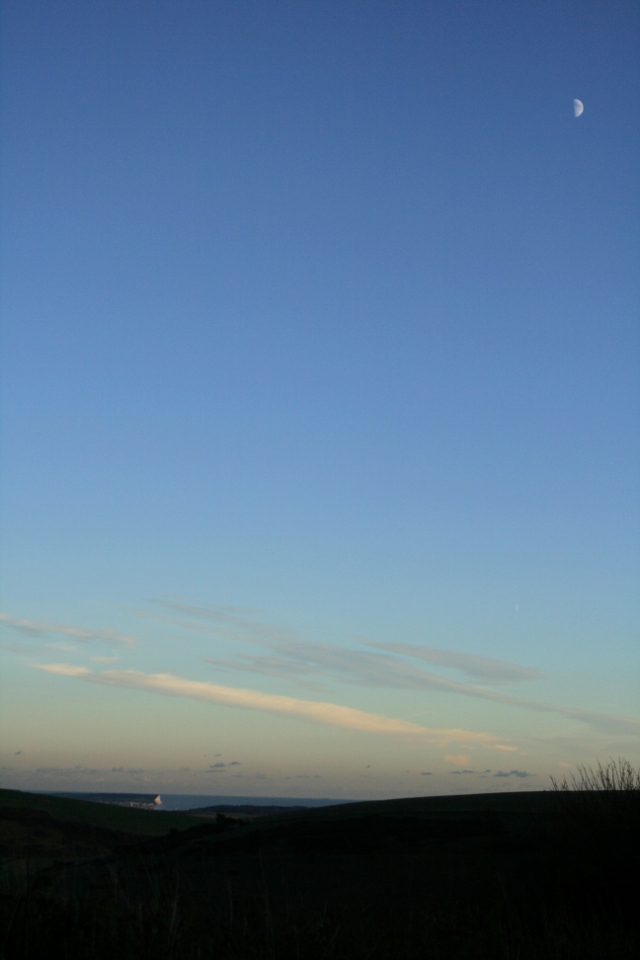
A beautiful sunset, with a half moon high in the sky, as well as magnificent views across amazing scenery, formed the perfect end to a really nice day!
Proof that I don’t just take photos of other people working!
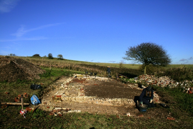
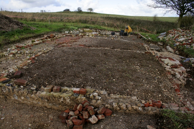
Looking N at excavated remains of Newmarket Farm Cottage.
It was good to get back to digging again after our recent weekend of guided tours. Our current priority is getting the site squeaky clean, ready for a high-resolution 3d-laser scan offered us for free by SeSurveying.
Looking NW at front garden gateway.
With this in mind we have also started further excavation of the outside of the front garden wall to the west of the garden gateway. We delayed doing this earlier because parts of this wall are in a particularly poor state of decay.
Looking SE at outside of garden wall, W of garden gateway.
The original ground surface sloped downhill from west to east, and our excavation revealed that the ground sloped steeply down to the relatively level pathway surface. The 19th century pathway headed towards Kingston in a north-easterly direction, thus avoiding this steep bank. With a change of ownership in the 1920’s traffic shifted round to the west, towards Woodingdean, making access less easy.
It seems that the 1950’s bulldozer, pushing demolition rubble from west to east towards the demolition rubble mound, dropped part of its load down on top of the path right outside the garden gate. This is where most of the finds were located; the usual .303 cartridge, rusty nails, one or two intriguing metal finds, and a few bottle and ceramic shards, including some nice bits of ‘blue & white’. We always like to find a bit of ‘blue & white’!
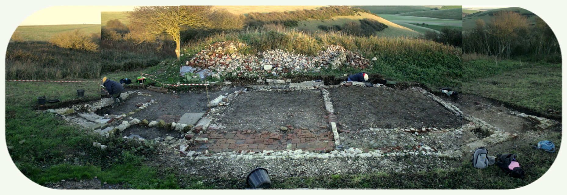
Looking E at (composite image of) Newmarket Cottage; click for enlarged view.
It certainly was a busy week since the last blog post. Extra hours during the week were spent getting the site looking at its best for our successful weekend of guided tours.
Both the nineteenth century kitchen and the scullery had all of their covering vegetation removed, along with much of their topsoil cover and some demolition fill. All internal and external wall lines for the cottage, and associated structures were also nicely cleaned up. As expected, few finds were excavated as the majority of all the floors have been lost inside the cottage.
Site access was also worked on, including cutting a ramp through topsoil, and demolition fill layers, down to the original ground surface of the front garden gateway to provide easier access into the cottage site.
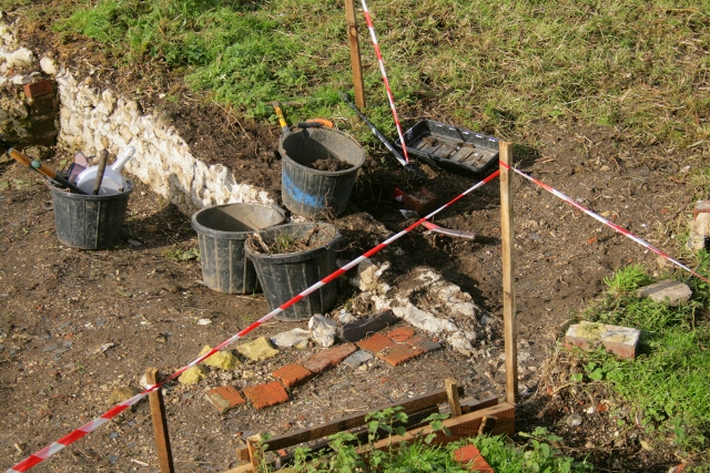
Safety tapes were set out to protect both visitors, fragile archaeology, and our precious survey posts.
Myself and my mother, Peggy, on guided tour, 2/11/13.Myself & some cold attendees, guided tour 3/11/13.Some very well dressed guided tour attendees looking at some archaeology, 3/11/13.
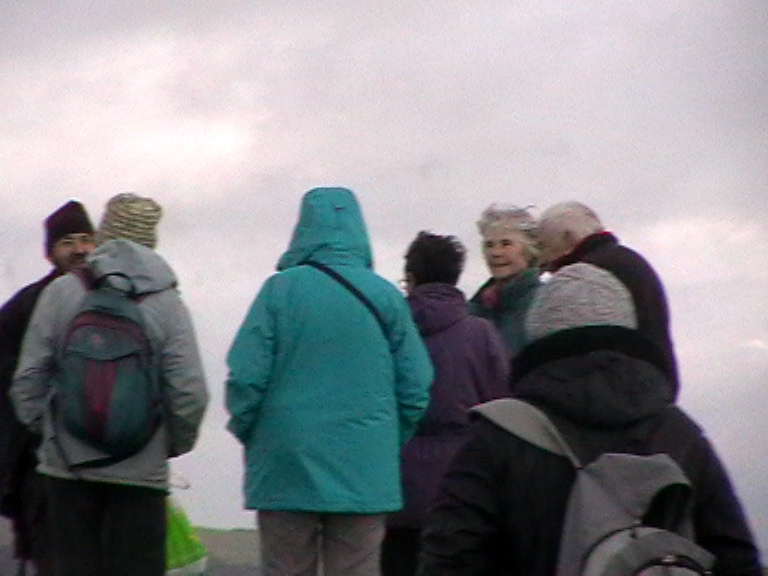
In total 24 people turned out for the site tours. Though the weather was somewhat blustery, luckily it stayed dry for both Saturday and Sunday.
For those who couldn’t make it – or who want to revisit – we are happy to show people around on dig days. We will continue this dig until frosts are forecast, when we will have to backfill all the excavated structures – sometime before Christmas.
A very blustery day was spent stripping back the topsoil from within the Newmarket Farm Cottage’s 19th century washhouse.
Looking N at surviving floor of N end of cottage.
As expected there very few finds; the strangest of which was a hard black plastic screw fitting ‘something’ – a cross between a table lamp light fitting and a fancy hose pipe connector. The surviving terracotta floor tiles were all nicely cleaned back, as were all the external and internal flint and brick wall lines.
The front room of the cottage now looks as good as we can manage with the resources we have available!
Looking N at W side of garden gateway.
A little more of the front garden gateway was also worked on, and a few more flints with worn surfaces were uncovered at the base of the overlying demolition rubble. The very few finds included the usual range glass, ceramics and rusty nails, as well as fragments of cast iron ‘ogee gutter’. Interestingly, this was the first dig day without any obviously military finds.
Looking SW from demolition rubble mound at excavation S of cottage.
A really good day. Lots of finds, a new feature, and positive feedback on a rehearsal for my guided tour next week.
The brick foundation of the cottage’s internal wall was excavated along its complete length, and the division between the two main downstairs rooms can now be clearly seen. As expected, since the 1950’s bulldozer had removed all but a metre wide strip of the floor on the west side of the cottage, only a very few finds were uncovered; probably from the small amount of demolition rubble spillage from sweeps of the bulldozer blade and so may not be in-situ.
Looking SE at excavation immediately S of cottage, E of ~1880 extension.
To the south of the cottage, and east of the approximamately 1880 ‘sort of lean-to conservatory’ extension, some very muddy demolition rubble was further excavated.
Finds tray from partially excavated grid square S of cottage, E of ~1880 extension
As should have been expected, at least a kilo of glass shards were dug up, most of which were window glass. Also found:
Cup handle shard from partially excavated grid square S of cottage, E of ~1880 extension.
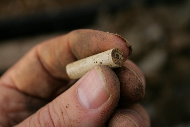
19thc clay pipe stem shard from partially excavated grid square S of cottage, E of ~1880 extension.
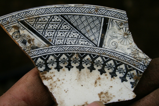
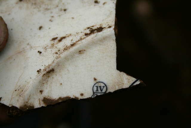
Decorated dinner plate shard from partially excavated grid square S of cottage, E of ~1880 extension.Reverse of decorated dinner plate shard from partially excavated grid square S of cottage, E of ~1880 extension
The reverse of this plate reveals part of a diamond mark from the British Patent Office whish were issued between 1842-1883;
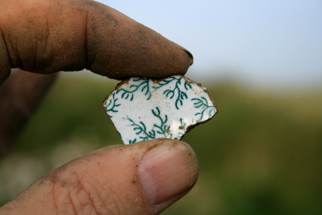
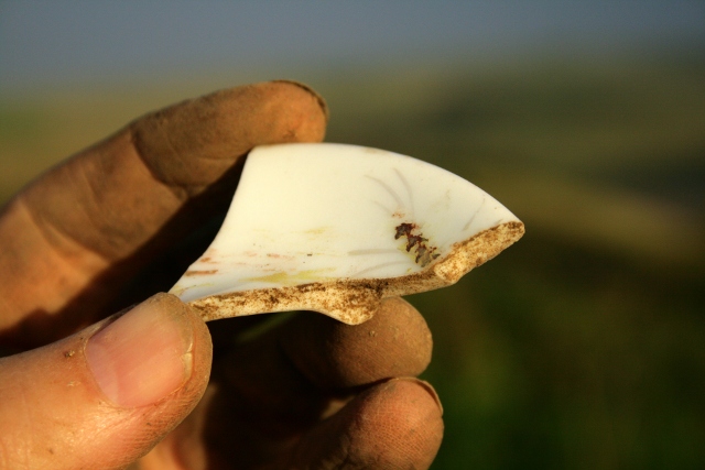
Decorated ceramic shard from partially excavated grid square S of cottage, E of ~1880 extension.
Decorated ceramic shard from partially excavated grid square S of cottage, E of ~1880 extension
A few bottle shards;
Metal finds included an interesting looking large iron bracket, possibly at one time attached to a door hinge;
A medium sized thick-ish piece of sheet lead;
And the inevitable rusty nails, which luckily were not as numerous as the glass (both of which slow down digging considerably!)
Front garden gateway.
The front garden gateway was opened up to its immediate north. It was hoped that beyond the garden wall both the modern and original ground surfaces would more or less coincide. Thus a gentle slope down from the west, through the original gateway could be easily dug to enable next weekends’ visitors to enter through the original gateway to the site. However, I was surprised to discover a much deeper layer of demolition rubble beyond it than I had expected.
Within the gateway there was little sign of the expected brick quoin to which the gate was presumed to have been attached. The western mortar edge of the wall sloped gently back and seemed relatively smooth, and contained the negative imprints of rounded flints. Thus the bulldozer cut through the wall here is not immediately apparent. The southern edge of its threshold appeared to be partially sealed under a shallow layer of compacted earth. This lensed out across the mortared flint threshold and was replaced by the relatively loose and well draining demolition fill. Immediately to the north some rounded flints, with the initial appearance of small cobbles, were observed at the same level as the threshold of the gateway, but they did not seem particularly well embedded. Evidence for a small fire was unearthed over its threshold, and the rusty nails and charcoal found there may have been of wood from the demolition of the house and its outbuildings. The demolition rubble also contained similar proportions of roofing slate, brick, flint and mortar rubble to those found right across the area in front of the cottage. A very few small shards of ceramics and glass were found. The almost inevitable .303 cartridges were found in all three of the areas we dug.
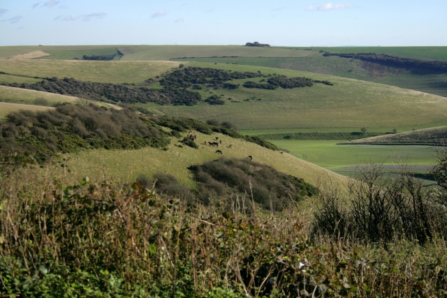
As you may already know, the Newmarket Farm was located in what is now the top north-west corner of the Castle Hill National Nature Reserve. The reserve is in two halves;
the south-eastern part, on the slopes of Castle Hill itself, overlooking the site of the hamlet of Balsdean, which is particularly important for the early spider orchid;
and the north-western half, which is more important for the wart-biter cricket.
However, the management of this latter part of the reserve is a challenging one. Wart biter crickets prefer slighter longer vegetation. Grazing animals, eating the taller grasses in the spring and summer, have been observed to also eat the young crickets (by accident), so they are not allowed on the reserve at this time. But autumn and winter grazing by sheep, cattle or horses, doesn’t do so much to reduce the growth of brambles, nettles and the coarser grasses.
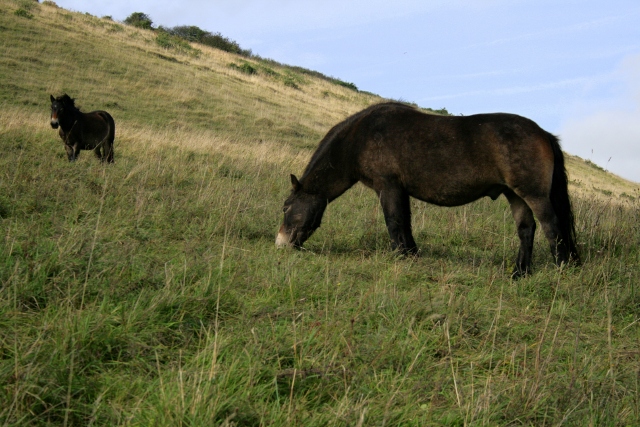
Exmoor ponies in Castle HIll NNR.Exmoor ponies in Castle HIll NNR.
This year, after a lot of work replacing worn out fence posts, Natural England introduced Exmoor ponies in the beginning of October. They are particularly good at ‘conservation grazing’. They have been slowly exploring all corners of the reserve, and a few hoof prints have been seen in the vicinity of our dig. Hopefully they may help keep down some of our brambles and nettles which have made our dig somewhat challenging. As we may be digging again next year, any help we can get keeping down unruly vegetation would be really useful.
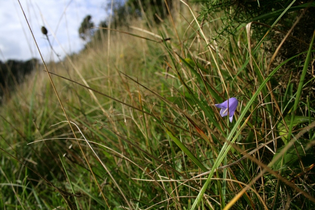
Harebell, Castle Hill NNR.
On the upper slopes of the un-named ridge between Falmer Bottom and Newmarket Bottom, it was nice to see a late harebell in flower.
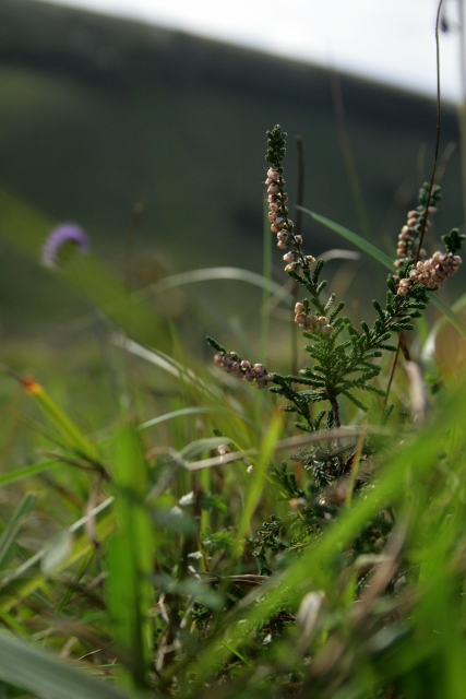
Heather, Calluna vulgaris, Castle Hill NNR.
For me, a small area with a light scattering of heather was a really important indicator of the changing environment of the downs. They hate chalk, so will only grow on the chalk downs on undisturbed acid topsoil. Also they need poor soil, so the current rarity of this once common plant on top of Newmarket Hill (as reported in newspapers covering the 1868 murder of David Baldy) is a sign that these grasslands may be getting more fertile.
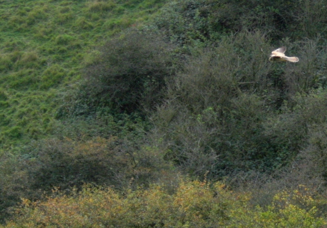
Kestrel (top right) hovering on hillside by Falmer Bottom.Hunting kestrel over Newmarket Bottom.
It was also nice to follow one or more kestrels hovering over the edge between the scrub and the open grassland, looking to feed on large insects and small mammals.
Back at the dig site I continued cutting back the paths around the site. The brambles have an annoying habit of sending out trailing tendrils at ground level, which produce new roots at their growing tips whenever these come in contact with the soil. This creates perfect trip hazards for the unwary! They are often so low that they are missed by the strimmers, so I have found a rake to be the best way to find them, then to cut them back with shears. Raking back the debris covering the paths also reduces the fertility of the soil, which reduces the speed at which any future brambles might grow. So this slow work is doubly worthwhile.
Back in medieval times, up until about the beginning of the 20th century, sheep did this work. They would be driven up from the fields surrounding the village early every morning to graze the open downland – which was less suited for ploughing. The grass would be stored in their stomachs for digestion later that evening, when they would be driven back down off the hill and penned up on one of the fallow fields overnight. During the night they would digest what they ate during the day, and excrete out what they didn’t digest. Thus most of their fertile manure would be deposited on Kingston’s arable fields overnight – the result of all the grass which they ate during the day. Thus, whilst the arable fields became more fertile, so the grazing areas over the downs became less so. Brambles, nettles and many of the coarser grasses prefer more fertile soils, so the labour intensive traditional methods of shepherding created ideal conditions for the growth of heather on the downland hilltops. There would have been few brambles on the downs in those days to trip up the shepherd or his sheep!
What of the wart-biter crickets? They prefer a slightly taller vegetation, and not the short springy bowling green length turf which the sheep used to create. They are most common in the vicinity of Newmarket and Falmer Bottoms, the steep sided valleys south-east of Newmarket Farm. I suspect the soil on Newmarket Hill was a fertile one. So it was suitable for being ploughed and growing crops. But it was a long way from the village of Kingston, to which it belonged. So in 1830 they built an out-farm with barns to store a plough and the harvested crops, and to house a farm labourer and his family to look after things up on the hill. The other side of the hill was Brighton, with lots of hungry visitors who might have wanted to eat lots of beef. So they may have kept a small herd of cattle down in the relatively fertile valley bottoms down below Newmarket Hill, which though they belonged to the Parish of Kingston, up until then they were not at all easy to keep an eye on. So, after 1830, this end of the Kingston Down may have had a different grazing management regime to those elsewhere. Cattle don’t eat the vegetation as low as sheep, so create a habitat better suited to the wart-biter cricket.
I like my story of the link between Castle Hill NNR and Newmarket Farm. Next year I hope to do some more research to see if it might be true!
Looking SE at ~1880 extension from excavation spoil heap.
A mid-week unofficial half day’s digging to help get the site ready for our dig tour. The east end of the 1880(-ish) extension to the south of the cottage was further excavated and cleaned up. The relatively few finds were expected since they would only be spillage from from the 1950’s bulldozer cut. This had completely removed both the west and east walls, including their foundations, and all of the floor of this room. The finds included some undecorated 19th century clay tobacco pipe stem fragments.
Looking N across whole of cottage to N boundary wall; click for higher resolution.
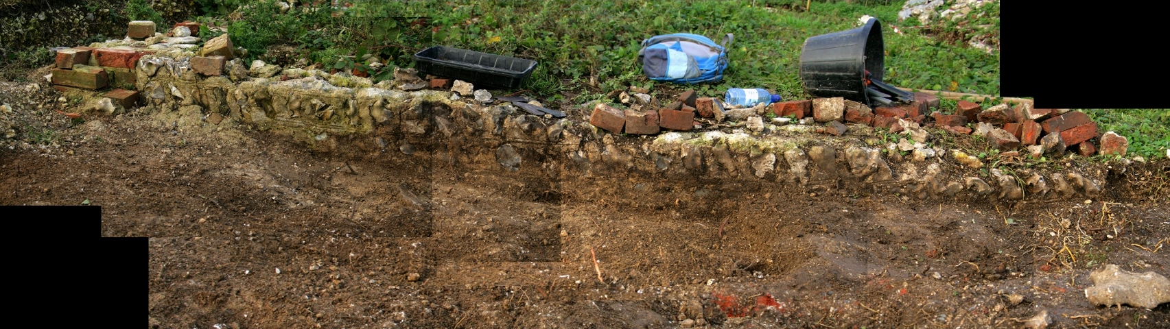
In photo above, both the south wall of the cottage and the north boundary wall of the site can clearly be seen. Both of these walls clearly show the double struck pointing between the courses of flints. These lines are more or less horizontal on the south cottage wall, but on the north boundary garden wall they – more or less – follow the slope of the ground surface. On the ground surface of the garden, yard & paths between the cottage and this latter wall, the rain had washed out a few more finds. These included;
a medium sized shard of a very beautifully designed black and white plate;
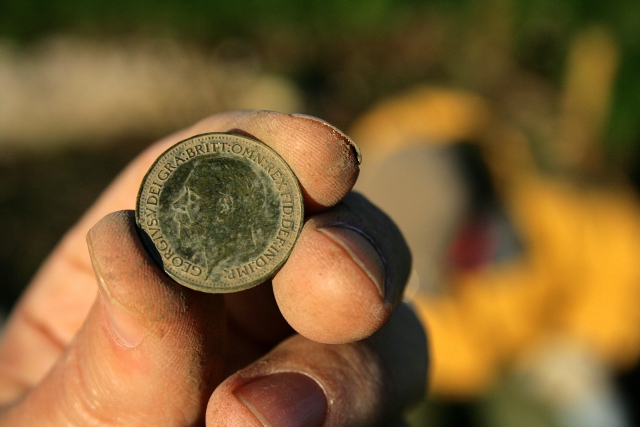
1927 – George V – farthing.1927 – George V – farthing.
Our third coin – a farthing – dated 1927. It is interesting to note that this and the 2 halfpennies found earlier, all dated from the reign of George V. His reign was for about a quarter of the cottage’s time of occupation.
Monday afternoon we took the opportunity of a break in the weather to excavate down through the chalk rubble backfill which formed the foundation for the ~1880 extension’s floor.
Looking N at W end of extension to S of cottage
A sondage dug back in May found a mortared surface under this chalk rubble fill. Because the east end of the extension was lost to the 1950 bulldozer, we hoped that following this mortar foundation might better reveal its full extent.
Composite photo looking N at S end of cottage; click for higher resolution.
This was our ‘level’. Except it wasn’t horizontal, and seemed to generally slope downhill, perhaps following the original ground surface. Assuming the floor surface above was horizontal, the chalk rubble would have been used to level off the floor. We need to put a spirit level onto the double lines inscribed in the mortar – they should line up the flintwork courses to those of the brickwork; if they are approximately horizontal, then over a 4m length we have a drop of about 5 courses. However, over the estimated length of the extension, a little over 2m (internal), the top of its mortar foundation had a drop of about 2 or 3 brick courses from west to east.
Looking W at foundations of extension at S end of cottage.
Unfortunately we ran out of time to fully excavate the far eastern end of the extension, so the exploration of the remaining evidence for the location of its lost wall will have to wait till next time we dig.
Fragment of 19thc. clay pipe stem.
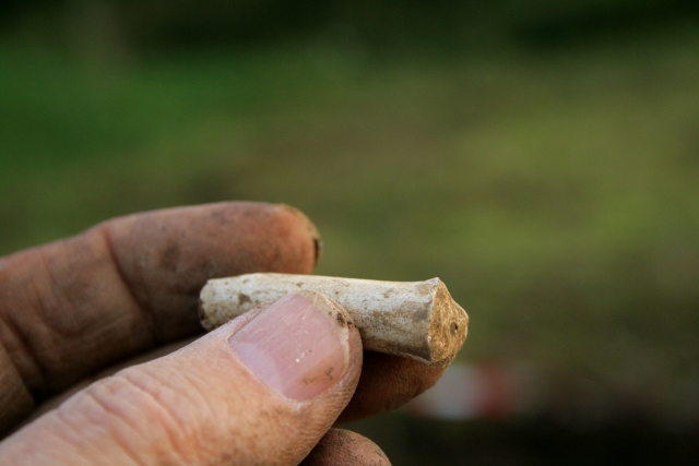
As expected, almost nothing was found; the single shard of window glass and a rusty piece of metal were almost certainly from outside of this context. However a short length of 19thc. clay pipe stem, may well have been in situ.
Our next planned dig day is Friday – weather permitting. We would love you to join us – no experience required. We will be preparing the site for our guided tour on the 2nd & 3rd Nov.
We meet at the car park near the junction of Bexhill Road and Falmer Road, just north of Woodingdean, at 10am. Please don’t hesitate to give me a call for further info.