Some real progress was made with our dig, despite no new finds, or features. We also had a very welcome visit from John Funnel (in charge of digging with Brighton & Hove Archaeological Society)!
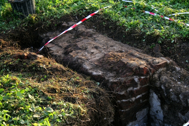
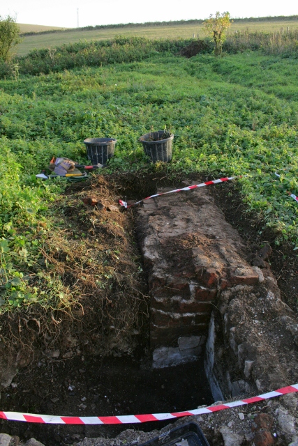
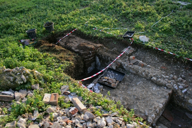
The day was spent extending Friday’s trench by an extra 2x2m, to completely take in, further excavate and clean up the surviving remains of the chimney and its immediate context.
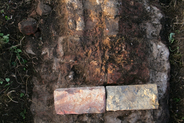
It was a solidly built structure using smaller bricks than was generally used elsewhere.
Its external width was 1.6m and projected out 0.65m from the inside edge of the cottage wall. In the 19th century, this room was used as the kitchen, all cooking would have been done here over the open fire. It may well have burnt coal, like most of Brighton at this time.
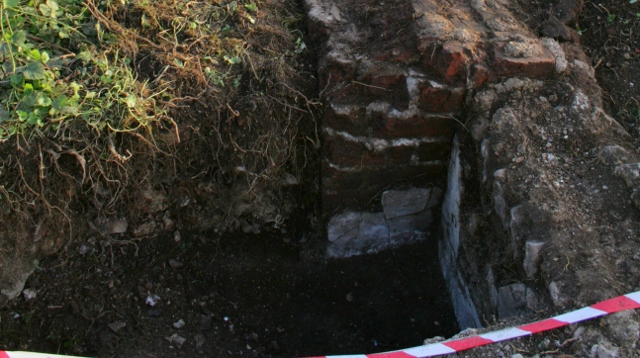
Immediately to its north the original ground level was 0.56m below the top of its surviving remains, buried in demolition rubble.
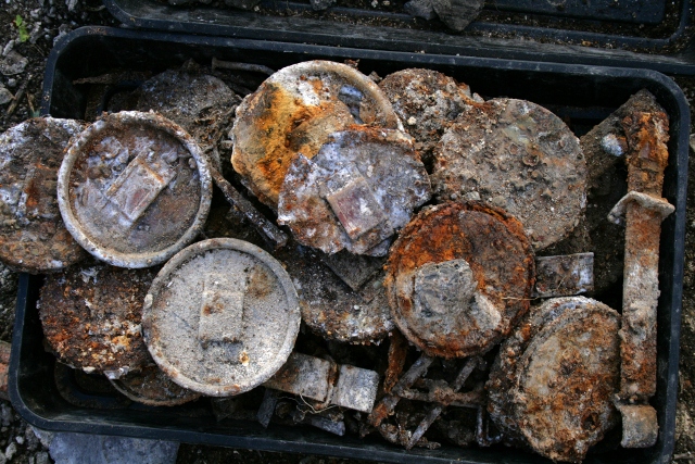
Towards the bottom of this fill exactly the same range of finds as those first discovered on Friday were observed; metal lids with fastenings on top for a strap to secure them in place; strange ‘bicycle bell’-like curved lids(?) with 3 holes (for ventilation?); solid metal brackets with buckle fastenings at either end for a carrying handle but with no means of fixing them to the container they were probably intended to help carry other than the broken fragments of thin metal strapping which were plentiful supplied with holes for small metal nails/tacks. Ceramics and glass shards were hardly to be found. As previously recorded, the area showed many signs of burning – mostly ash and fire scorched and shattered flints, though this seemed to be localised. The evidence for the limited burning is the finding of (a very few) lumps of unburnt coal.
This Friday – weather permitting, for it is forecast to be both cold and windy so we will need to dress warmly, and heavy rain is expected in the afternoon which will not be fun – we plan to move round to the south side of the cottage (though the grid square containing the chimney has not been fully excavated it has given up most of its secrets). The east wall of the ‘lean-to-conservatory-like-structure’ which was added to the south end of the cottage in about 1880, has yet to be located. Also to the south of the cottage, just outside the 19th century kitchen / 20th century living room’s window, there is a memory of another well. We were unable to find the remembered well to the north of the cottage – for whatever reasons. The search for possible water supplies is a major objective of this dig. There was no mains water, and water would have been essential to the survival of those that live there. There is good evidence for an underground water-tank having existed further down the back-garden, but none of the surving children from the 1930’s and early ’40s can remember it. Those who were old enough to recall a water source, all recall a well – not a water-tank – close to the house, but none can agree as to its possible location;
- to the north we have looked and failed to find anything;
- to its east is the rubble mound which is a lot more than one metre deep – so beyond anything safe to dig without major health and safety implications;
- and to the south, which is where we will look on Friday.
We would love you to join us – no experience required! We meet at the car park near the junction of Bexhill Road and Falmer Road, just north of Woodingdean, at 10am, and if the weather is too bad to dig we are still happy to give a quick tour for anyone interested. Please don’t hesitate to give me a call for further info. Also, our official guided tour of the site is on Saturday 2nd November, with a second tour Sunday 3rd, same time and place as above.

One reply on “Forty Sixth Dig Day – Sunday 6th October 2013”
[…] 2013; Forty Fifth Dig Day; Forty Sixth Dig Day; Forty Seventh Dig Day; Forty Eighth Dig Day; Forty Ninth Dig Day; Fiftieth Dig Day; Fifty First […]