
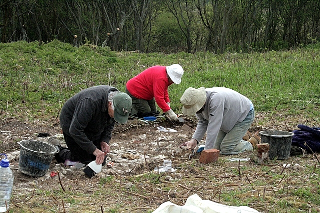
After a grey start, the sun soon came out, though the wind was cool. Four volunteers turned up. Brighton and Hove Archaeological Society are busy for another week with their Saxon dig in Patcham.

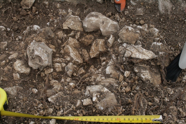
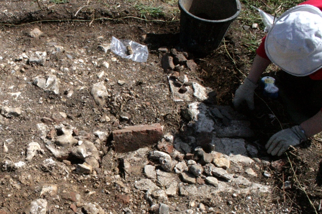
The pictures above show the approximately circular area of brick and chalk rubble which had previously been uncovered to the side of the house, associated with a fill of chalk rubble. Further excavation revealed an absence of fragments of brick, roof slate, or other items that might have associated it with demolition fill. This makes its earlier identification as a possible shallow post hole more likely. However, the lumps of chalk which formed the inside edge of its roughly conical centre did not appear to have been crushed by a heavy post. It may have been just a random coming together of stones, or it may have been an unused post-hole. However, if it had been used as a post hole, three possibilities come to mind;
- It may have been used to secure a scaffolding pole during the construction of the house.
- In a 1911 sale document “a lean-to Wagon Lodge” was recorded in a list of the farmyard buildings. It may have been of wood and leant against the side of the house. It is not shown in a plan possibly dating to 1921.
- It may have been for some other farmyard structure, such as a cattle crush, or a post to which hurdles may have been tied.
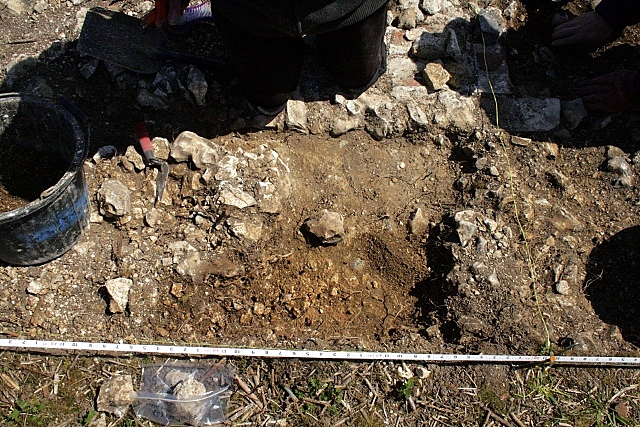
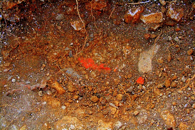
Immediately to the south of this probable post hole, the chalk rubble fill was further excavated out away from the house. This revealed that beyond the solid bed of mortar (free of inclusions), which formed the foundation to the wall, a friable mortar surface extended further out under the chalk fill of at least this part of the farmyard. Associated with this friable mortar was a firmly embedded fragment of brick and of slate (clearly shown in the colour-enhanced photo above). Therefore the chalk rubble fill, which is older than the demolition rubble (it sits under it), is almost certainly as old or younger than the construction of the house itself (from which the slate and brick probably originated). When the foundation trench was dug, it may have been quite wide, and left open during at least the initial construction of the house, before it was backfilled with chalk rubble, sealing the fragment of brick and tile – which may have been broken during the transport of the building materials to the site. Further excavation out into the farmyard and alongside the outer load-bearing walls of the house would be required to further understand his particular feature.
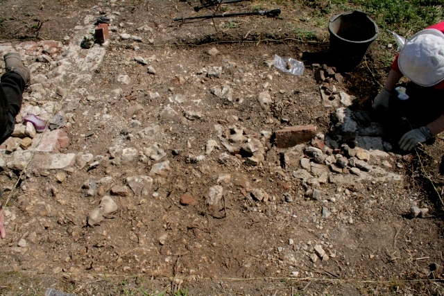
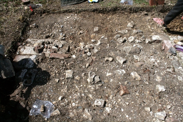

Partial excavation of the demolition rubble layer, down to a chalk rubble surface – as shown in the photos above – strongly indicates that most of the west wall of the lean-to-‘conservatory’ structure was completely destroyed by WW2 ordinance.
Against the outside of the south side of the lean-to-‘conservatory’ was a beautiful dark-brown, humic loam, garden soil. This contrasted strongly with the chalk rubble and orangey-grey-brown clay-loam soil on the farmyard side of the house. This would have been a particularly well sheltered SE facing corner of the garden, set against the heat absorbing walls of the lean-to brick and flint structure at the back of the house, and the garden wall. Further excavation out into the garden would determine whether this soil extends right across all of the garden, or whether it is limited to the highly cultivated soils of the vegetable and flower beds.
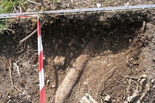
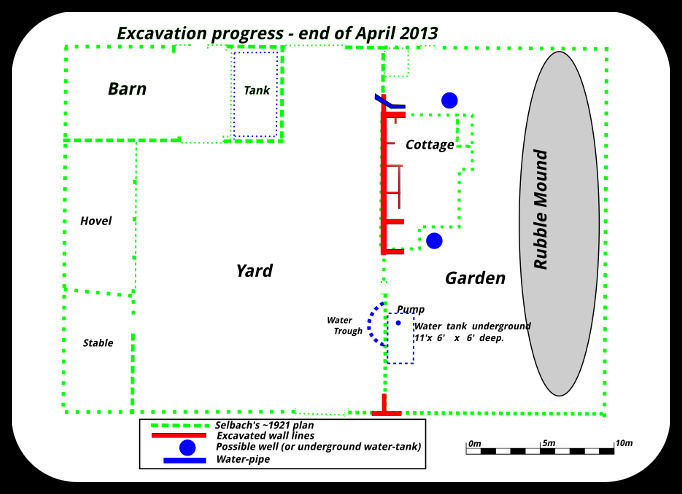
The pipe, which was found in front of the house, clearly heads in an approximately NW direction towards the site of a large barn shown on maps and plans of Newmarket Farm in one direction, and towards an alleged well in its other direction. excavation so far indicates it is located under a layer of topsoil, flush with the probable bulldozer cut, and surrounded on either side by a chalk rubble fill. This increases the likelihood that it is in-situ, and may not have merely fallen from the side of the house. The barn has been described as having a water-tank, probably filled from rainwater from its roof. Was this pipe installed as an overflow to this tank, to top-up a well (or fill an underground water-tank) located in front of the house? Further excavation may answer this question.

2 replies on “Sixth Dig Day – Sunday 5th May 2013”
[…] May 2013: Fifth Dig Day; Sixth Dig Day; […]
[…] wall. This was a little over a foot to the north of the front corner of the cottage (see Second, Sixth, Tenth and Twelfth dig […]