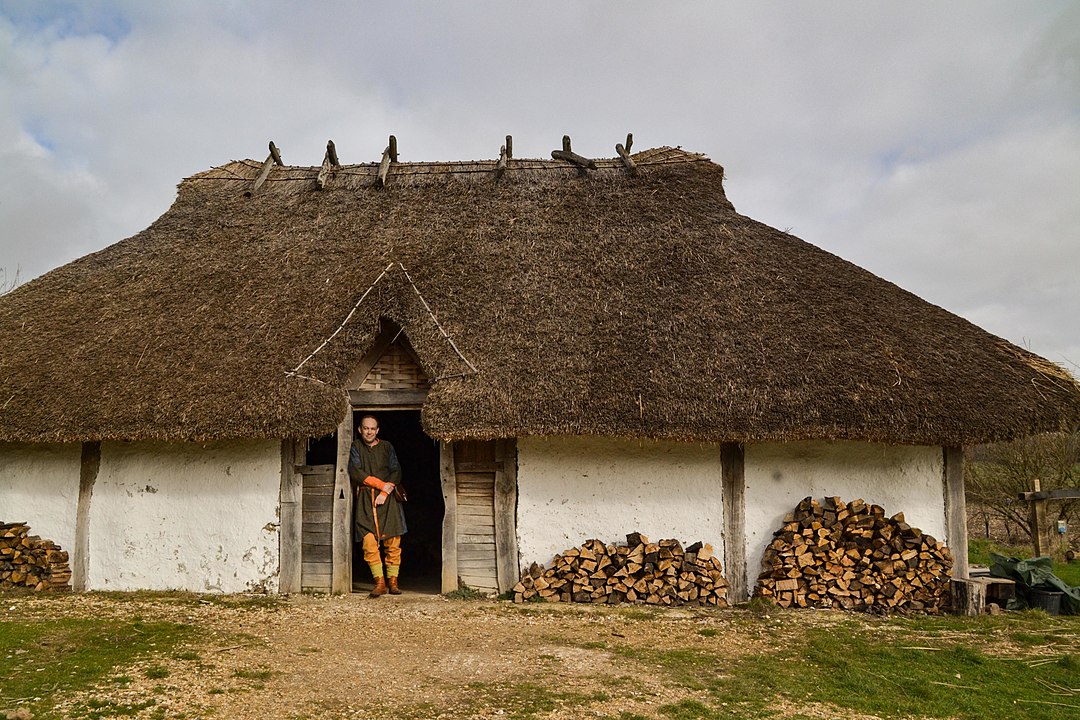
Still struggling with my lurgy. Even if I do my Saxon history walk on Saturday, I will be cutting it very short. I have therefore chosen to give the walk’s historical content here. It is taken from the book I am currently writing with the support of my mother.
Where to start? I will begin at the beginning.
Prehistoric beginnings
This eastern half of the South Downs, centred on Lewes, has been famous for its rounded broad-backed sheep grazed hills since they were described in Gilbert White’s Natural History of Selborne in the late 18th century. These treeless prairie-like grasslands were likened to the Argentinian Pampas by WH Hudson over a hundred years ago. But they are not naturally so. It took some five thousand years of grazing, most famously by sheep, to produce the flower rich chalk grasslands preserved today in nationally important nature reserves such as Castle Hill.
The earliest sign of human activity that I have found on these Downs was half a broken Neolithic polished flint axe head, found near an ancient ridgeway track, locally known as the Juggs Road. The flint axe was made by Britain’s first farmers, to help them clear the forests to make way for their fields. Evidence of this forest was found on Whitehawk Hill, at the end of Brighton Racecourse, in the bottoms of the ditches which formed part of a large Neolithic Causewayed Enclosure. Charcoal, pollen grains and snail shells have been rescued from the prehistoric ditch fills. These tell a story of (temporary?) clearings in an otherwise wooded landscape. Whitehawk Camp, as it is known today, was constructed hundreds of years before Stonehenge, for ceremonial purposes and as a place where they buried their dead. Sadly though, we don’t know where these people actually lived and worked their fields. But it is possible to make an educated guess.
Of Chalk, Flint, Clay and Water
The geology that underlies the hills of the Balsdean and Kingston Downs is seen at its best in the towering white chalk cliffs which meet the sea between Brighton Marina (Black Rock) and Newhaven. This chalk has three properties of relevance to our story.
Firstly it contains nodules of glassy flint which prehistoric peoples shaped into razor sharp tools, such as the polished axehead that I found. Secondly, it is a porous rock that absorbs water like a sponge. For this reason only the lowest and largest of our downland valleys have ever possessed running water, and then only in the winter, at times of high rainfall. These are known as winter-bourne streams, such as flowed down the valleys either side of Falmer, along the Brighton to Lewes road, whenever the water-table rose to the surface.
The other important factor that determined where people lived was the soil. Essentially, our area of downs has three types of soils: A chalky alkaline, light soil, especially on the steep hillsides; acidic heavier clay on the hilltops (called clay-with-flints) which has an orangey colour; and the valley fills, called head deposits, that are a more fertile mix of chalk and clay, eroded from the sides of the hills.
Soils are formed through the interaction of living organisms with eroded minerals, either from the underlying geology, or the eroded remains of former overlying geology. Verdant forests can help produce deep fertile soils. But our chalk is extremely pure, which means it contains very few of the minerals that are essential for life. The chalky soil, which can be clearly seen at the top of the cliffs, is therefore often only inches deep. The nutrient poor chalk was therefore unable to support great forests with deep roots.
However, much deeper, richer clay soils are to be found on the relatively flat tops of the hills. These are the decayed remains of all the geological formations that were laid down on top of the chalk over millions of years, which — because of the hills’ relatively flat tops — haven’t been washed down into the valleys below.
Plants, especially those we grow to eat, prefer a neutral soil, such as the mix of chalk and clay which forms the more fertile soil found in the valley bottoms. It is here that the earliest farmers may have lived, perhaps on the edge of the steeper slopes, easier to clear of their trees, but also near sources of open water. The aptly named Poole Valley in Brighton may have been an ideal location for an important family group to live. Whitehawk Camp, on the hill above, with its distant views, would have been where many such family groups from miles away came together for festivals, perhaps to mark the seasons. Such gatherings may have enabled a trade of goods and ideas, helping to cement bonds with distant tribes.
The western chalk Downs differ from our eastern South Downs because of the former’s deeper, more fertile soils and their greater distance from the sea. The Hampshire and West Sussex chalk Downland had more woodland, the East Sussex South Downs, was more open, with prairie-like grassland. This difference resulted, over the course of hundreds if not thousands of years, in two different breeds of sheep being found either side of the River Adur. The more profitable eastern Southdown sheep breed may have encouraged farmers to keep more of them, thereby accentuating the differences between these two areas even more.
Bronze Age Deforestation of the Downs
The invention of the bronze axe marked the beginnings of the complete deforestation of these Downs. The exact details of how fast this happened are not entirely known, but the general picture of an increasingly deforested Downs — which coincides with indications of an increased population density — seem clear. We know this because archaeologists have found a large increase in grass pollen and of sun loving species of snail on the Downs in this area from Bronze Age deposits. A bronze axe makes easy work of felling a tree in comparison with easily blunted flint tools. But the invention of bronze wasn’t the end of the use of flint, for on the Downs, with just a little training, it is a matter of just a few seconds to pick up a flint and strike off a flake with a useful razor sharp cutting edge. Back in the Neolithic probably the highest status object that one could own was a polished flint axe-head. The quality of flint tool making during the stone age was extremely high. But with the advent of bronze, a flint knife became a poorly made disposable object without any status value. Nevertheless, these poor quality Bronze Age worked flints are extremely common on the Kingston and Balsdean Downs.
Other monuments to their presence in the landscape are their burial mounds, which are also relatively numerous (such as on top of The Bostle, and on the low ridge overlooking Newmarket Bottom). More enigmatic are their many cross-dykes — linear banks and ditches that cut across hill tops and ridges. One cuts right across the eastern end of Bullock Hill; a long one cuts across the ridges from the east of Newmarket Bottom, to the western end of Cold Coombes, forming a diagonal boundary between the Newmarket and Castle Hills; others cut across Castle Hill itself, forming the northern edge of the mysterious rectangular earthwork which gave Castle Hill its name (possibly a high-status Bronze Age stock enclosure, but definitely not a castle!). Though their purpose remains ambiguous, when freshly cut, the bright white exposed chalk would have been seen from miles away — a huge statement of their presence in the landscape.
All of this strongly indicates that they were living and farming in significant numbers right in the heart of the Balsdean Downs. But these Downs were without water, which is absolutely essential for the survival of a farm. Therefore, despite a relative lack of definitive archaeological evidence in this country for this period, they must have dug deep wells into the chalk and/or constructed clay lined ‘dew ponds’. Evidence for both has been found abroad even for Neolithic peoples, so it was at the very least, in principle, possible. An alternative is that they carried water from spring fed sources at the foot of the Downs, from several miles away, but this is not a sustainable option. One such well, which was almost certainly prehistoric, was discovered due to the erosion of the cliffs near Beachy Head. It was 40 metres deep.
Celtic and Roman Balsdean
The transition from the late Bronze Age to the Early Iron Age, especially in the East of Sussex, was almost certainly one of cultural transition and absorption of ideas, rather than of conquest or revolution. It has been proposed that such separate labels for the peoples who lived some three thousand years ago is not helpful. The metal changed from Bronze to Iron, but (most) people didn’t.
This change of technology enabled a more intensive use of the land, increasing productivity and, therefore, population pressures. Fortified enclosures, such as Hollingbury Hillfort, may have been a place of retreat in times of strife. The Roman conquest would have been one such event.
Romans were definitely in the area. Their coin hoards have been recorded as being found on these Downs ever since antiquarians became interested in writing about local history in the eighteenth century. A sherd of posh Samian tableware was found on Bullock Hill. But it is highly unlikely to be from a posh villa, at least not in the vicinity of Balsdean, for these hills and valleys are dry. The Romans considered water, especially in the form of a spring, as sacred. No nearby water, no villa. The nearest known site of a villa was to the west, immediately south of Preston Park on the London Road next to where the Wellesbourne stream used to flow in winter. Others have been found a short distance to the north of the downs, on or near the greensand ridge — which was served by an east-west Roman Road — such as at Plumpton, whose parish today is long and narrow and extends all the way up and over the Downs, almost reaching the Brighton to Lewes road to the south. It may possibly reflect the extent of many such villa estates, whose landholdings may be recorded by more modern parish boundaries north of the Downs.
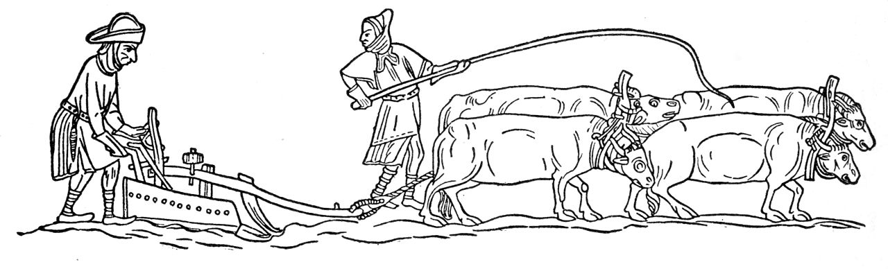
The native Britons at the time of the Roman Conquest were (culturally but not necessarily genetically) Celts, peoples of the Iron Age. Developments in farming technology and our mild climate meant that we exported at least some of our excellent quality grain to Gaul, even before the Romans arrived. Their small rectangular fields are exceptionally well preserved on the Downs to the north-east of Balmer. But they can also be seen in old aerial photos and modern satellite images (such as used by Google Maps) on the ridge-tops to the south-east and to the west of south Woodingdean, south-west of Balsdean. Despite the Roman invasion and occupation of Britain, for these native British farmers it may have been more or less business as usual. New technologies, new markets, new people in charge — but the seasonal cycle of ploughing, sowing and harvesting would have continued as before.
Ironically, during the time of the Romans, more of the Downs may have been ploughed than at any time till the Second World War. And, just as with the demands of the County War Agricultural Committees, the ploughing of what was previously valuable permanent pasture was perhaps done against the will of the local farmers themselves. Balsdean’s farmers may have just been simple farmers, but they were part of the Roman Empire and expected to make sacrifices in tribute to their Emperor all the same.
Also, the posh piece of Samian Ware pottery was more likely to be just from a local farmer who bought something expensive to impress the neighbours. An example of such a Romano-British farmstead was excavated at Rocky Clump in Stanmer. Nevertheless, despite the pottery almost certainly not being from a posh villa, it is proof that people were not only working but living here too. It is unlikely to have accidentally fallen off the back of a wagon, for there was no significant trackway over the hill that could have led to such a villa. The nearby Juggs Road (Drove Avenue), however, was called by some the Roman Road. It ran across the top of Newmarket Hill — where a coin hoard was buried — midway between Brighton and Lewes, both of which had villas in their vicinity. Between the Newmarket and Castle Hills, there is a fork in the track, heading northwards towards the villa at Plumpton.
The Kingston and Balsdean Downs may feel remote, or isolated, but they have always been connected to the rest of the world. Their international connections required ports. Well known were those near the town of Chichester in the west and the military fort of Pevensey in the east. In the centre are indications of there having been a commercial Roman port at Aldrington, Portslade. To its north, along the road from Hassocks to London, were large iron workings in the high Weald. And in its immediate vicinity many corn-processing ovens have been found.
Of note is that this port was east of the more modern harbour town of Shoreham. Longshore-drift — caused by sea currents moving pebbles from west to east — blocked the entrances to the rivers Adur and Ouse in the past and pushed them further along the coast — something that Brighton benefited from, 500 years later, in Medieval times.
Post-Roman Saxon Downland Decline and Rise; Times Changed, People Didn’t
The Saxons were one of many barbarian (bearded) peoples who were involved with the collapse and overthrow of the Roman Empire. They were already raiding (and trading with) Britain long before the Romans left. The challenge was that by the 5th century AD we were pretty much totally reliant on a cash economy to buy and sell goods at the market. Industrial production was specialised and its control centralised. So when Rome withdrew from Britain, taking all of their money with them, the economy collapsed. Farmers were no longer self-reliant. Slaves couldn’t be fed, or servants paid. Our urban population became starving beggars. Large arable farm estates collapsed. And trees returned to our Downs, for the first time in a thousand years or more.
This is more or less the traditional historical view of what may have occurred. Though the Empire was Roman, not British, this time of transition was generally pictured as an isolated England cut off from its wider Empire, set against a breakdown of civilized values of law and order, with rampaging hoards of Germanic savages, raping, pillaging and burning to the ground our country villas and urban cities. Variations on this image of a Germanic threat gained increasing popularity after the German unification of 1871.
Recent studies now strongly indicate a much gentler transition to a different way of life. The rule of law (mostly) remained, but the laws themselves changed. Germanic goods were (mostly) not forced on us by invading hoards, but were introduced through trade and barter. Our eastern facing districts in particular did a lot of trade with the peoples of Europe bordering the North Sea. The Byzantine civilization of the Mediterranean, which replaced that of Rome, traded with the western parts of Britain, especially Tintagel in Cornwall, because of its precious tin. We adopted their cultures, they joined us in relatively small numbers as settlers, as farmers, craftsmen and fisherfolk. There were battles, but they were relatively small scale affairs, greatly exaggerated by both sides. They didn’t wipe us out, or drive us away screaming into an imaginary wilderness which we in the south-east of England consider Cornwall, Wales, Scotland and Ireland.
The return of trees to our Downs, for example, was also not necessarily a return to a savage untamed wilderness. Our intensively farmed Romano-British arable fields were expensive to manage. This was the experience of Balsdean farmer, Guy Woodman when he was forced to obtain two expensive tractors to plough his new arable fields. But after the Second World War, Dalgety — who took on the Balsdean Farm tenancy — returned the farm to a much less intensive ranch style, which it had been before the war. It was cheaper and easier to run; the lower outputs were offset by considerably lower costs. For the late/post-Roman Balsdean Downs, one might therefore imagine a landscape similar to the New Forest, perhaps a parkland type of environment, with lots of grazing among isolated trees (early Bronze Age), or a more dense, generally closed canopy woodland with patchworks of clearings (Neolithic).
Genetic studies have been made of our modern British population, in particular those who were most likely to have ancestry from the area where they were living at the time of being tested (the same location as their parents and grandparents places of birth). They have shown that our native British population largely dates back to pre-Roman times.
Isotopic analysis of the chemical elements in tooth enamel is a way of testing where someone has eaten during the course of the growth of ones teeth. This has been done for many individuals excavated from early Anglo-Saxon cemeteries. Their skeletons are all outwardly identical. Their grave-goods are all more or less the same. But only just a very few had ever lived in Europe or Scandinavia. Just as the vast majority of people in Britain during the Roman period were British, so it was during the Anglo-Saxon period. We are culturally diverse; Angles, Saxons and Jutes all had an enormous influence on us culturally, but contributed relatively little to our genes, or if they did, it was no more than they had already been doing for thousands of years.
Examination of human skeletons excavated right across the country, from before, during and after the collapse of the Roman Empire showed no significant increase in battle scars during this challenging transition period. Yes, there were battles, but however violent they made themselves out to be in their stories, they do not appear to have systematically raped all our women or slaughtered and driven out all of our men.
Early Medieval Downs
The earliest discovered and excavated, culturally Saxon, post-Roman, settlements on the Downs were on ridge-tops. Later in the mid-Saxon, early Medieval period (8th century), these settlements moved down into valley bottoms, eventually becoming the villages which survive today. Bishopstone (near Newhaven) was one of them. From such limited information it was initially presumed that the earliest Saxon conquerors, nervous of attacks from local Britons, congregated on the hilltops. The more sheltered valley bottoms were only occupied some two or three hundred years later, once the native Britons had been driven out of the area.
However, since the advent of sophisticated DNA testing, isotopic analysis, better dating techniques and a significant number of early post-Roman (culturally Saxon) valley bottom sites also having been discovered, this story has changed. Simply speaking, hilltop sites are easier to find, and the peoples who were considered to be Saxon invaders turn out to be almost all native British who had adopted a largely Saxon way of life. However, during what some now call the early Medieval period (for our purposes, 8th to 10th centuries), many of our villages and farm settlements did establish a new valley bottom existence.
Most of our local ancient South Down farms and villages, from placename evidence, were established or continued their existence in this period:
- Balsdean — Beald’s valley;
- Bevendean — Beofa’s valley;
- Falmer — Fallow mere, dark pool;
- Kingston — King’s farm/settlement;
- Ovingdean — Valley of Ufa’s or Ofa’s people;
- Rottingdean — Valley of Rota’s people
- Woodingdean or Woodendean — may be an exception, first appears unnamed as an isolated farm or outfarm, to the south of the modern village, on a 1714 map and may have acquired its name by copying the form of others in the area.
The latest thinking is that these peoples’ names, recorded in the names of their settlements, were not heroic Saxon warriors, conquerors of little corners of England. They were just local leaders, farmers, estate managers — founders of new farm settlements, but worthy of being remembered all the same. Kingston near Lewes was not the residence of royalty, a great chieftain, but merely one of many royal landholdings, bringing in an income to swell their coffers.
An observation of my own (which may or may not be original) relates to their geography. They are (almost) all located:
- In the shelter of a ridge to their south-west, the prevailing wind direction;
- At the coming together of two or more valleys; the exceptions, Falmer and Kingston, had a permanent pond or a spring respectively.
All of these factors would mean that their valley bottom soils would potentially be deeper, have a larger collection area for the run-off of rainfall, and the effects of winter gales would be less — hay ricks would be less likely to blow away (a problem reported by Woodman for Balsdean).
The locations of settlements at the meeting point of two (or more) valleys would have served a further purpose. Their arrangement is like that of a capital ‘Y’, consisting of two upper branches and one lower, with the farmstead in the middle. This enables the classic Medieval three field system – one in each of their fertile bottoms – a system possibly developed in the 8th century.

One reply on “Saxon Balsdean Walk”
Such an interesting read.
Thank you David.