Taking it easy today. Looking after myself after an unfortunate (dicky tummy doesn’t do it justice) accident in the early hours of the morning.
After a detour to visit 2 local pharmacies for suitable medications I felt brave enough to head for the rocks which form the foundations of the Marquess of Anglesey’s Column.
Blueschist!
Not an Anglo Saxon euphemism for my condition. It is the type of rock I hope to find once I have finished my lunch (veg soup & a roll with a large peppermint tea). The nearest toilets were near a famous railway station.
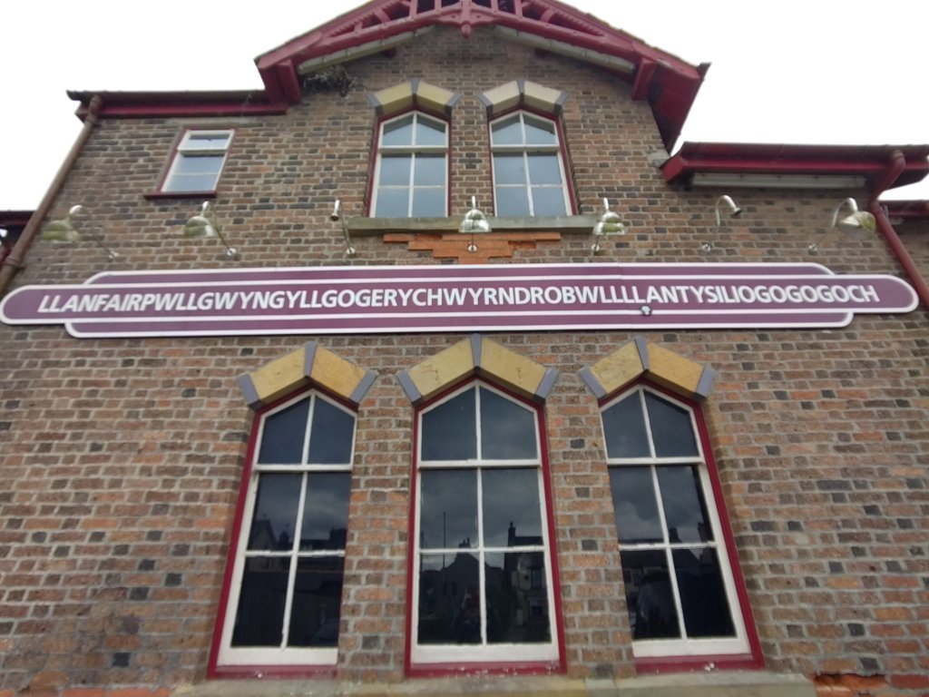
Luckily locals just call it Llanfair P G!
But First The Science Bit
Ever since the first accurate maps of the Atlantic coasts of Africa and South America people have noted that the two continents appear to fit. However a coherent explanation why (how come) was only developed during the 60’s and 70’s.
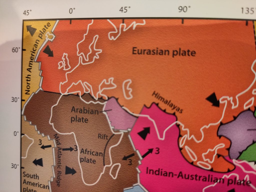
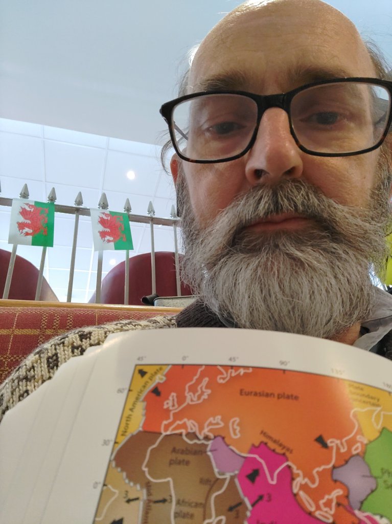
The ‘Footsteps Through Time’ book (my bible for this adventure) is the most up-to-date and detailed guide to Anglesey’s geology. However, since the most recent geological research was done by a Japanese team, most of the diagrams are centred on Japan and the Pacific, not the Atlantic. I leave it as an exercise for a reader to find a nice map of the Atlantic.
Try to find one that shows the Mid-Atlantic Ridge. It is hidden so deep down that submersible craft only managed to visit it after we had landed people on the Moon.
Pangaea
335 million years ago, during the days of the swampy Carboniferous Era, when great layers of coal were formed, a supercontinent came together called Pangaea. It only started breaking up a little over a hundred million years later, just as the first dinosaurs started turning up.
Mid-Ocean Ridges
This break-up separated Africa from South America and Europe from North America. And thus, the Atlantic Ocean was born.
I like to imagine that the Mid-Atlantic Ridge is a sort of giant linear crack which separates these continents. Boiling hot lava is being pushed upwards through this crack like toothpaste squeezed out of a tube.
Great quantities of lava billowed out from the centre of the earth, forming shapes like great overstuffed blobby pillows. As it hit the cold water it instantly solidified leaving no time for crystals to form. Such lava rocks are generally of a type called basalt.
Now imagine that this process is like two great conveyor belts. The solidified lava gets pushed sideways, in opposite directions, by new molten lava being squeezed out of the central crack in the middle of the Atlantic. The Atlantic expands.
But there are other mid-ocean ridges, such as the one in the Pacific Ocean. It too is pushing new oceanic crust sideways. What happens when they meet?
They could both push each other upwards, causing the Earth to inflate – forming great mountain belts – but this theory was rejected for a better idea.
Subduction

The edges of these tectonic plates were pushed down – subducted.

As the basaltic pillow lava gets pushed downwards, sometimes other types of forces get involved. Volcanics and earthquakes can, over millions of years, push rocks from deep down – up to the surface.
Remember I said I want to see blueschist? This was basaltic pillow lava, forced by subduction, 35 km underground. At this depth the pressures are supposed to be enormous!! But the temperatures are not hot enough to completely melt it. It transforms – it becomes a beautiful blue-coloured metamorphic rock – like a caterpillar becoming a butterfly.
However, time – my time measured in hours – just like geological time – is moving on. I just hope after all this exciting build up I can actually find it 🙂
P.s. Fortunately my insides feel much less volcanic.
<- Ancient Geology 3: Research
Ancient Geology 4.2: Blueschist and the Marquess of Anglesey’s Column ->

5 replies on “Ancient Geology 4.1: Wandering (In)Continents”
[…] my previous post I told of my new-found understanding of its formation. How it originated as a fine grained rock […]
Your body was perhaps in empathic union with the chosen subject matter 🙂
[…] you remember what I wrote in Ancient Geology 4.1: Wandering (In)Continents? How the blueschist rock under the Marquess of Anglesey’s Column was pillow lava that erupted […]
[…] such as occurs as a result of an expanding mid-ocean ridge (see Ancient Geology 4.1: Wandering (In)Continents), occurred to break up Rhodinia at the same time as Llanbandrig’s stromatolites were […]
[…] Next post -> […]